

What a day.
We met Bud and Amanda at the boat in Anacortes for a quick sail (actually motor) out to a group of nearby islands: Hat, Dot, Saddlebag and Huckleberry. The group is huddled in an arc just off the southeast shore of Guemes Island. The San Juan 28 had been docked for way too long and it was well past time to unhitch and check things out for a more ambitious cruise, hopefully soon. Between forays to the mountains, I’d been working on various repairs, maintenance, cleaning this and that. The old boat was finally ready to depart the dock at Cap Sante Marina for a mini-shakedown on a bright blue morning.
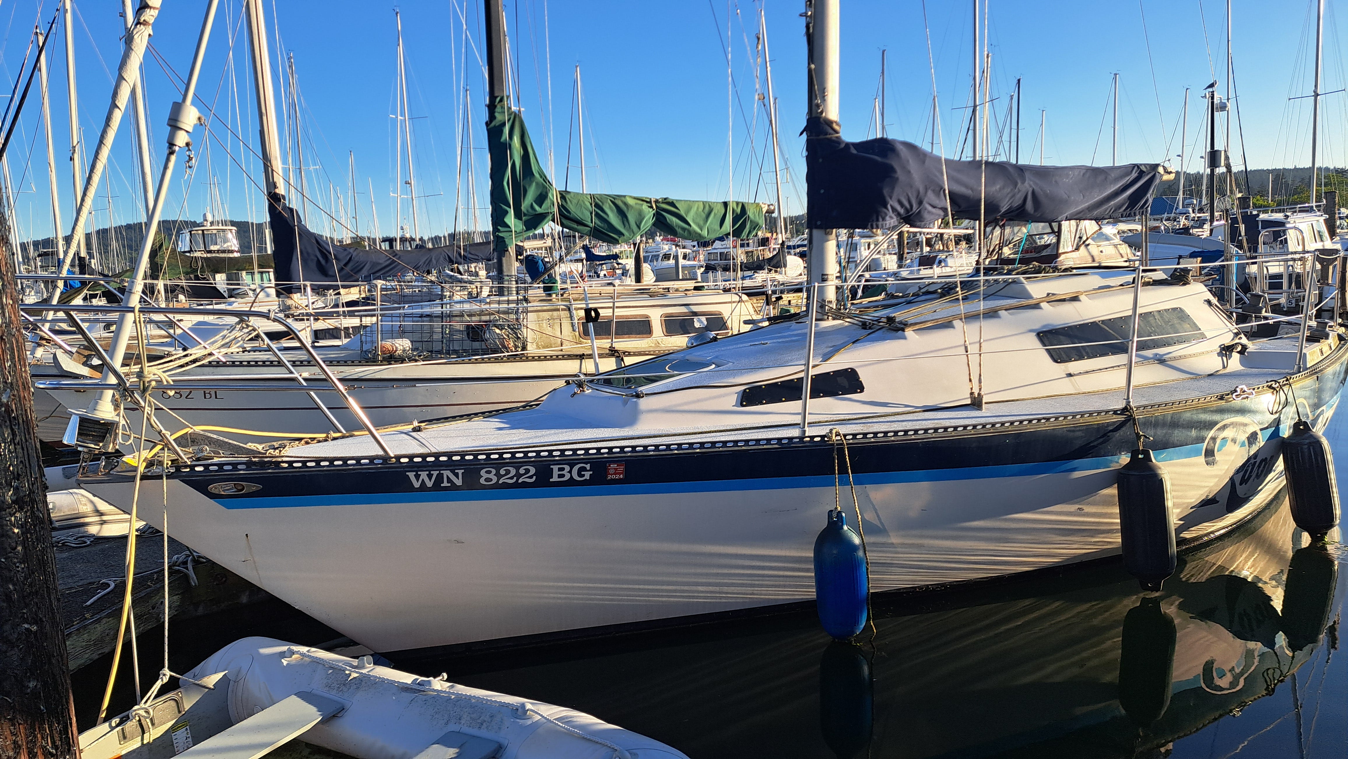
Prechecks complete, we donned our PFDs and turned the key. Rrrhh-rrrhh-rrrhh-rrrhh-rrrhh-pop-bang-phfft-bang-zzz. Rrrhh-rrrhh-rrrhh-rrrhh. What the heck? The little Yanmar diesel had always been quick to light up, a hundred-ten percent reliable. I tried again. Rrrhh-rrrhh-rrrhh-pop-bang. A puff of black smoke. Aha! Must be flooded. I backed off the throttle and cranked it again. Rrrhh-rrrhh-rrrhh-pop-pop-bang-bang-purrrrrrrrr—and we were off!
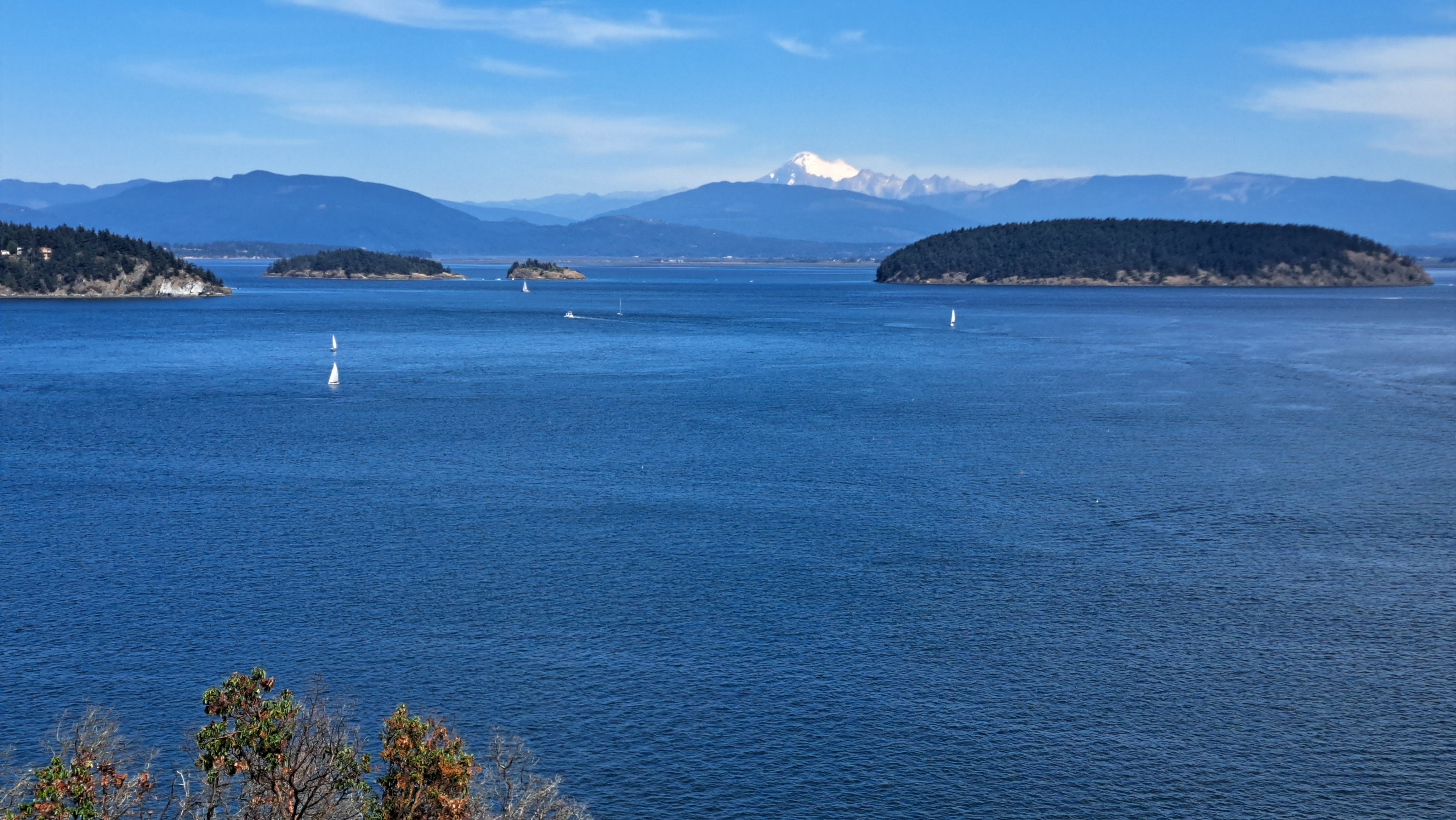
Clear of the marina, we bobbed along eastward in a brisky breeze and light chop. First up was a closer look at Hat Island. We wondered what might have inspired the name. Seems it could just as well be named Fir-Ball for all the bushy trees or Mammalback with its smooth profile vaguely resembling a seal lying on a rock. Apologies if there’s a romantic (or harrowing) story out there undergirding the placename.
Managed by the Washington Department of Natural Resources, Hat’s 91 acres are a designated Conservation Area. There are no facilities on the island, and reports are that you can pretty much see it all from the water, thus there’s really no need to go ashore. It wasn’t like we had a choice, since we’d left the dinghy at the dock. We let the critters enjoy it undisturbed.
Coursing a little to port, we approached then passed aptly named Dot. It’s more than a rock, but if you blink you’ll miss it. It too is reserved for the critters. Next to that is Saddlebag, its coastline similar to the outline of a slightly misshapen cowpoke’s saddlebag laid flat on the ground. I kayaked here once some years ago. The island is a marine state park with a short trail and several campsites that make it a bit more visitor friendly. A couple of boats were anchored off the south shore, sheltered from the chop and enjoying their moment of bliss. Imprinted in my head now is that I’m long overdue for another fair-weather paddle to these easy-to-reach islands.
Saddlebag, I should note, is also within the 11,000-acre Padilla Bay National Estuarine Research Reserve, mostly comprised of the bay’s sprawling, intertidal, habitat-rich marinescape. In other words, endless mudflats from here to the eastern mainland when the tide goes out.
A couple of years ago, while cruising down from Bellingham on the San Juan 28, we dropped the sails just off Saddlebag’s northwest cusp. Drifting along peacefully in 200 feet of water, we scarfed some lunch and chatted. That is, until we were rudely interrupted by the boat’s shallow-water alarm. We suddenly had barely a fathom of sea below the keel. The current had clandestinely carried us too close to said cusp where the deeper water abruptly ends. So who’s watching the GPS? Uh, that would be me. While Keith raised the sail I cranked the engine, and together we got out of there in the nick of time. A useful lesson in the ancient art of keeping your boat out of the mud and off the rocks.
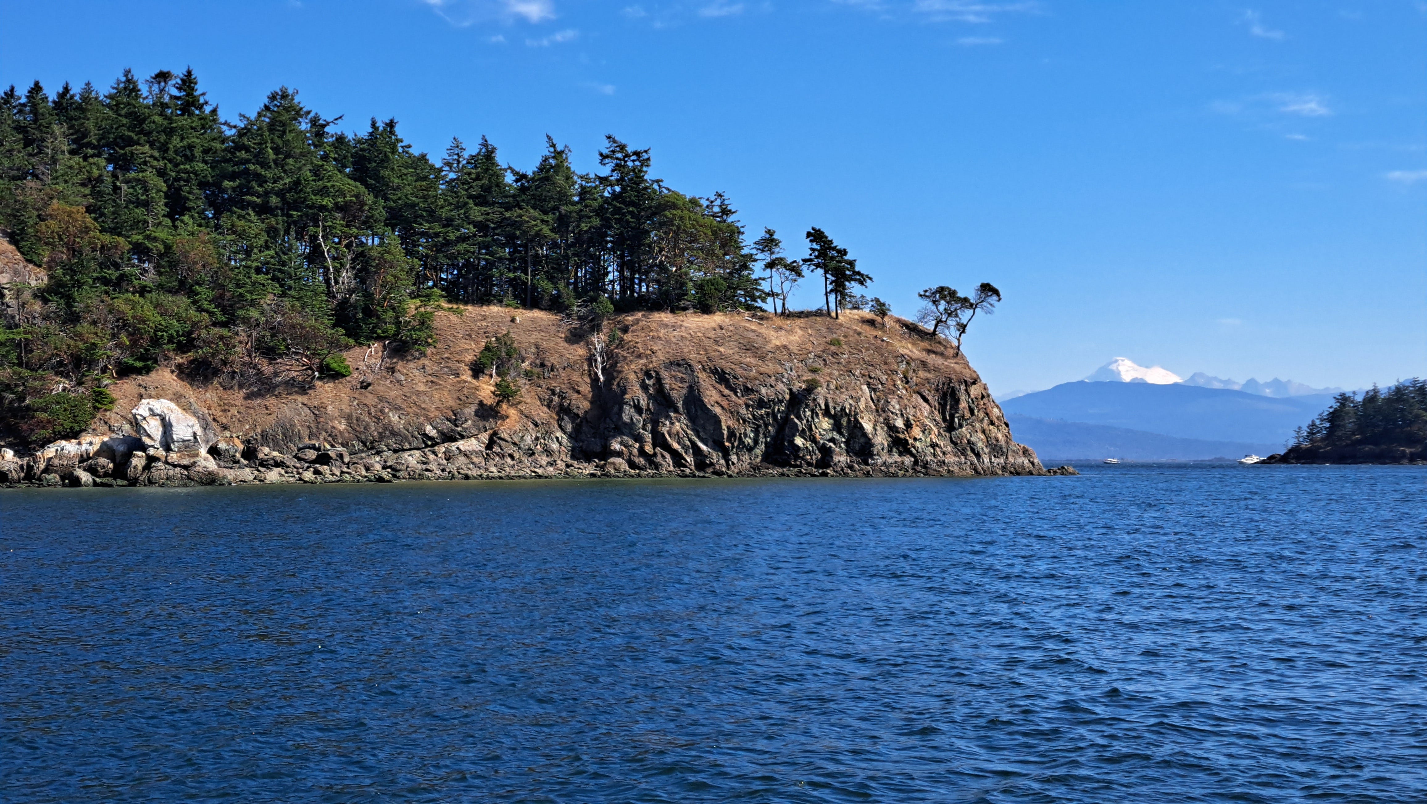
We motored on to Huckleberry, passing just a stone’s throw from its near-vertical shore. Once again, the depth registered at more than 200 feet—a veritable underwater precipice. We spotted a porpoise perhaps catching some lunch in the upwelling current. I wondered about the island’s fruity name as we circled around. A small beach beckoned and might have offered an answer, but with no dinghy in tow the mystery would carry on. We completed our lazy encirclement and headed back to Anacortes.
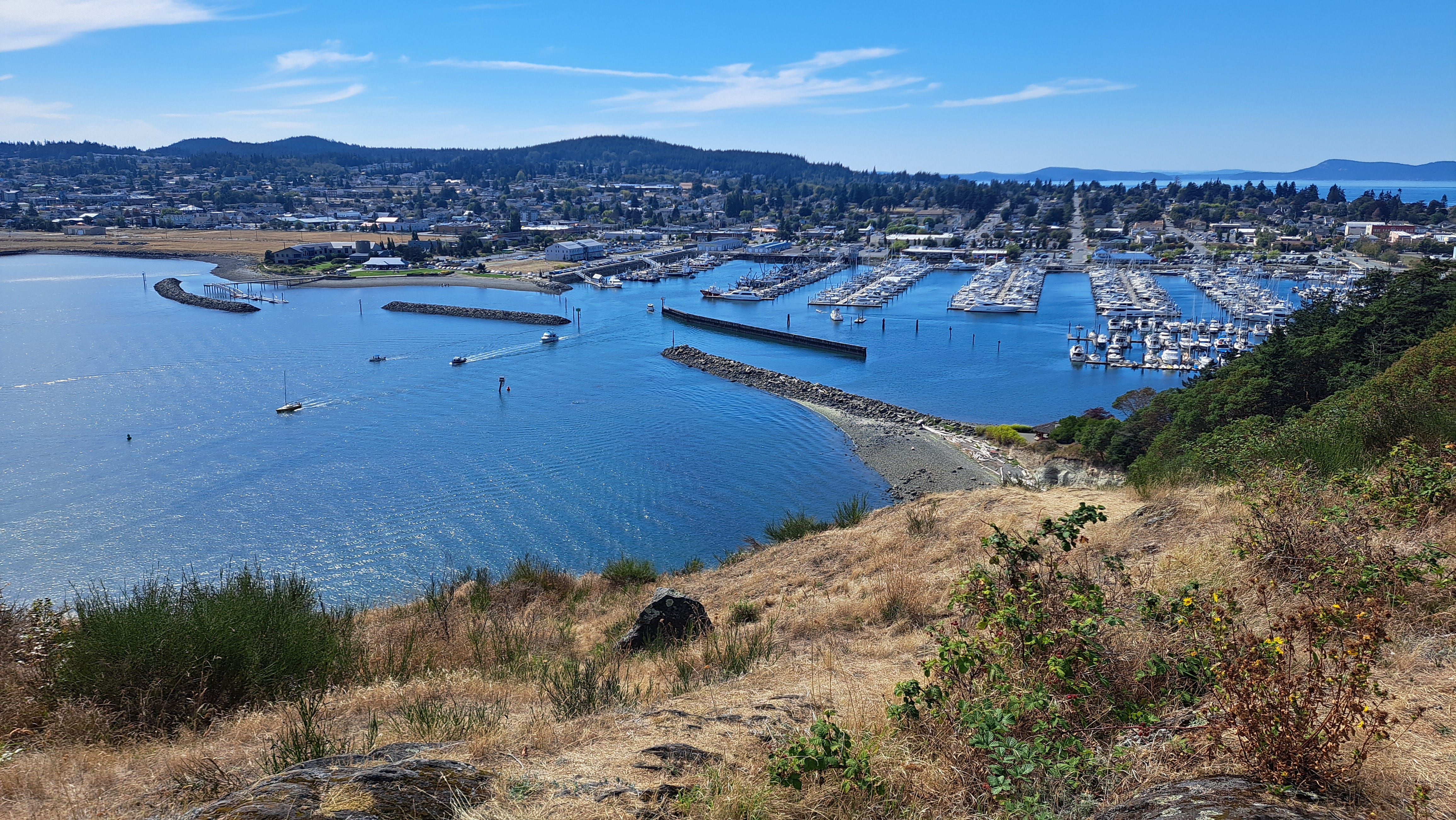
As we crossed the wide entrance to Guemes Channel, Bud pointed out an old amphitheater up ahead, perched on the hillside north of the rocky point known as Cap Sante. Beginning in the 1930s, spectators would gather there to watch boat races and other events. We couldn’t actually see it from afar, but we learned that a trail in Anacortes would take us there.
Too soon we were back at the marina pulling into the slip, pleased with our successful little shakedown. We bid our friends farewell, tidied things up and scampered up the ramp. Kris dropped me at the bottom of the trail leading up to the nearby Cap Sante overlook and drove on up to meet me. The short hike (or drive) leads to splendid view of Anacortes and the marina to the west, as well as the broad bay and islands to the east, including the course we had just enjoyed.
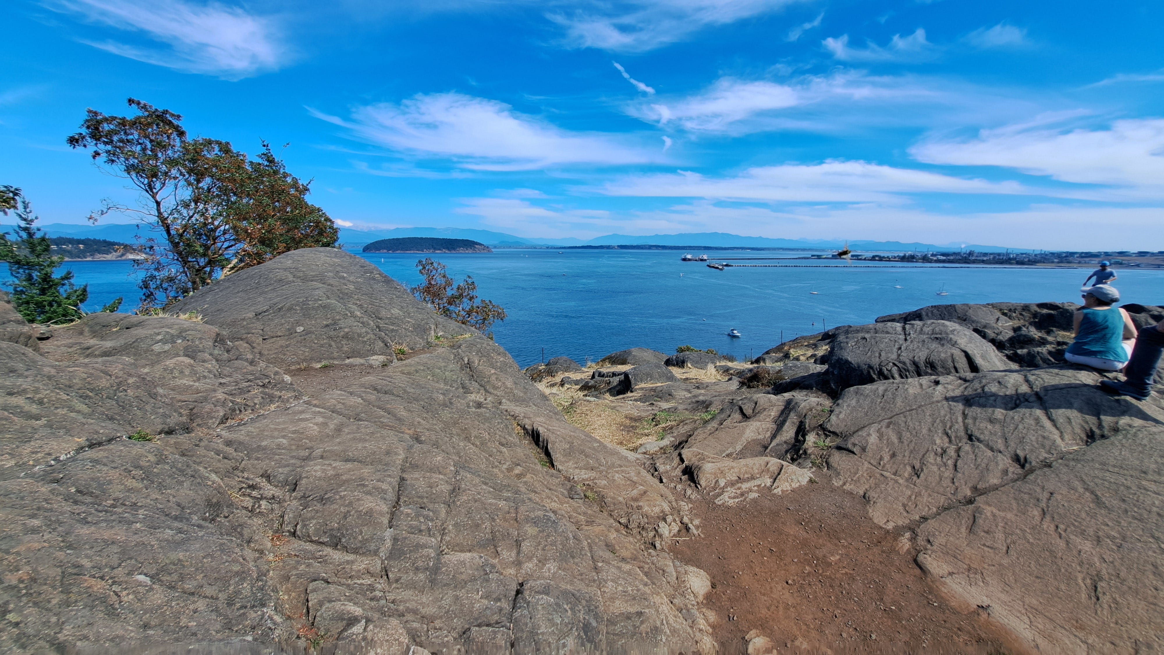
Kris spotted an interpretive sign with a map showing the trail leading down to the amphitheater, more correctly known as the Marine Stadium. Constructed in 1938, the rocky venue operated for two decades, essentially offering grandstand seating on stone benches for spectators attending the “Marineers Pageant.” The city describes the big event thusly:
Beginning in 1937 the town hosted thousands of tourists who were attracted by parades, events and zany contests. Following the pageant's successful first year, volunteer and Works Progress Administration (WPA) laborers constructed, in 1938, an amphitheater on the east side of Cap Sante, referred to as the Marine Stadium. Benches were structured of rock, and held an audience of hundreds of people gathered to watch water sports, acrobatic skiers and hydroplane races.
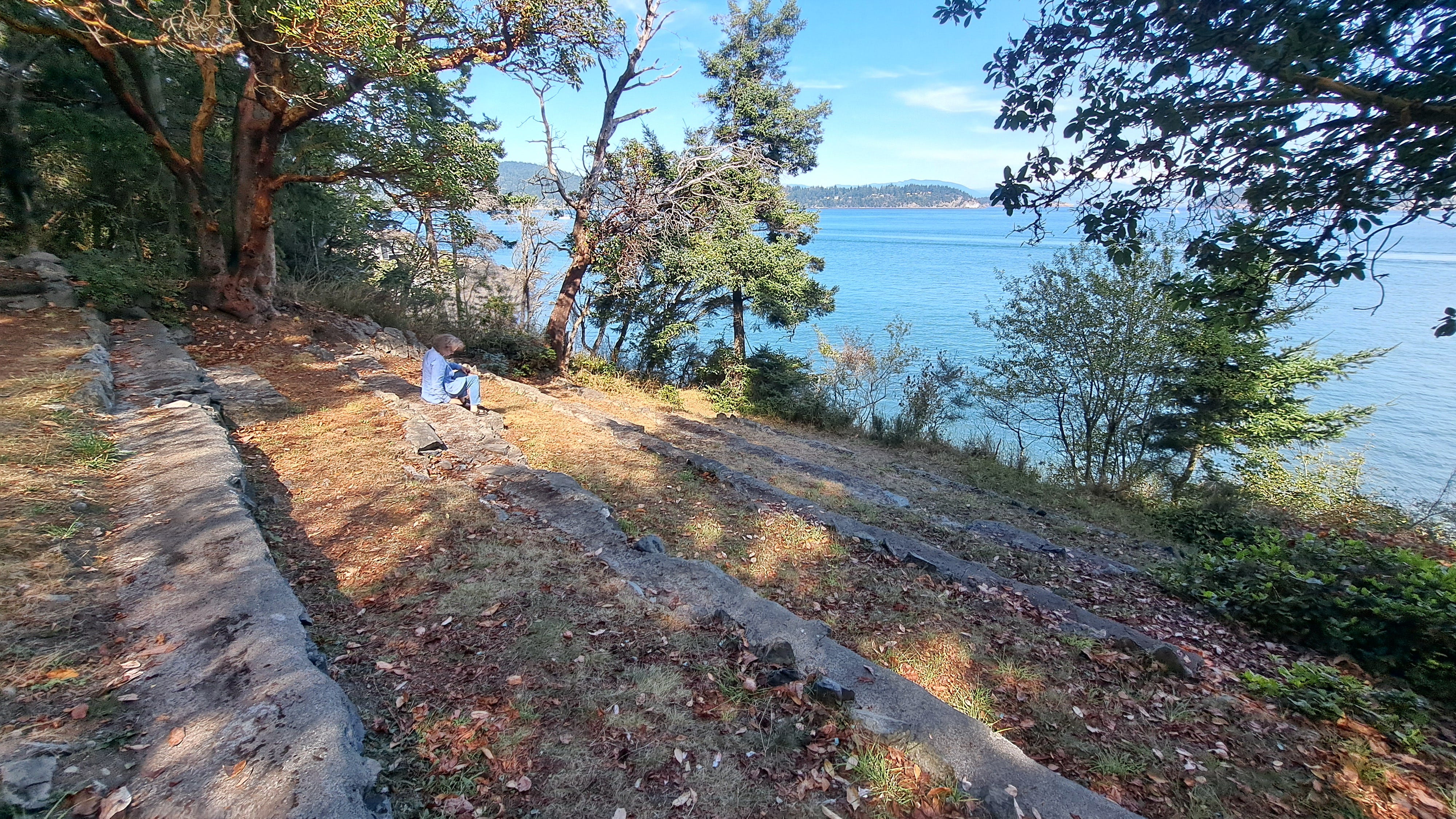
We hiked down the short trail and easily found the site of the old stadium. Rows upon rows of stone seating filled the forest like a prehistoric ruin. Long benches disappeared into the brush. Trees had grown up among them, somewhat obscuring what must have been a fabulous view of the exciting times on the water. The stadium appeared to be in great condition, solid as a rock, to borrow a term. Maybe someday it can attract a pageant anew and recover some of that prior glory.
Kris and I returned to Bellingham, but our day on the water was not yet over. That evening, we loaded the double kayak onto the old Datsun pickup, affectionately known as “Trusty Rusty.” We laid rubber and squealed around corners to reach the beach at Marine Park, arriving just after sunset. Our objective: to see the bioluminescence in the bay while the weather is still warm and clear. And there was a new moon to boot.
It is written by the elders of the Port of Bellingham that Marine Park doth close at dusk. But when I looked around at the nearly full parking lot and all the people loitering along the beach after sunset, I took it as an indication that said elders may be in a more forgiving mood than usual and that we could probably just leave the truck in the parking lot without triggering a citation or some other penalty for violating the closed-at-dusk thing. Who the hell even knows when dusk begins anyway? I figured we should at least be back by astrological twilight, and therefore did not pull the truck out past the gate where abundant evening parking was still available.
In civil twilight, we paddled south along the shore, the water as calm as table top, ruffled only by the occasional wake of a distant boat. Our eyes adjusted to the darkening sky as the sun’s glow receded in the west and the first stars appeared. A gentle slosh on the rocks was all that broke the evening’s silence. The darkening darkened some more. Pupils dilated.
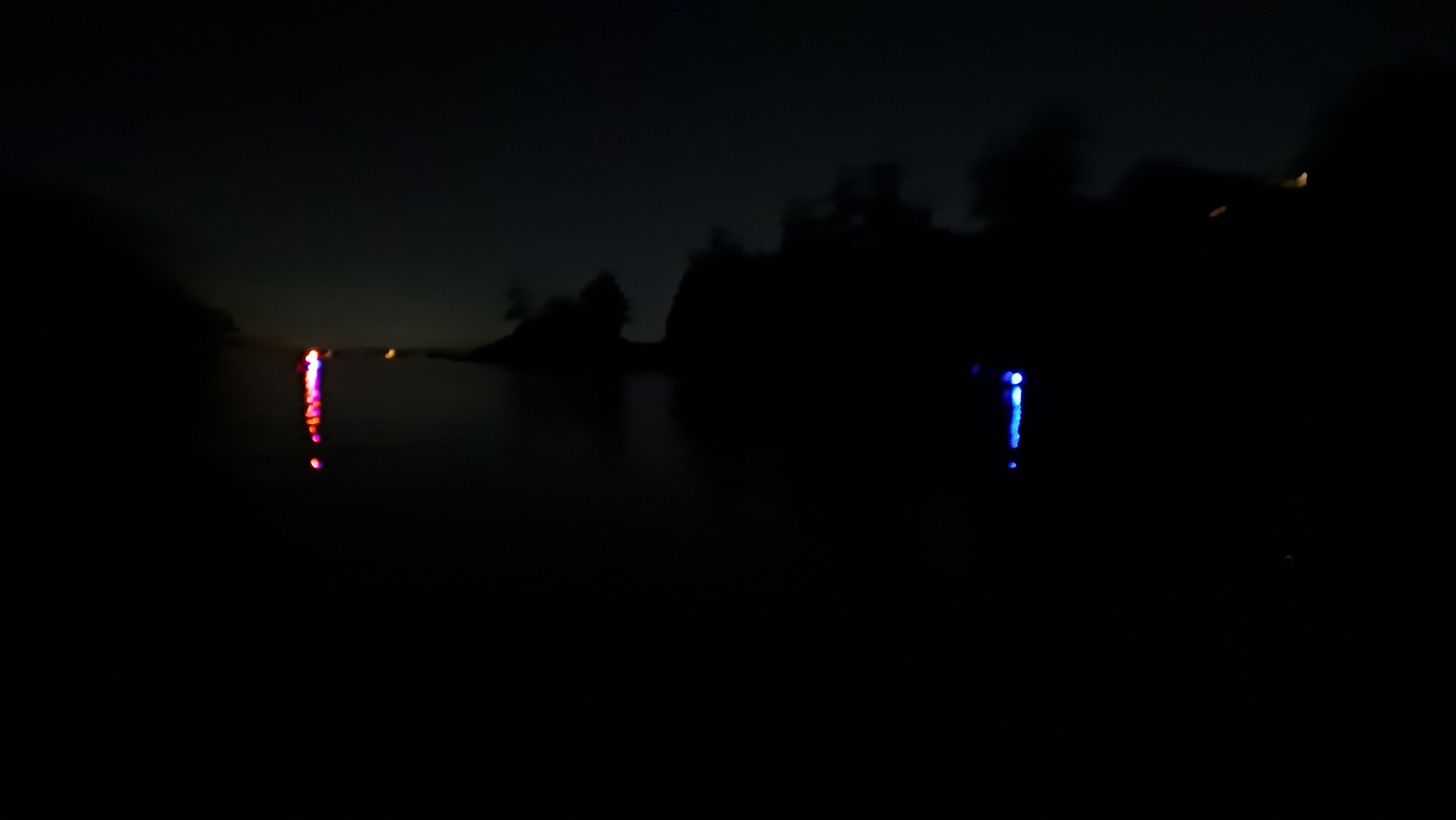
And then, there it was! The paddles were turning up a lighter, whiter bubbliness than a few minutes before. Could it be? We ran our fingers through the water and yes, it be! The trails from our fingertips lit up with a faint blue glow that seemed to brighten by the moment. The light danced off our fingers, the paddles, the dripping droplets creating a splash of light as they splattered. We slowly drifted along noticing the light’s intensity ebbed and flowed, from dull to almost electric.
Kris also noticed that the water even sparkled in her hands. When she dribbled water on the bottom of the boat, it too would sparkle. I tried the same, dribbling water all over my shorts, but the sparkles did last for a second or more, like stationary fireflies. I’d witnessed the bioluminescence from a kayak in the past, but somehow never noticed that the spakles would linger like that.
We passed a few other nighttime paddlers with similar ideas, equally jazzed by these weird little phenomena of the natural world. The warm evening, the gentle bobbing along, and the blue-white light of microscopic plankton pretending to be fireflies, made the time slip away—into and beyond, well, astronomical twilight. It was time to head back to the park, although I think Kris would have happily continued on to the Mexican Baja.
Back at the beach, people were still frolicking, some swimming or paddling wakeboards, others just sitting in the warm air and starlight. As we hauled the kayak up onto the shore, I could see the parking lot had completely emptied out, with the lone exception of a Datsun pickup. Oh gee, lookie there. There’s a note on the windshield. Busted. We loaded the boat and accoutrements and proceeded to the gate, which of course was locked. The note said we’d best call a certain number if we wished to be set free. I called and the extra-friendly security guy said he’d be right over.
So we, or more precisely I, boobooed thinking we could fudge the rules a little on such a primo summer night and leave the truck in the park. Moral of the story: don’t be a dunce like me. Heed the signs. But do get out there and enjoy our splendiferous Salish Sea.
By the way, my smartphone could not capture the blue light, but you can easily search online for some decent video clips of the Salish Sea’s summer night’s magic.
Wonderful Salish story! What a full day into luminous night! I haven4 been to Huckleberry and the lor by kayak in awhile. I too, must get out after dark to immerse in bioluminescence!