
Desert Canyon Getaway: Part 1 of 3
Two weeks at Capitol Reef, Bryce, Paria, Buckskin and Grand Canyon

While the body parts are still mostly working, I decided I’d better get my butt down to the Grand Canyon this spring for another good hike to the river and back. It’s been too long since I’d moseyed in and out of this massive hole in the ground with an all-too-heavy backpack. But I done it and came back home with only one sore knee and a little grit in one eye.
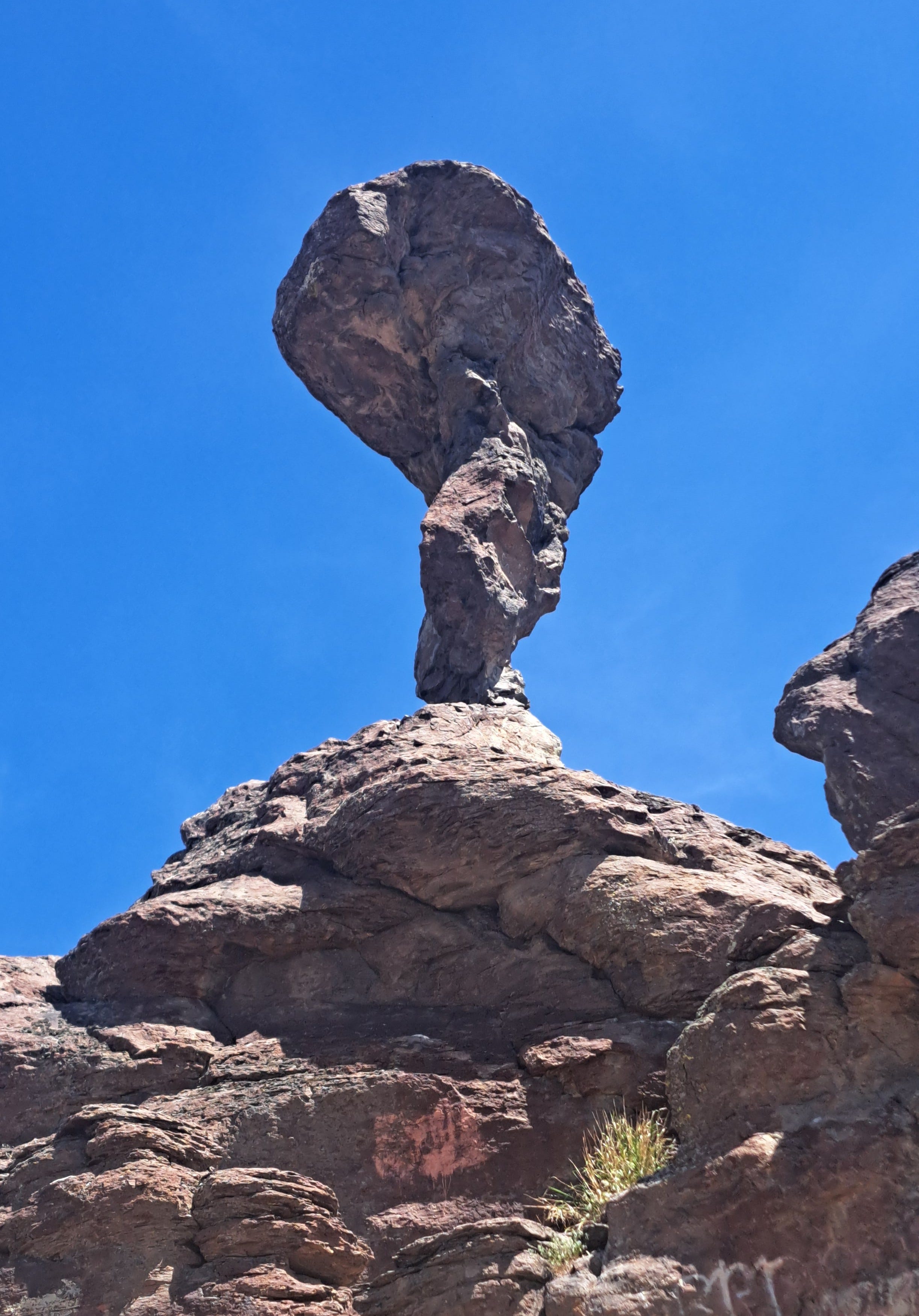
Of course, I had to tack on a few warmups on the way south. First up was a short, steep scoot up to the balanced rock at, wait for it, Balanced Rock Park near Twin Falls, Idaho. An easy diversion, the stop was well worth it for a break in the long drive to Southern Utah and Arizona. If you go (do) walk up to the base of the 48-foot tall gravity-defying monster, then continue along the ridge another 150 yards for more views and a natural arch.
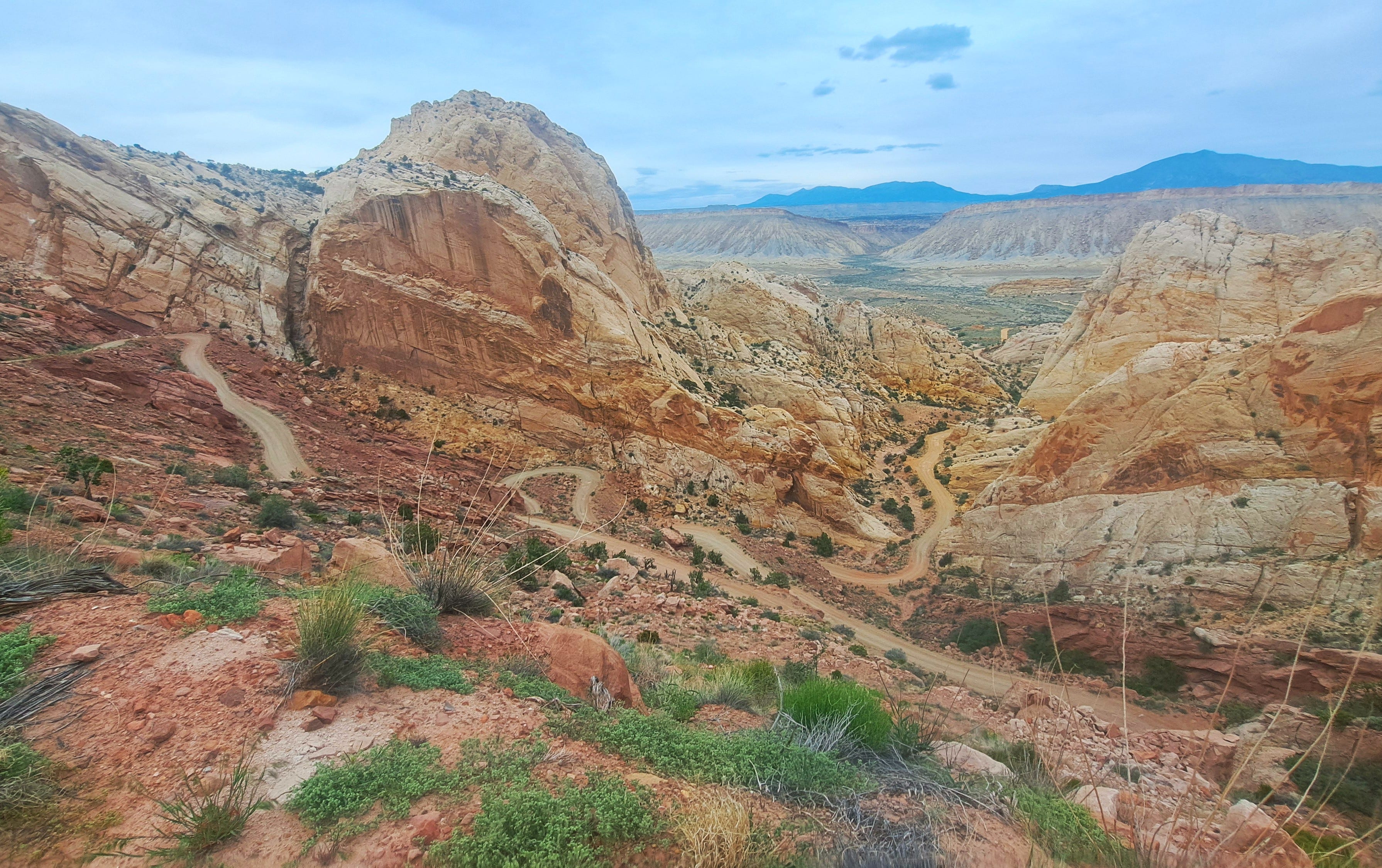
Next up was Capitol Reef, with time for just one good hike. I’ve done most of the trails there and a few of the canyons, but there are also some more remote places that I’ve been wanting to get to. So I picked the Upper Muley Twist, a reportedly scenic place with canyon narrows and a high open ridge for the return. Just follow the cairns, they say. The gnarly access road is signed four-wheel-drive, though our 2019 CR-V handled it fine, barely. But you’d better know how to drive in this stuff if you don’t want to leave a collection of used auto parts in your tracks. Not a good place to get stuck.
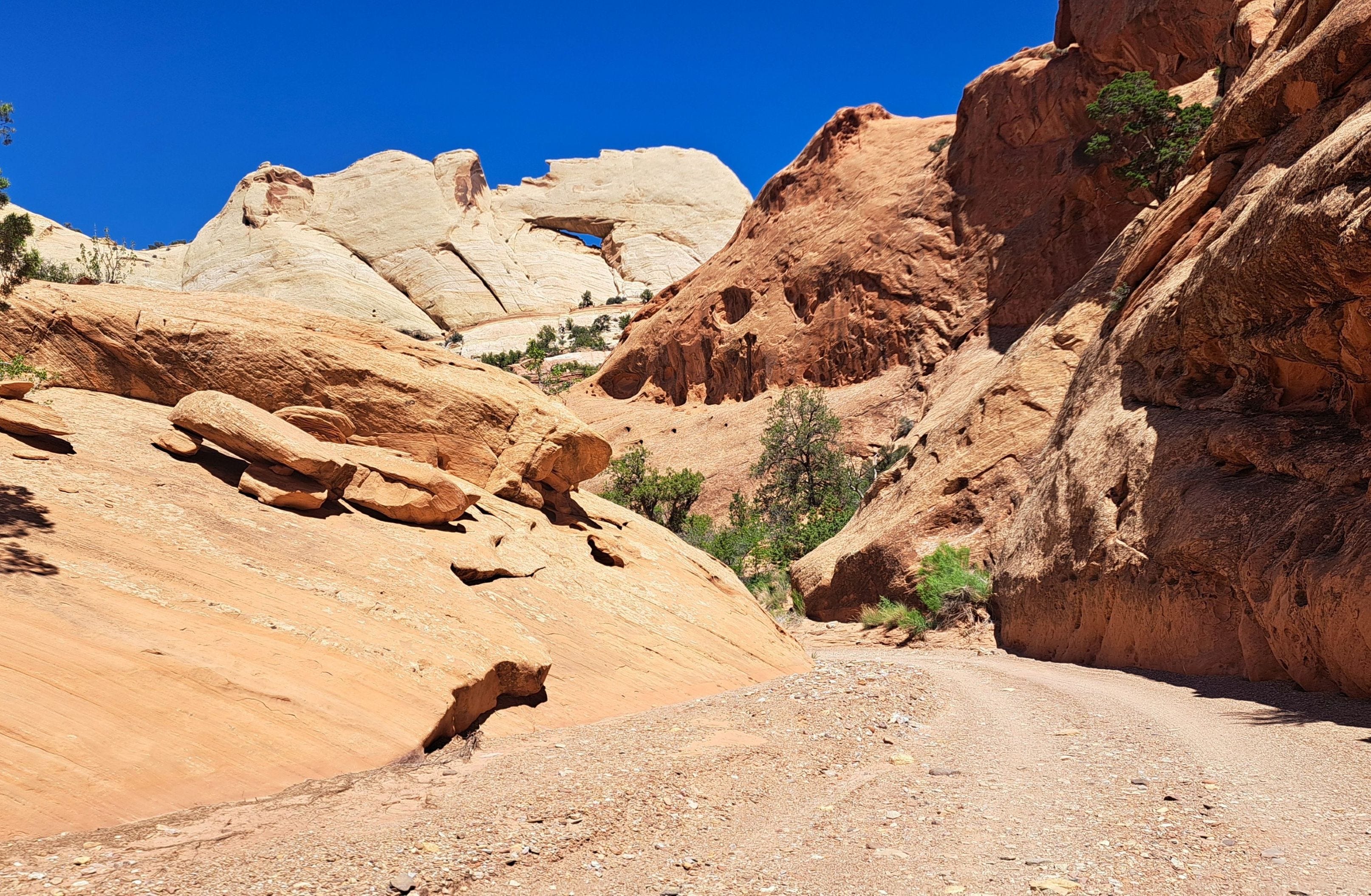
I seemed to be the only tourist out there. The hike was nice enough, with captivating rock forms and natural arches to ogle, with Saddle Arch stealing the show. The rest, however, may not be everyone’s cup of tea. When you reach the skinnier narrows of the Muley, obstructions block the way and the route is forced up a steep and somewhat scary bypass where a slip could be your last. I would not want to carry a backpack here.
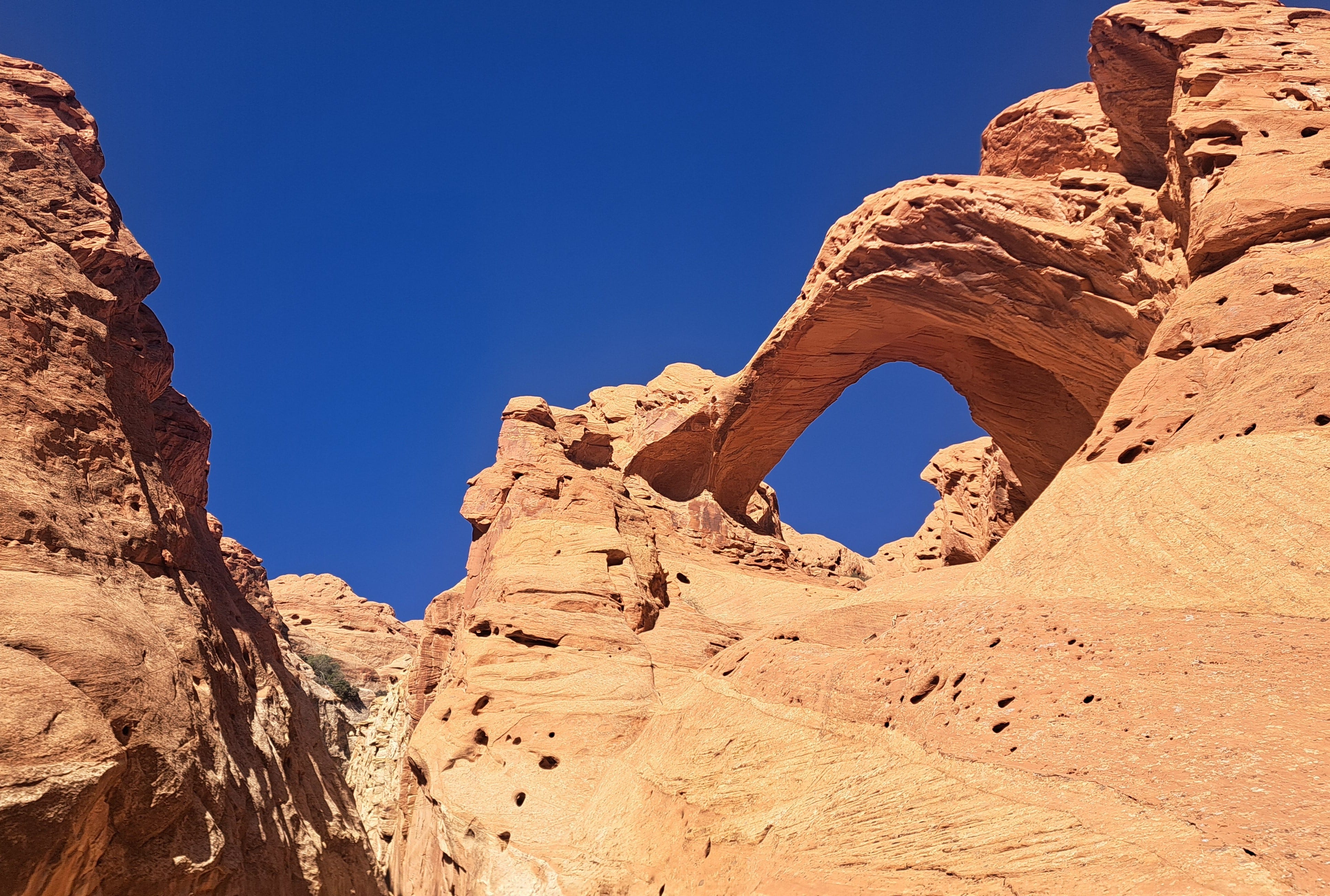
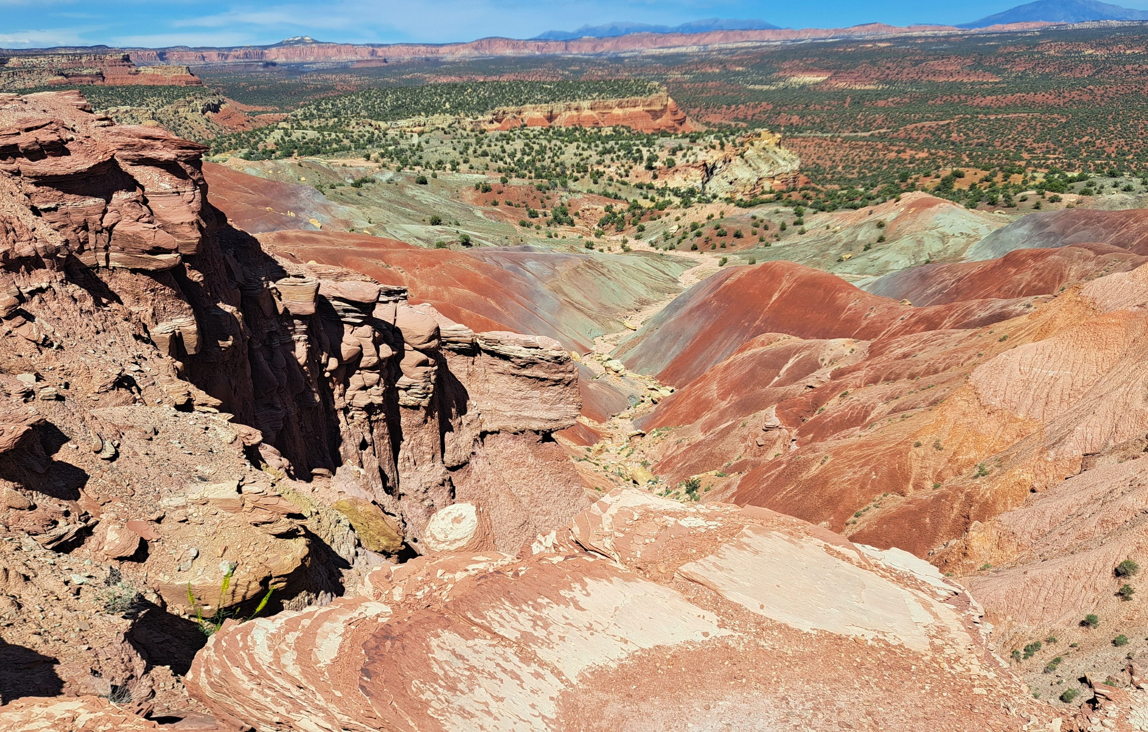
After the longish bypass, a crude path marked by cairns led steeply up the Waterpocket Fold until cresting out with awesome views across Strike Valley to infinity and beyond. From there, it’s a matter of following cairns along the slickrock ridge for several miles, passing a couple of steep scrambles (easier than they look), before descending back to the dry stream bed where you began. I found the ridge fairly easy to follow and quite appealing. But the weather was perfect too. It could be a very different story with poor visibility. From one spot on the ridge, I could see at least five natural arches. Together, it was about a 9.5-mile loop with 1,000 feet of elevation gain.
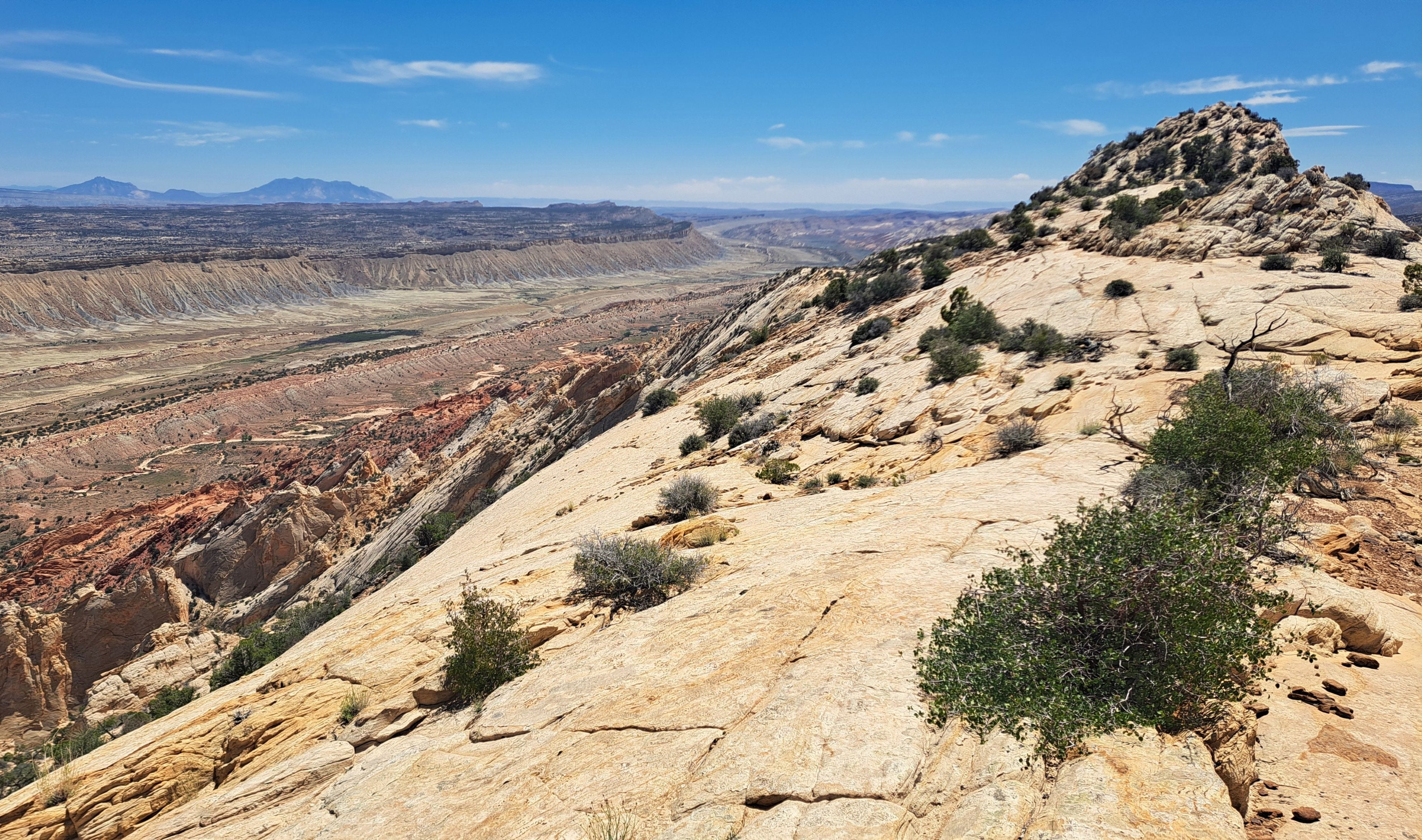
On the way out, I passed a couple of day hikers and a solo backpacker coming in who chose to walk the road to the trailhead. I realized on the drive out that some of the best scenery is actually along the road. If I was to go again, I’d forego the white-knuckle drive and just walk it. Beauteous place. By the way, the trailhead is not too far above the infamous switchbacks along the Burr Trail, a partly paved road that began as a cattle trail in the 1880s. Crazy. Awesome.
My route took me close to Bryce Canyon, so I checked recreation.gov and found that there was one campsite available. I snagged it and rolled in just before dark. It was pretty windy, cooling fast and not much fun sitting at the picnic table, so I called it a day and crawled in my bag. However, the folks next door were determined to have a campfire, whereupon I was nearly smoked out. After gagging for about 10 minutes, I was about to crawl back out and relocate the tent. But the neighbors gave up on it at about the same time, surrendering to the wind and letting go of the idea of a romantic evening by the fire.
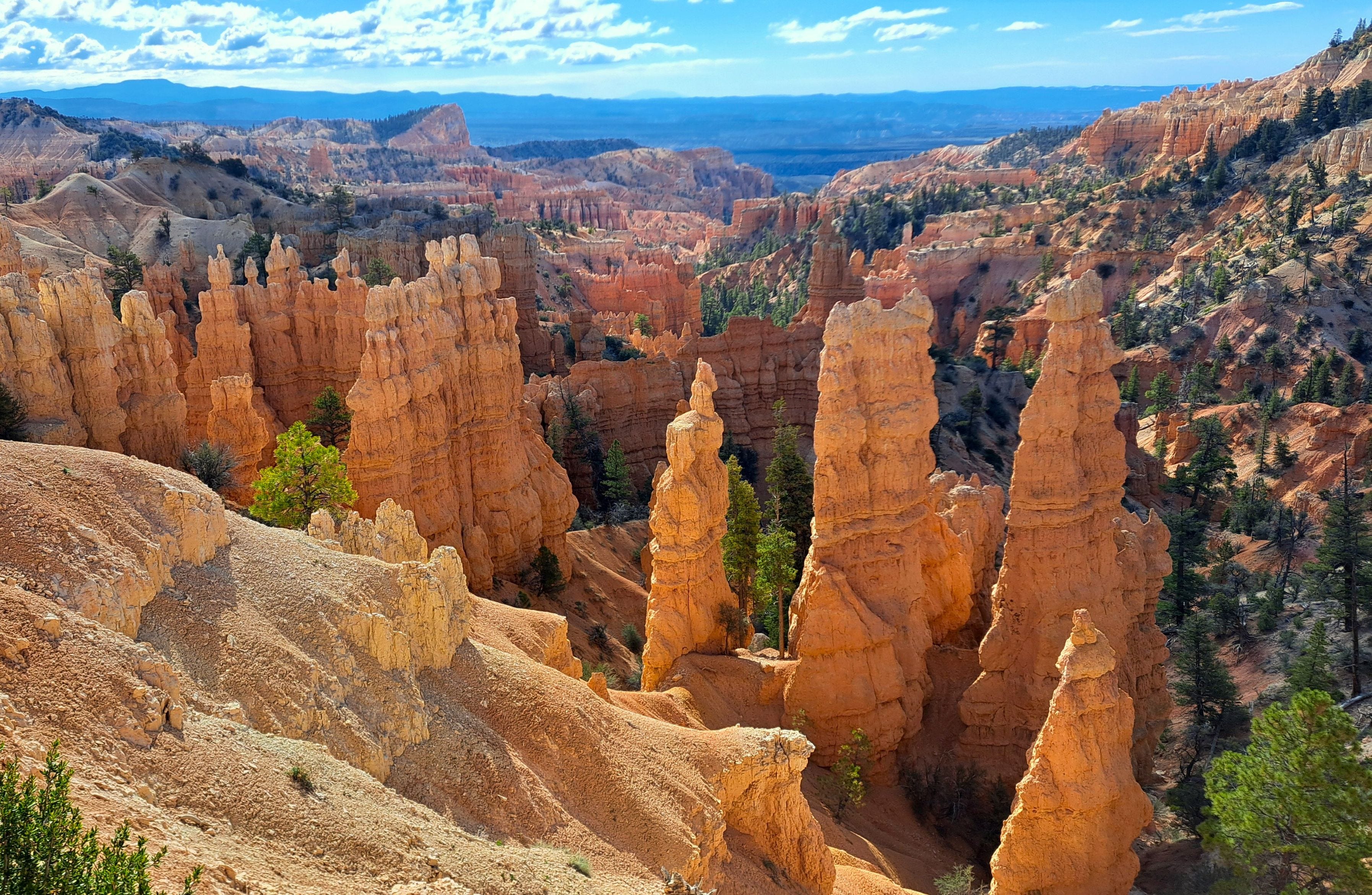
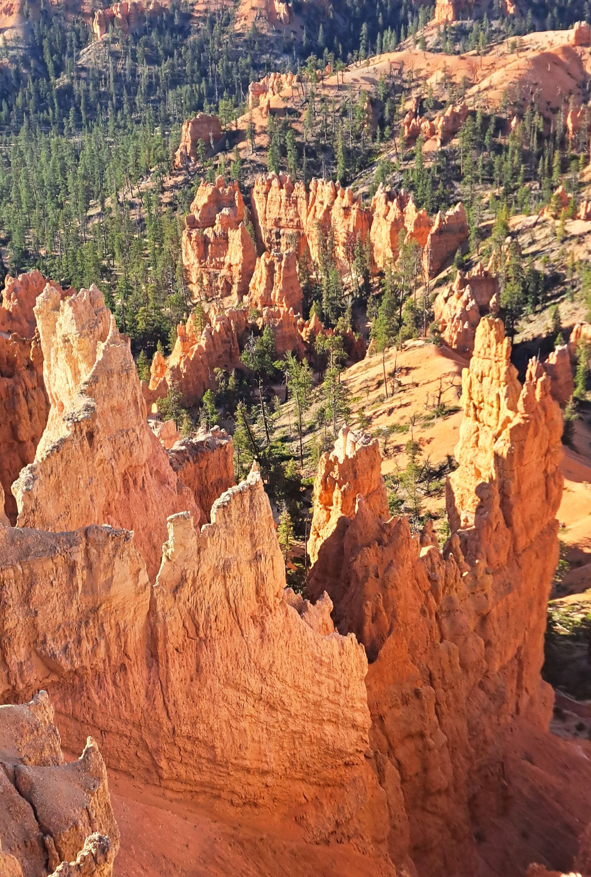
Sunrise at Bryce is pretty special, so I made the rounds of various overlooks with short walks to grab some photos for the stories back home. My right knee was a little stiff from the Muley hike so I took it easy to keep it healthy for the next wee trek.
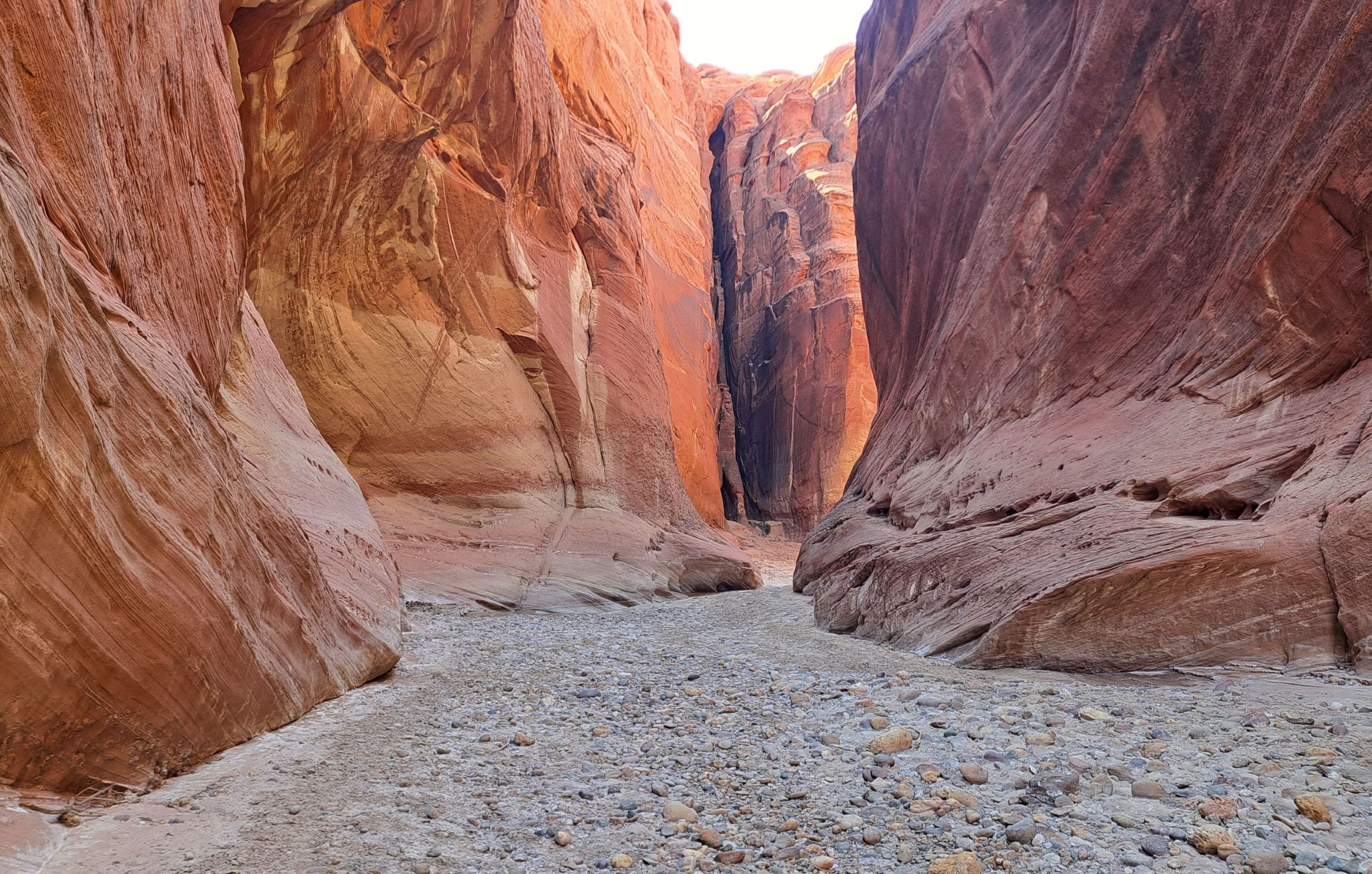
Next stop, Paria Narrows. I’d gotten a permit to hike the granddaddy of all the Southwest narrows, Buckskin Gulch. The 14.5-mile slot canyon is the longest in the U.S., if not the world, as narrow as six feet in places with rock walls hundreds of feet high. There is only one possible escape route midway. In 2023, I’d reserved a permit for a mid-April attempt, but I bailed after hearing of deep, cold mud and icy pools that I might need to swim, and little chance of warm sunshine. It had been, and remained, a stormy wet spring. A few weeks earlier two guys from Florida had been killed there in a flash flood, their bodies deposited miles downstream. The ranger told me someone had just found their phones, which somehow made it a little too real. A few weeks after I cancelled my plan for Buckskin, two more hikers died in another flood.
I finally rebooked a permit for early May this year. Buckskin is a tributary of the Paria River and is often done on the first day of a multi-day, 40-mile trek all the way down the Paria to Lees Ferry on the Colorado River. Lees Ferry is where most rafters and kayakers launch to run the Grand Canyon. I could not spend a lot of time here and still squeeze in the Grand, and being solo, did not feel like spending the big bucks on a shuttle. So I opted to walk in and out with just one night camped on high ground near the confluence. The plan was to descend Buckskin, exit Paria and hitch a ride back to the car.
When I read about current conditions on Buckskin, more cold, deep mud up to your waist, if not your armpits, I bailed once again. It was certainly doable and the weather was stable, but it just didn’t sound like much fun. I’d hoped the narrows might be drier by May after a low-snow winter. So I nixed that plan and entered via Paria instead. I’d simplify things by camping near the confluence, exploring a bit of lower Buckskin and Paria from there, and return the way I came.
I picked up my permit at the BLM outpost and drove to the little campground at the White House Trailhead. A friendly couple there had just walked out after the fellow injured his back. They’d planned to hike all the way to Lees Ferry, but that was now out of the question. The problem however, was that they’d sprung for a $250 shuttle and their car was parked at Lees Ferry. After failing to entice an Uber to drive up from Page to rescue them, I offered to take them that far, an hour and a half round trip, meaning I could still be back at camp before dark. With visions of a shower, dinner and hotel room, they quickly accepted and insisted on buying me a tank of gas.
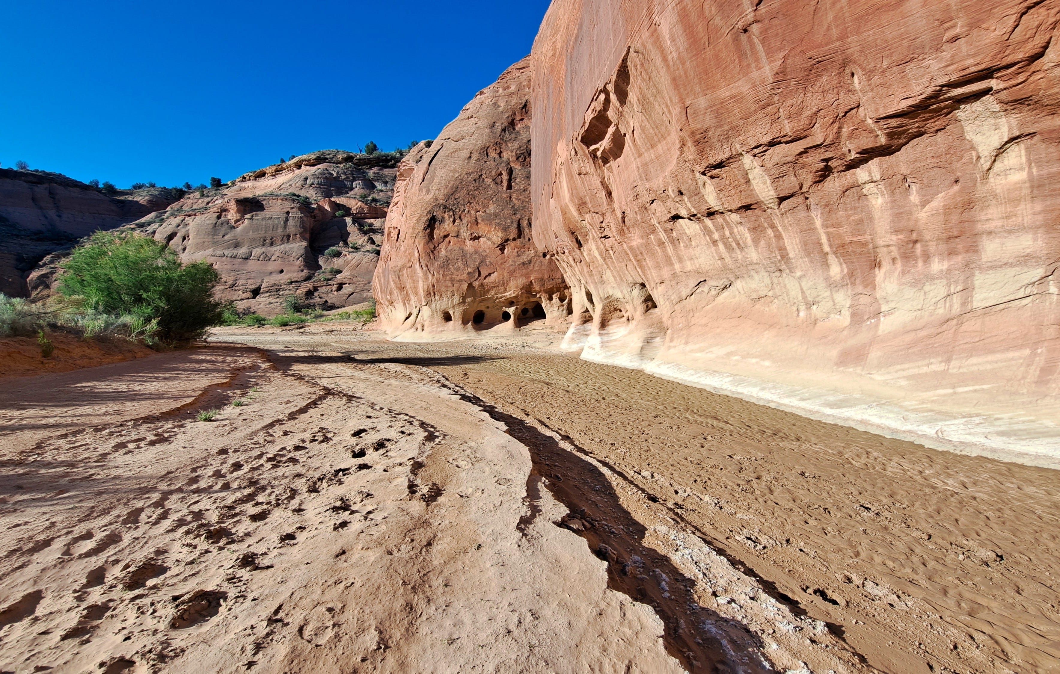
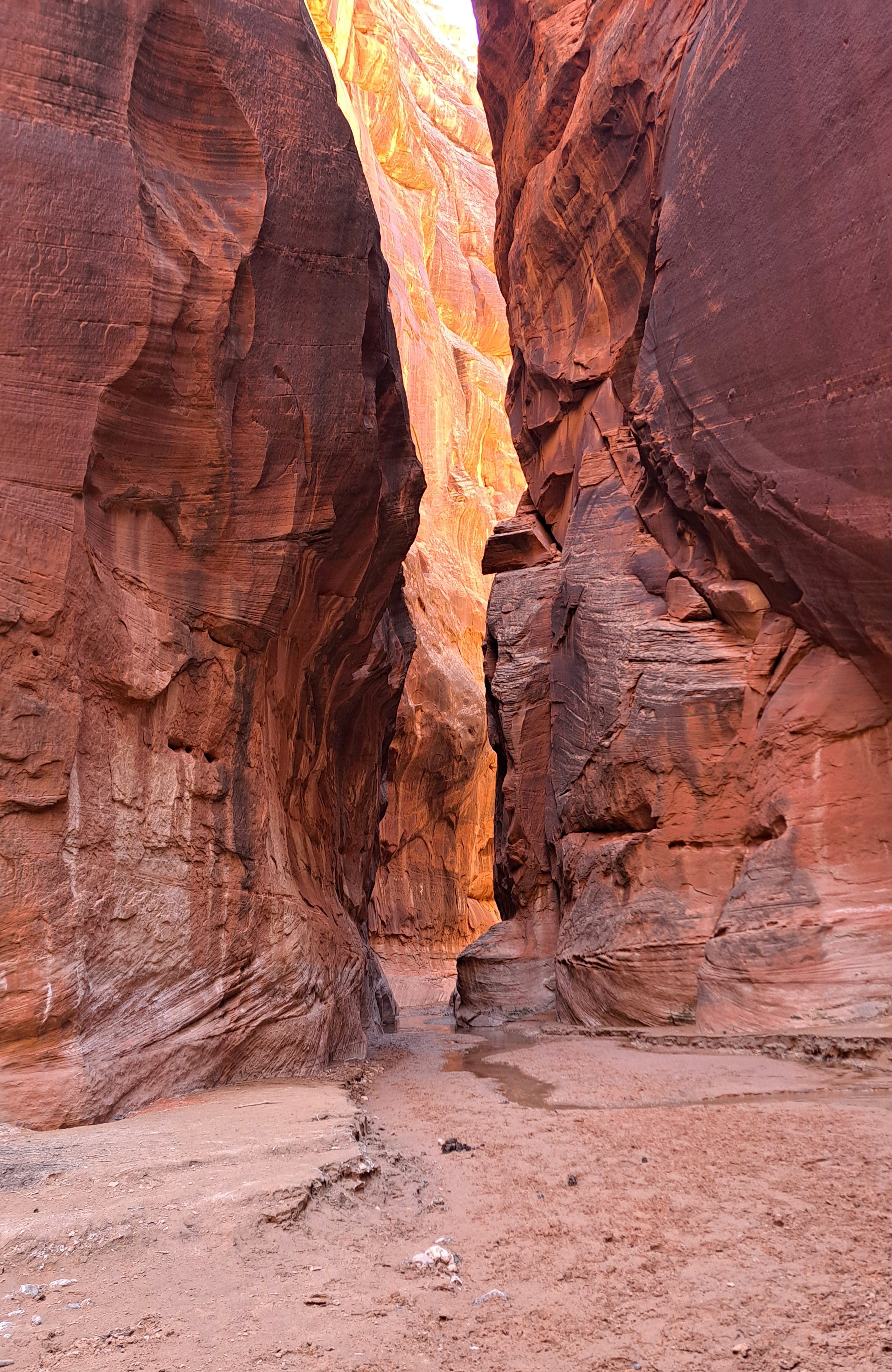
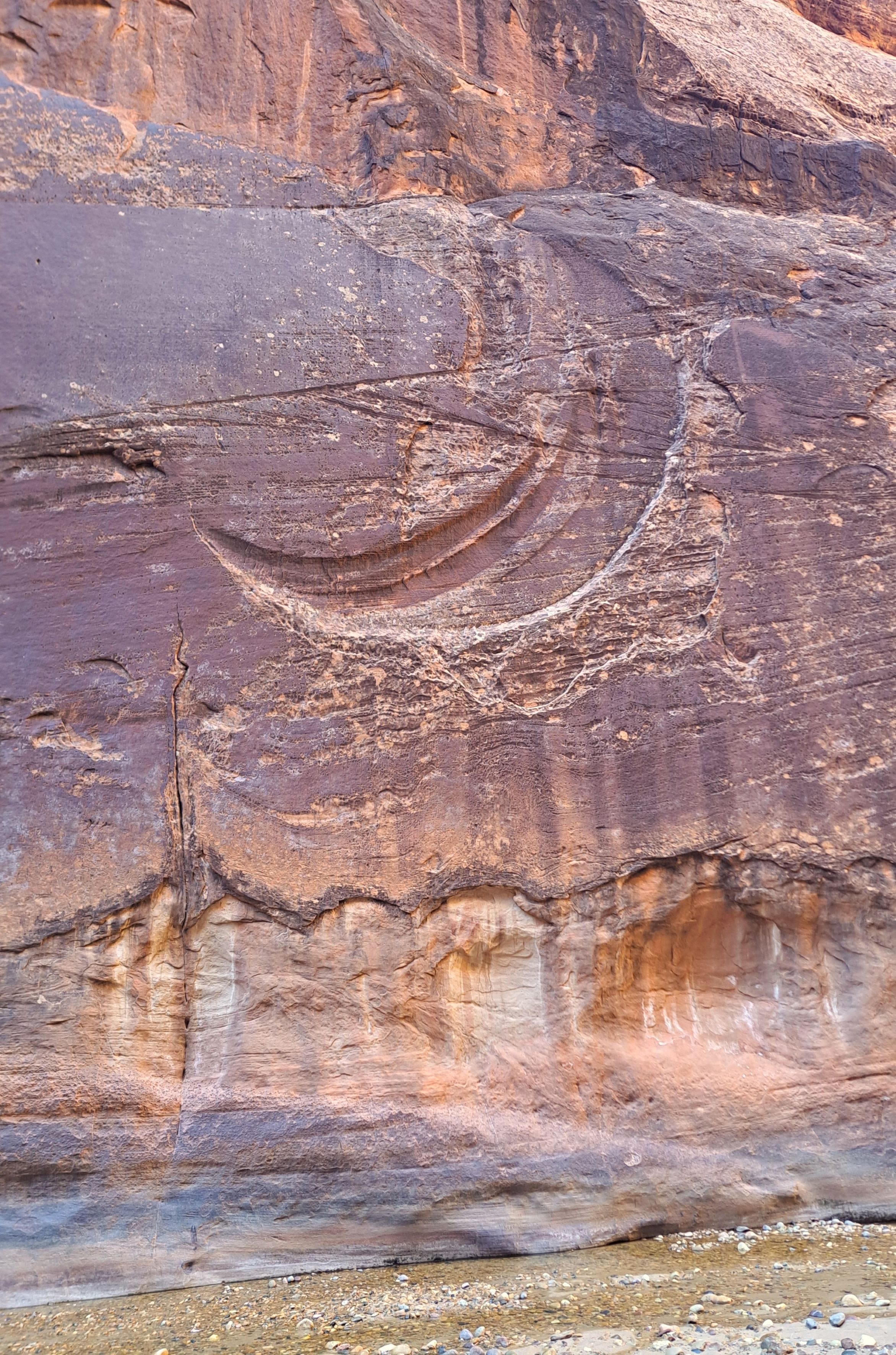
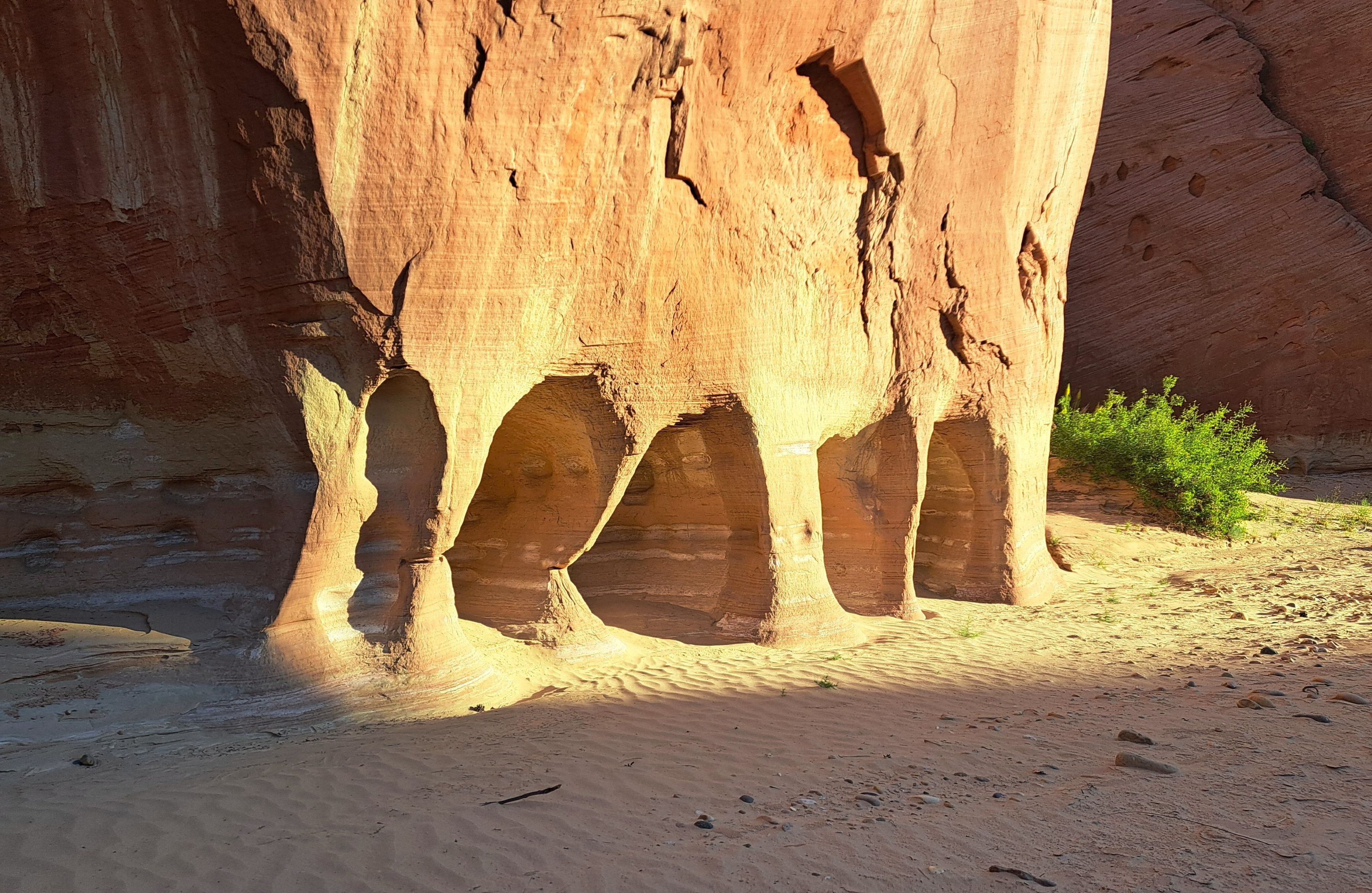
The next morning, I was surprised to find the Paria River almost completely dry, with only a few puddles about six miles in. I’d expected to be wading in a shallow river this time of year. What began as a wide, sun-drenched valley, closed in to scenic narrows with abundant, eye-catching sandstone formations well before meeting the Buckskin. Strangely, I once again seemed to be the only person out there despite the high demand for backcountry permits.
After a few hours, my internal odometer suggested I’d walked well over the seven or eight miles to Buckskin. I kept on a while enjoying the narrows, until I began to wonder if I’d somehow missed the confluence. But how could I miss the place where two major canyon narrows converge? I’d presumed that the GPS app on my phone would be useless in such a deep narrow place, so I hadn’t even bothered to look at it. I’d surely encounter a few tents, hear voices, etc., right? I finally pulled the phone from my pocket, and sure enough, I had good satellite reception. I’d walked nearly two miles beyond the confluence and was now in Arizona!
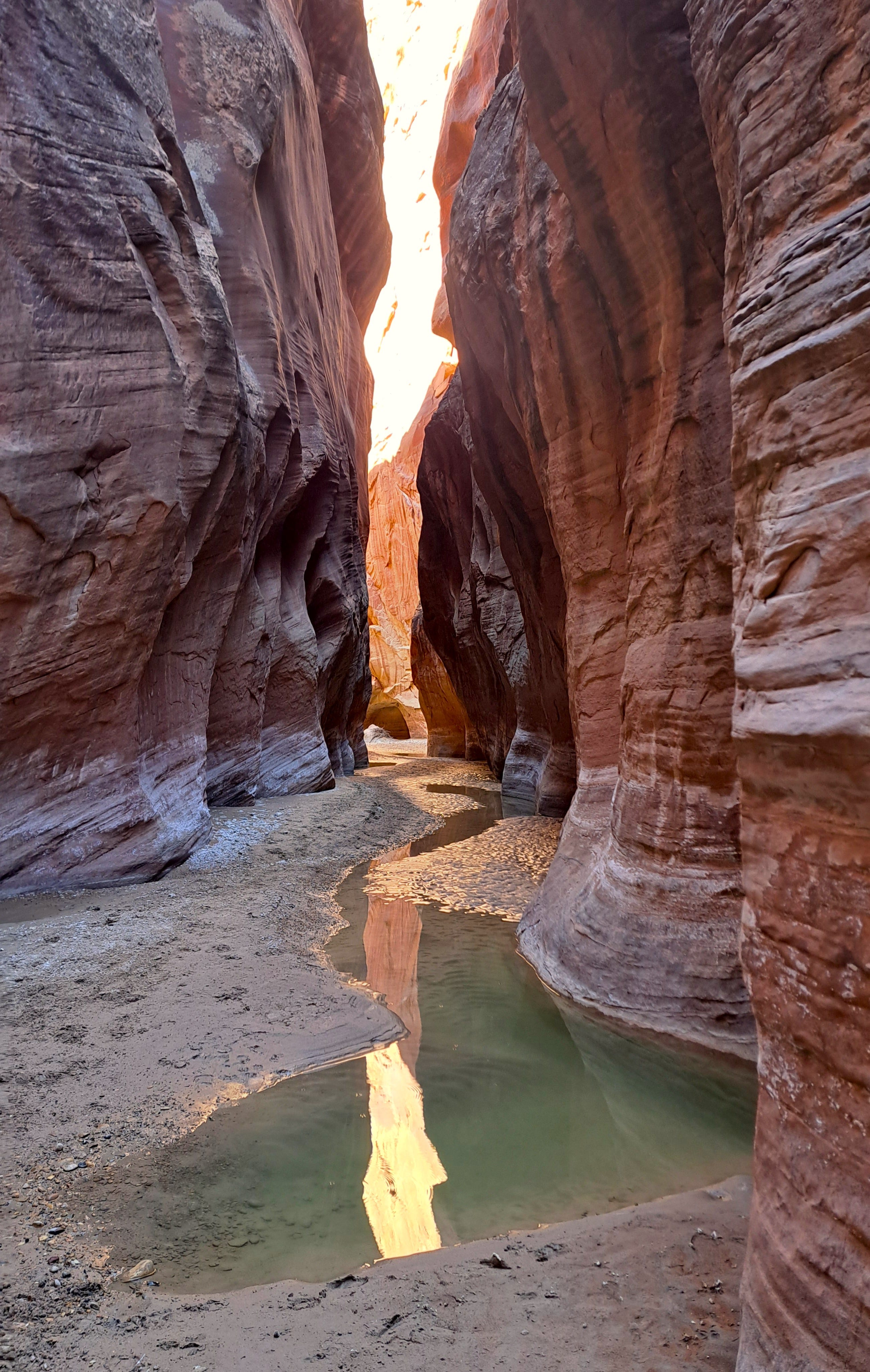
Still seeing no one, I finally reversed course found my evasive Buckskin, a good-sized gap between high rock walls. It couldn’t have been more obvious. I have no idea how I managed to walk right past it. Lost in deeply important thoughts apparently. I wandered up Buckskin a short distance and found an elevated campsite, pitched the tent and consumed a late lunch. Then I hoofed it up lower Buckskin briefly to get a feel for the place.
I hadn’t gone far when I ran into a long, watery mudhole that looked to be at least knee deep. I was still relatively clean and my boots were dry. I’m thinking I really would like to descend all of Buckskin Gulch some day, so maybe I should save it for an all-in mud fest. I cowered once again and returned to my tent. Soon after, a half dozen hikers emerged from Buckskin, muddy as mud wrestlers but exuberant to have finally reached the confluence, now bathed in warm sunshine.
By now, having unexpectedly gotten a taste of both Buckskin and Paria after about 11 miles of hiking, and with plenty of daylight remaining, I repacked my tent and scattered accoutrements and headed back up Paria. I walked another three miles, or about 14 for the day, which would shorten the hike out the next day and get me to the campground at Grand Canyon well before dark. After a brief chat with a local snake, I skirted a large ant hill and camped on a sandy river bank with no one else around.
I was walking again before sunrise. Despite the sunny weather, I was baffled to find the leading edge of a small stream meandering along the river bed, as if someone had turned on a hose miles away and the water had just now reached me. The past few days had been quite warm, so I guessed that the warming had accelerated some high mountain snowmelt and it finally just got here. The headwaters of the Paria River reach all the way to Bryce Canyon at over 9,000 feet. The trickle gradually became a creek the farther I went, until I finally had to get my boots wet at an easy crossing. I was out by breakfast and on my way to the Grand.
Part 2 will post soon!
Great pics, honey!