

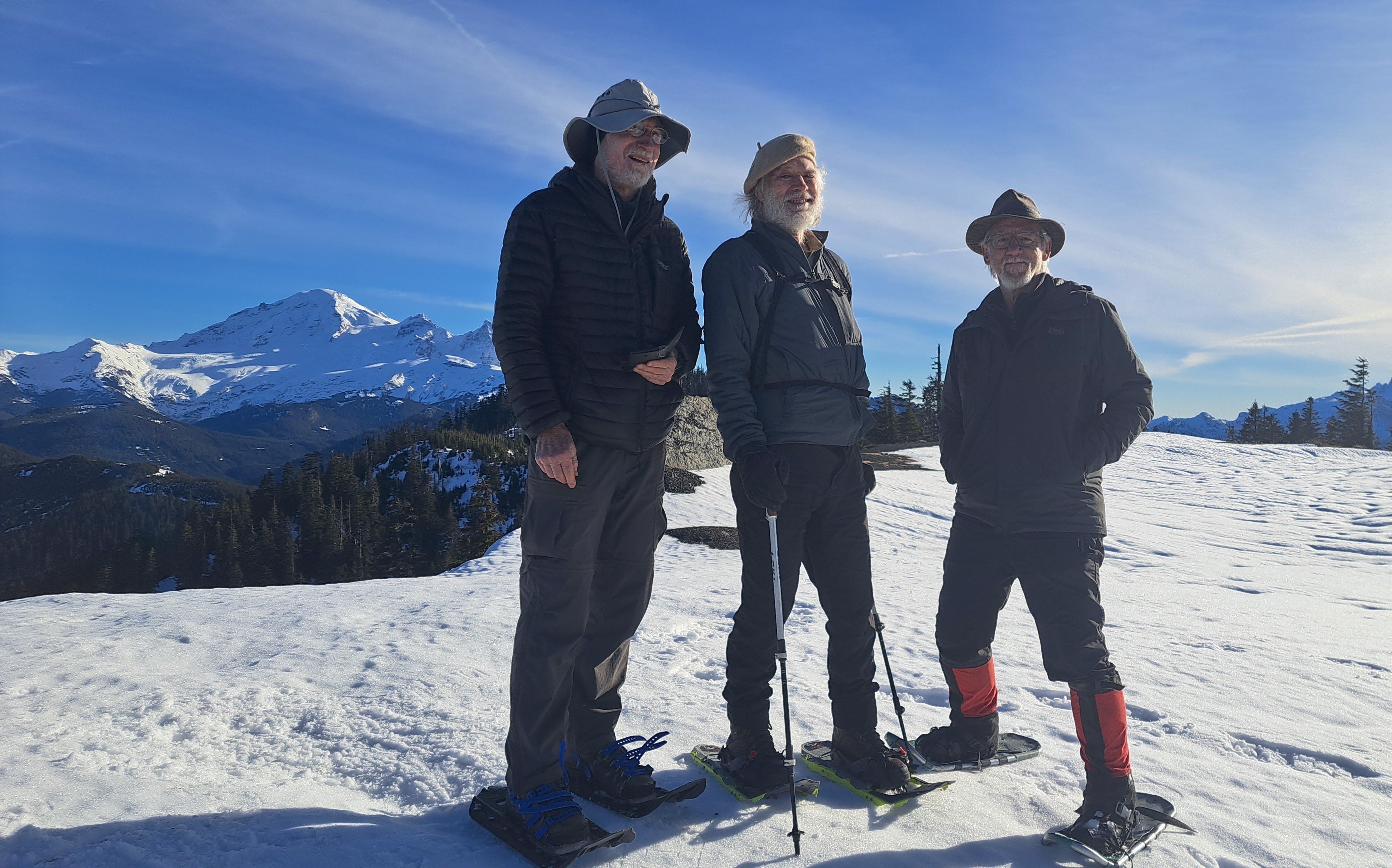
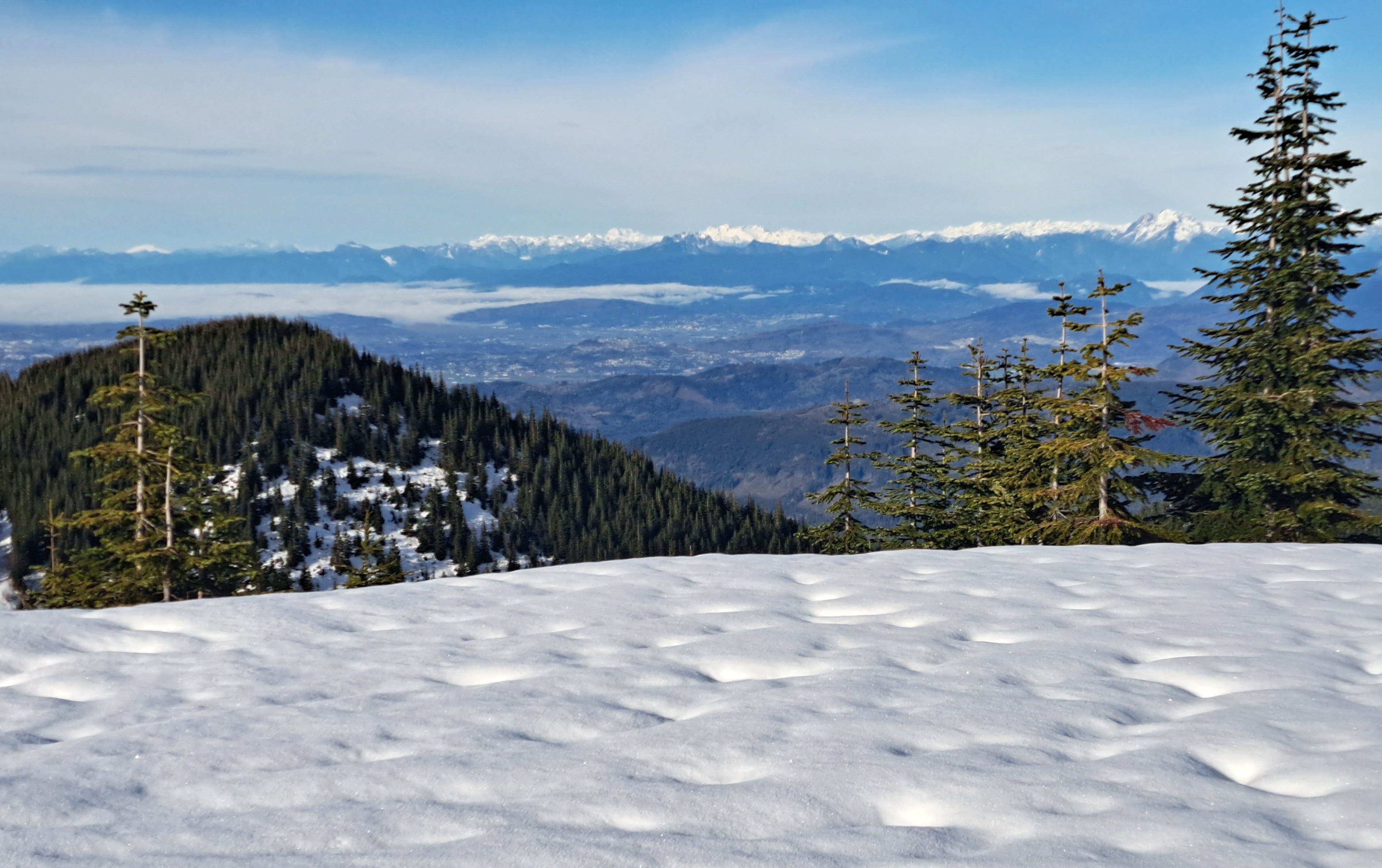
Perfect day today for a snowshoe hike in the foothills. Keith, Jeannie, Kiko and I took a chance on road conditions northwest of Mount Baker to see if we could hike up to a 4,900-foot summit I’d set my eye on a couple of weeks ago. I refer to it as Racehorse Mountain, although I’m not entirely clear on local nomenclature. A slightly higher forested nub close by just reaches 5,000 feet, but ours clearly had the better view. Together, they account for the highest terra firma in the Racehorse basin.
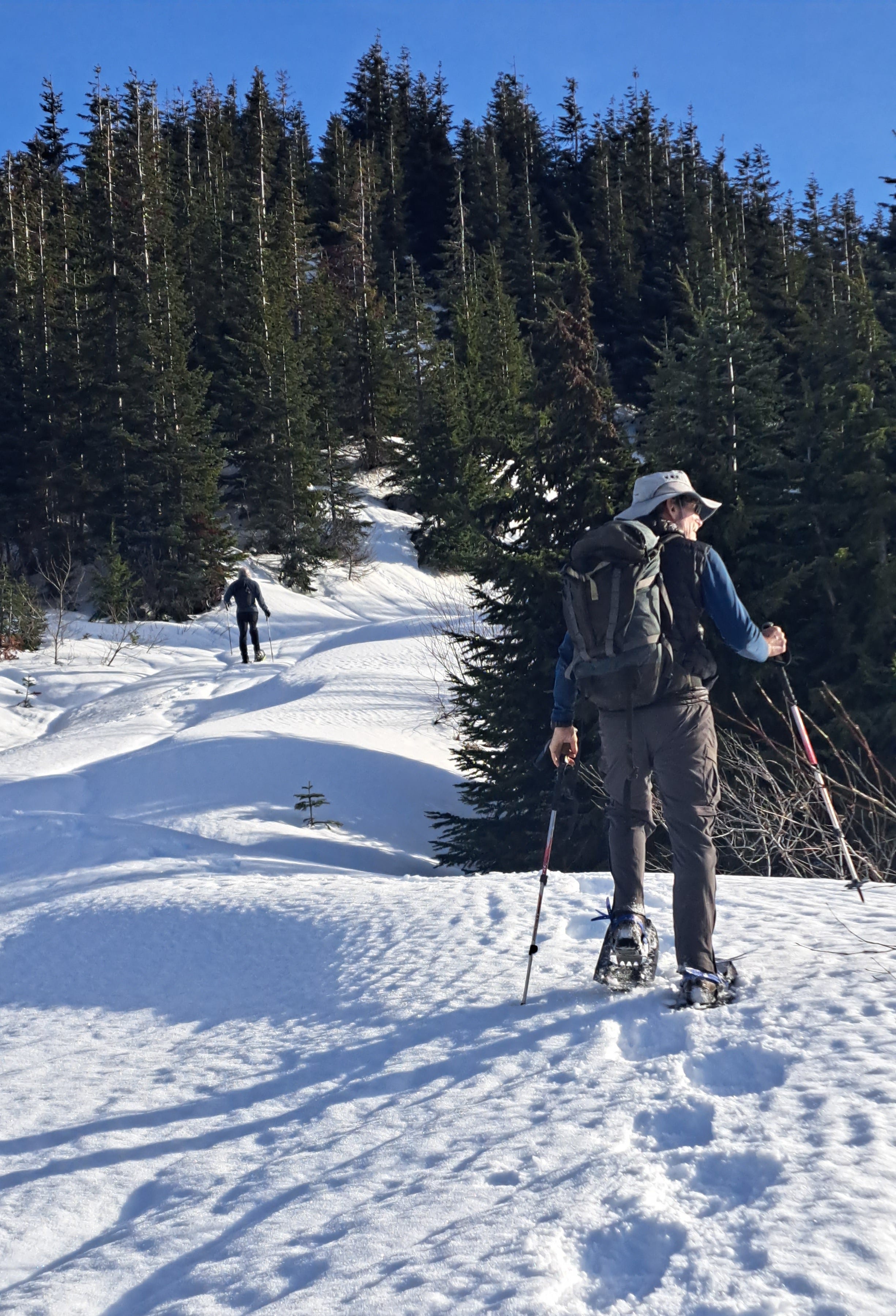
Driving up the road system, north and east of Racehorse Creek, we encountered a bit of intermittent snow and ice at around 2,300 feet, then crossed the creek where the road remained passable to 2,900 feet. We parked there. It was a 2.5-mile walk and snowshoe to the 4,500-foot ridge crest, plus a half-mile more to the top with widening views.
Logging and a broad landing at the summit provided a 360-degree view, from Mount Baker and the Twin Sisters to the western lowlands of Whatcom County and Salish Sea. Many peaks of the North Cascades and B.C. Coast Range also marked the horizon. Even the Olympics were fairly clear, and Mount Rainier poked her noggin over a ridge. Great spot—and great company—for my 55th summit this year.
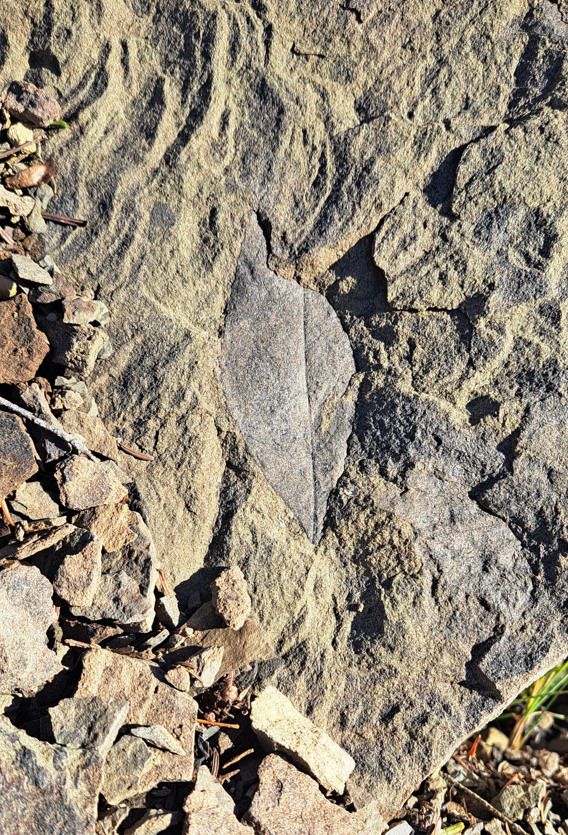
Of note, we passed all sorts of animal tracks, including some very recent bear tracks that were an impressive six inches across. A smaller set appeared farther up the road. There were small canine tracks (without humans), snowshoe hare, possibly a bobcat (which I’d also seen in the same area a couple of weeks ago), a probable raccoon, and squirrels. No deer this time. Lastly, as you close in on the summit, there are rocky outcrops on the left with abundant leaf fossils if you look around a bit.
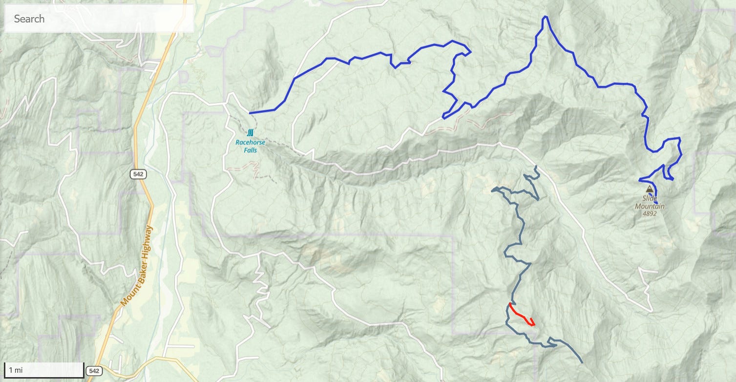
This really is a great snowshoe hike, although a much lower snow level could stretch the distance considerably. The map below shows the spur up the peak in red lower right. The road in is generally good, but becomes steep and high-clearance after crossing over Racehorse Creek.
Once at the ridge crest (before heading up the summit spur), drop down slightly for a good view and possible turnaround, or hike northwest on a level road for a short distance to a landing and more views. Or for the summit, ascend that steep spur to the southeast. Beware of some major dropoffs at the summit if you happen to have kids along.
We were five hours up and back (from 2,900 feet), including about 40 minutes for lunch on top. This could also be a worthy hike earlier in fall or late spring when the snow’s gone, unless there’s active logging underway.
Sounds like a great day! Great photos....especially those keys! Hope you weren't "racing" to the top!