

No drama here, just a routine trip report, kinda . . .
So there I was, sitting at Camp Maybe, staring at storm clouds, arguing with self about whether to go for the pass or pitch my tent. A procession of undaunted hikers marched past, some heading downward, some up. But up wasn't looking so good, and I guessed that these latter folks either knew something, or maybe nothing, about iffy weather in the High Sierra. Or maybe because we were less than a thousand feet below Glen Pass, these unfazed passersby planned on hopping over the crest before anything seriously electrical developed. Or maybe it was herd instinct, boots on auto-pilot, lightning zappers be damned.
Do I go or do I sit it out? I sat on a rock rib aside the trail, looked up, munched and ruminated.
I was on Day 3, backpacking the Rae Lakes Loop, a well known, 41-mile trek In Kings Canyon National Park. It was barely a month ago, though it already seems like last year. Rae Lakes is a popular circuit, with wilderness permits in high demand. The access via Cedar Grove and Roads End had been closed all of last year due to major damage from winter storms. But I’d read in the spring that repairs were nearly complete and the area would likely reopen this summer. When they released the backcountry permits, I jumped online and snagged one for my solo excursion.
For years, decades really, I'd been wanting to do some backpacking in the Sierras, say five days or more. Perhaps a few weeks? Like, say, the John Muir Trail, which everyone else calls the JMT. My buddy Mitch did the entire 211 miles back in his 20s, plus a side hike all the way out via Bishop Pass and back in order to resupply. Mitch, too, was eyeing the Sierras this summer for some lighter day hiking ahead of planned knee surgery in the fall. Given my overly ambitious to-do list at home, there was no way I could squeeze in a mucho-lengthy adventure. But I could finagle some small part of it, and five days would have to do.
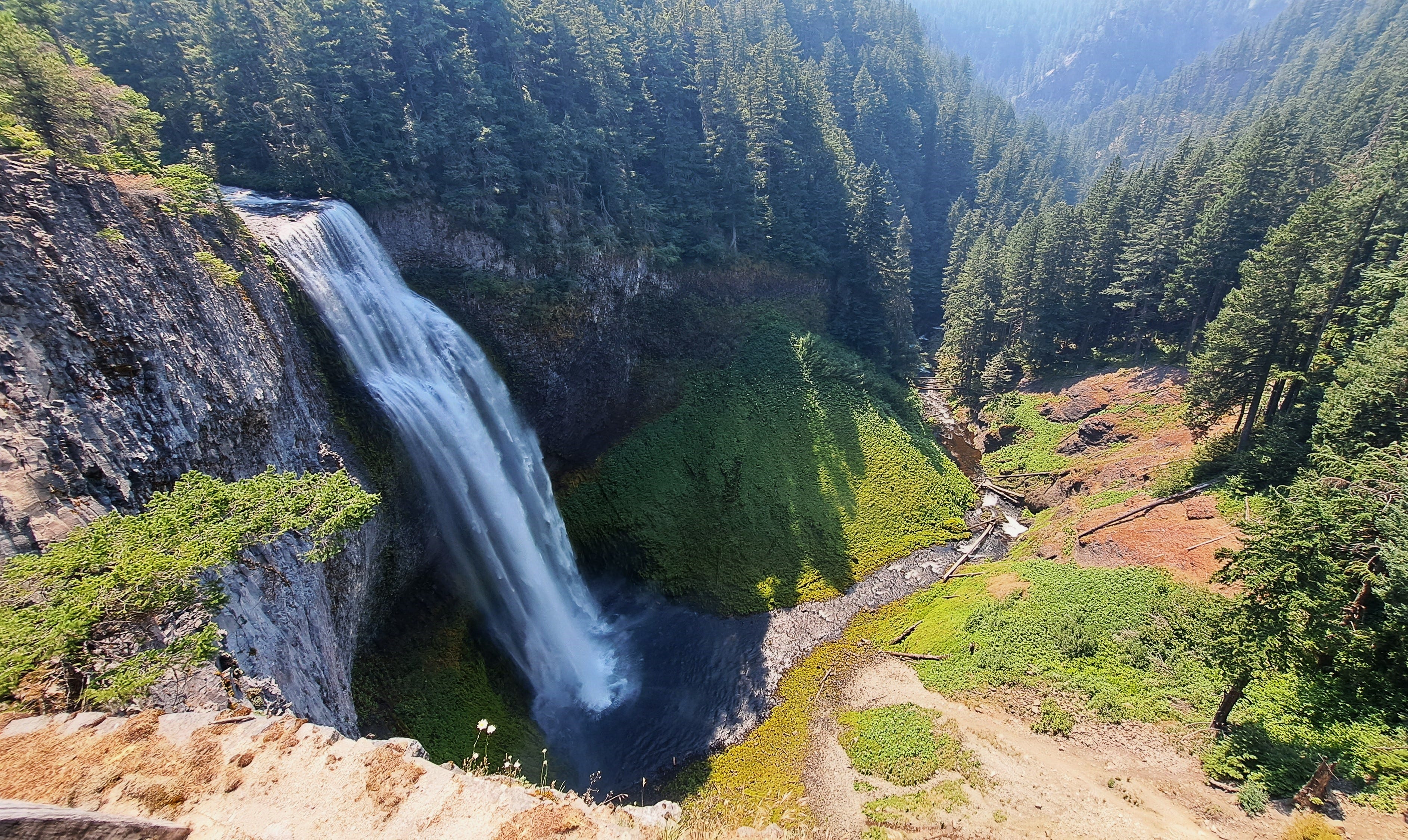
In mid-July, Mitch and I drove down from Bellingham, whereupon he could do his thing while I did mine. The marathon drive took us through the Oregon Cascades, with an unplanned pit stop at Salt Creek Falls off the Willamette Highway. Wow. Somehow, we'd both missed this awesome, nearly 300-foot-high waterfall in all the years we'd traveled around the Northwest. Wowser.
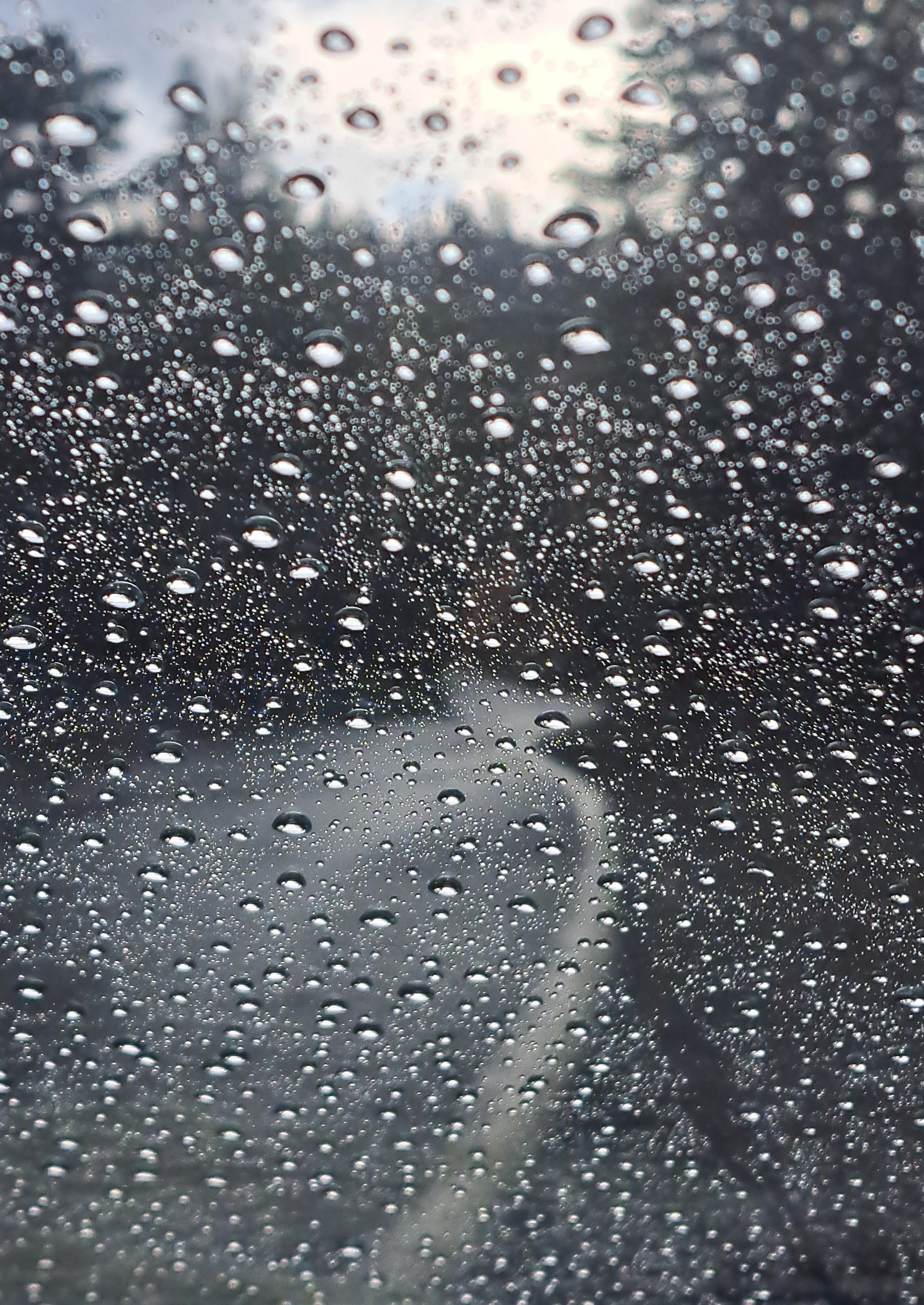
Selecting our road trippers’ route to Kings Canyon in real time, we opted next to scoot through Reno and aim for State Route 4, the Ebbetts Pass highway. It was a little out of the way, but new ground for both of us. Nearing the pass, and being that it was lunch time, and eating in the seat of the car didn’t sound very outdoorsy, we kept an eye out for a picnic table. We spotted one just as the sky rumbled and raindrops began to splatter on the windshield. Mitch had barely arranged the mayo-and-mustard buffet on the big, woodsy table, when, kaboom! We’d arrived just in time for a pretty substantial thunderstorm. We did the manly thing and ate in the car, while it rained puppies and kittens outside. Boom-boom.
We motored on down into the lowland heat near Angels Camp, with our hopes set on finding a campsite at Tuttletown Recreation Area. The sprawling campground abuts New Melones Lake, a huge reservoir on the Stanislaus River. When we asked the ranger if there was a site available, we got a look like, “Hey, dudes, it’s 100 degrees out. How many sites do you want?” There were probably 100 or more to choose from. Mitch got in a swim while I dawdled in camp.
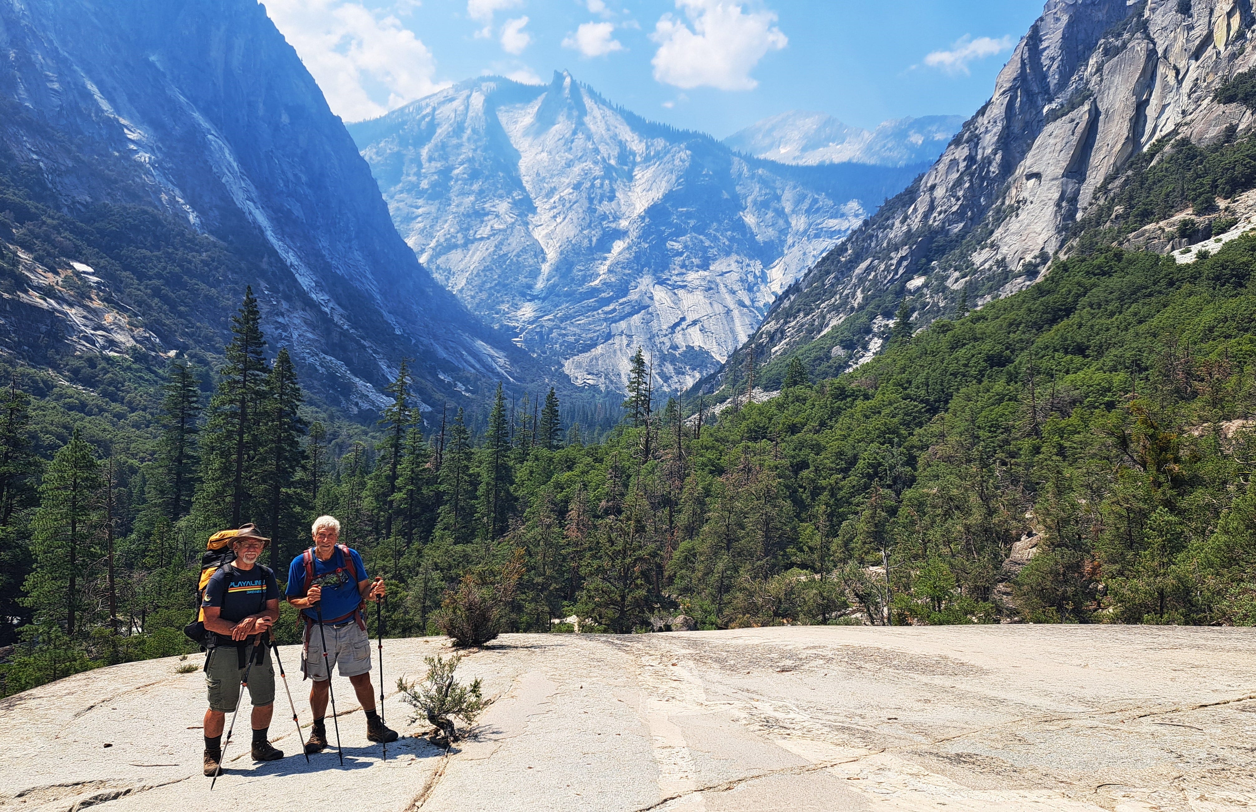
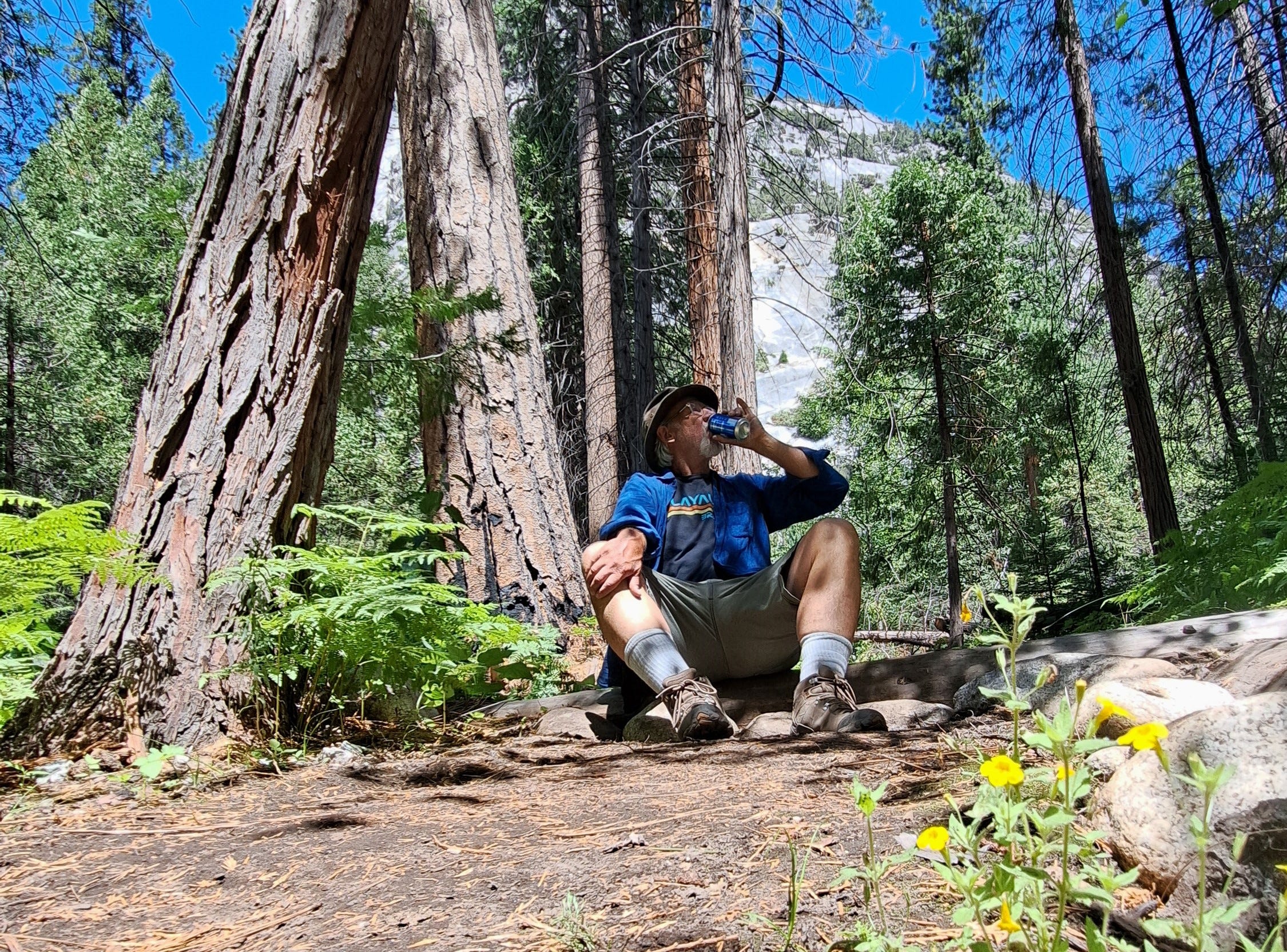
We finished the drive the next day and finally reached our campsite at Cedar Grove on Sunday afternoon, July 21st. It was nice to finally be in the actual space we’d been fawning over for months. The tents could wait. First thing on the agenda was to pull out the chairs for a sit and a sip, or maybe that’s two things. And unwind from the long drive. Need I say, Mitch and I are good friends, having camped and adventured many times, many places, and also having celebrated a few milestone birthdays together, he being the more mature by a week.
Once the tents were up, I turned to see a big sow and two tiny bear cubs trotting past our site and into the woods. “Teaching her babes to steal food from campers,” the ranger later told us. We stashed our grub in the bear box and ambled over to the amphitheater for an evening talk on the history of Sequoia & Kings Canyon National Parks. Great story, glad we went.

In the morning, I loaded up my first overnight pack of the year, all my food in a bulky, rented bear canister, as required. After consulting with his knees, Mitch agreed to join me for the first four miles to Mist Falls. We checked in with the friendly ranger behind the wilderness desk at the trailhead, secured my permit, and learned there were a couple of smallish wildfires out yonder, though nothing too worrisome for the loop. I weighed my pack at a handy scale: 38 pounds, including three liters of hydration. Off we went. At the Bubbs Creek fork, I became nearly a pound lighter after stashing a can of cherry cola underwater, a sweet reward to look forward to after completing the loop.
The hike to the falls was lovely, the views awesome, and I was a little sad to carry on without Mitch. I would be in the company of myself for the next five days. Mitch promised to pick me up on the 26th at the same trailhead. In the heat of the day, I passed a work crew muscling heavy rock steps into place, yet kindly stepping aside to let me pass. Soon enough, my thoughts turned to the high country, and I marched ahead with my usual mountain verve.
The hike led up Paradise Valley, where I pitched my tent at the higher camp and chatted with a couple of new friends from Fresno, and another from the Bay area. Later in the trip, I’d meet folks from France, Denmark, Australia, Japan, and a giddy young woman from Florida, hiking solo and beside herself amid all this Sierran beauty. Nine miles down, 32 to go.
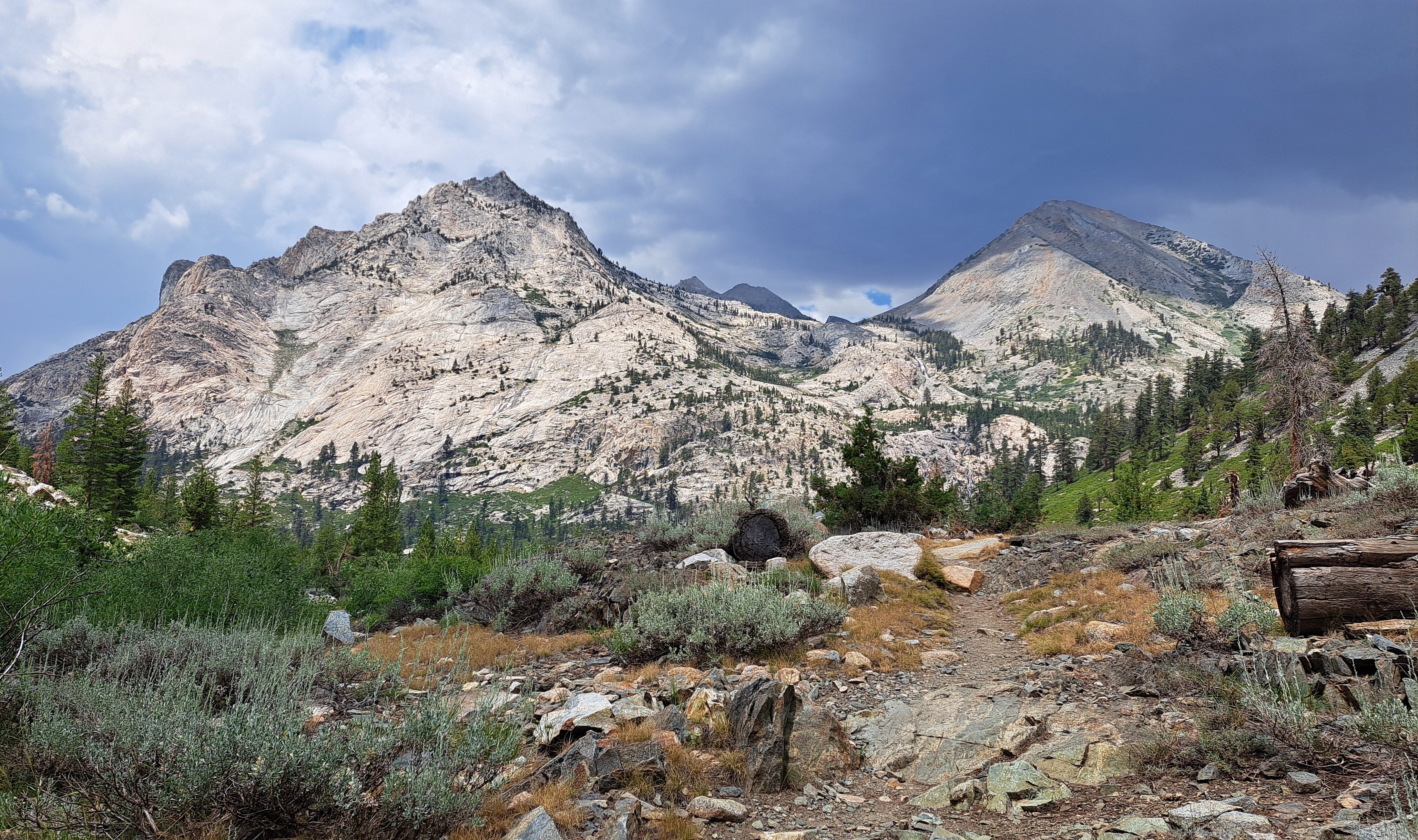
Day 2 led me out of thicker forest into bright meadows below imposing granite domes. I crossed the springy suspension bridge over Woods Creek, where the loop now follows the John Muir Trail, which coincides with the Pacific Crest Trail in this part of the Sierra. Ahead, the path was obliterated through a wide area littered with avalanche debris. The morning’s blue sky had coyly turned into dark billowing clouds, and they were soon releasing a light, steady rain. On cue, a convoy of thunderbolts trucked over the ridgelines, as is apparently the norm here for much of July.
After a let up, I ducked out of the trees and up to the first of many lakes, now above 10,000 feet elevation. I’d gained a vertical mile since departing the trailhead. I thought I’d be feeling whupped by now, but all was well and I remained eager to see what lay ahead. After a 10-mile day, however, I was right on schedule and might as well camp here at Dollar Lake. I boiled up an early dinner and watched the clouds melt away into a cool, pleasant evening.

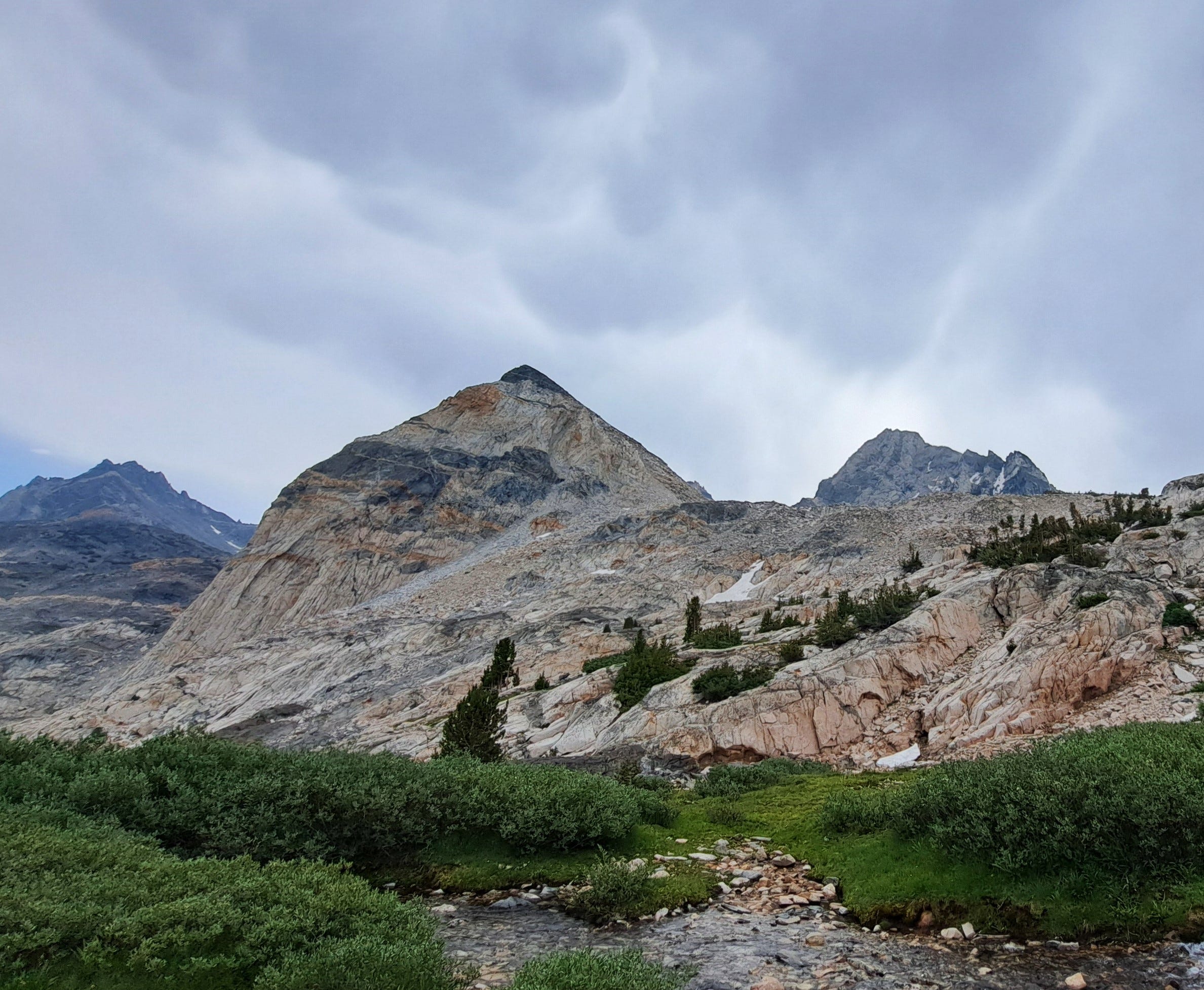
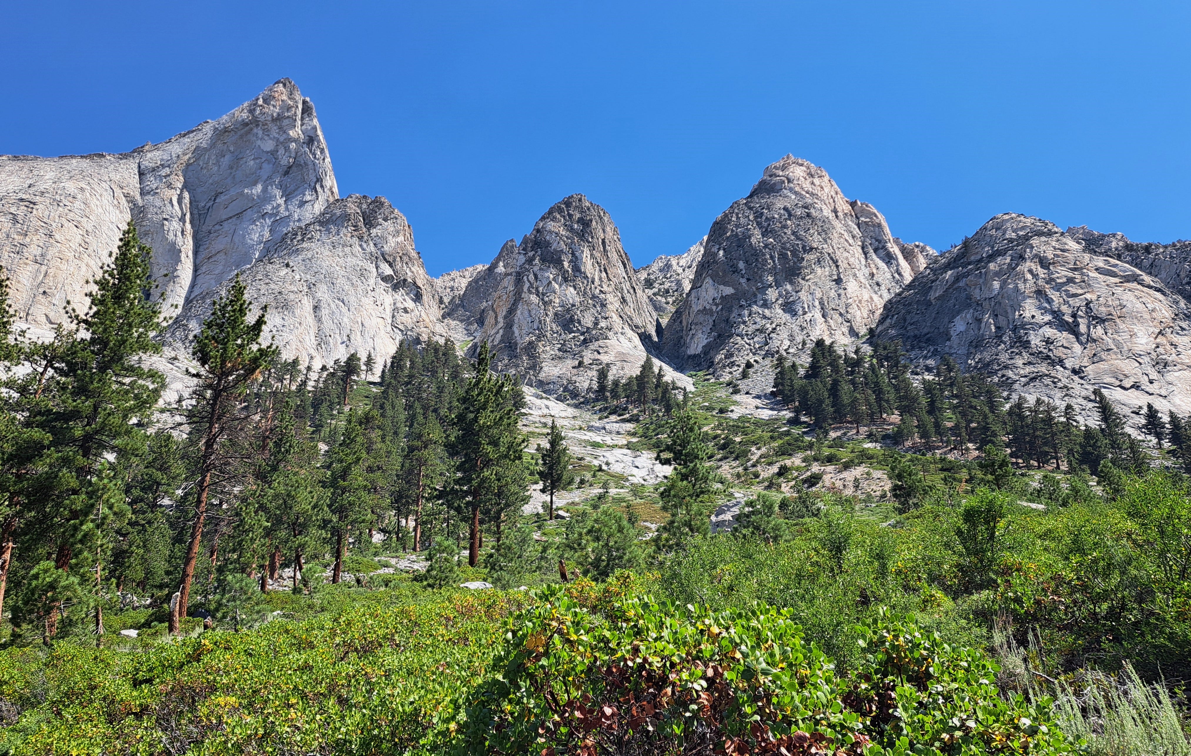
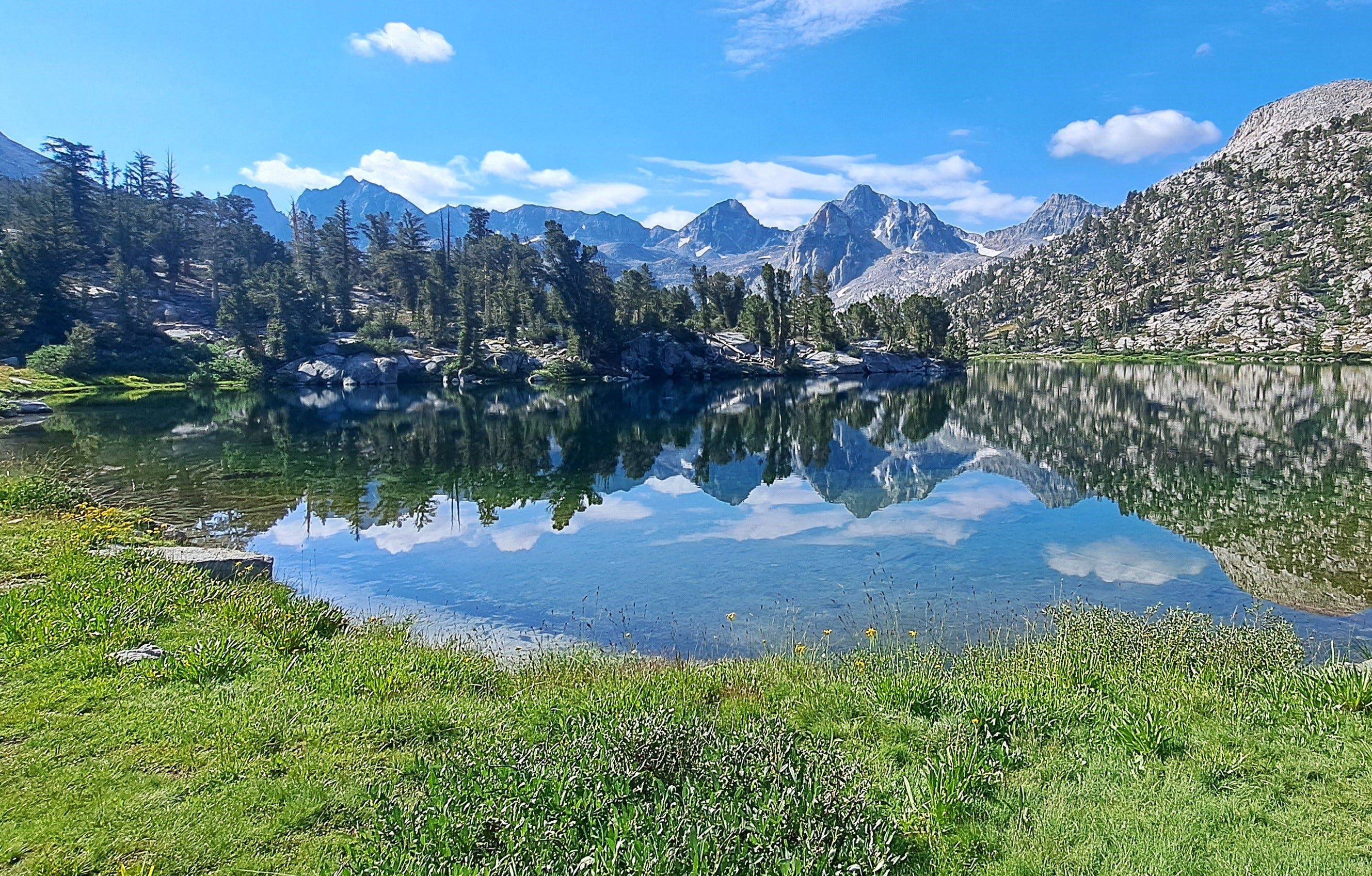
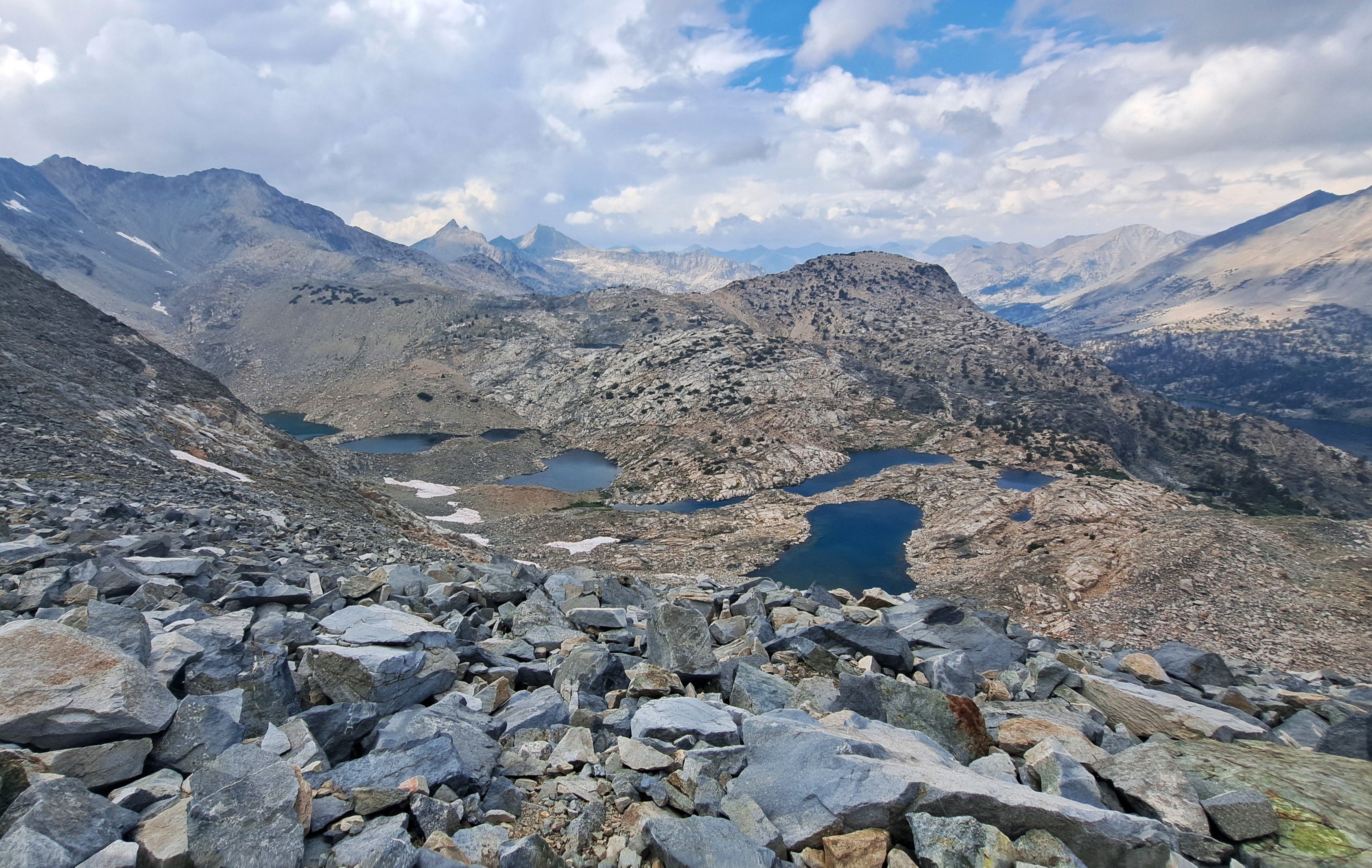
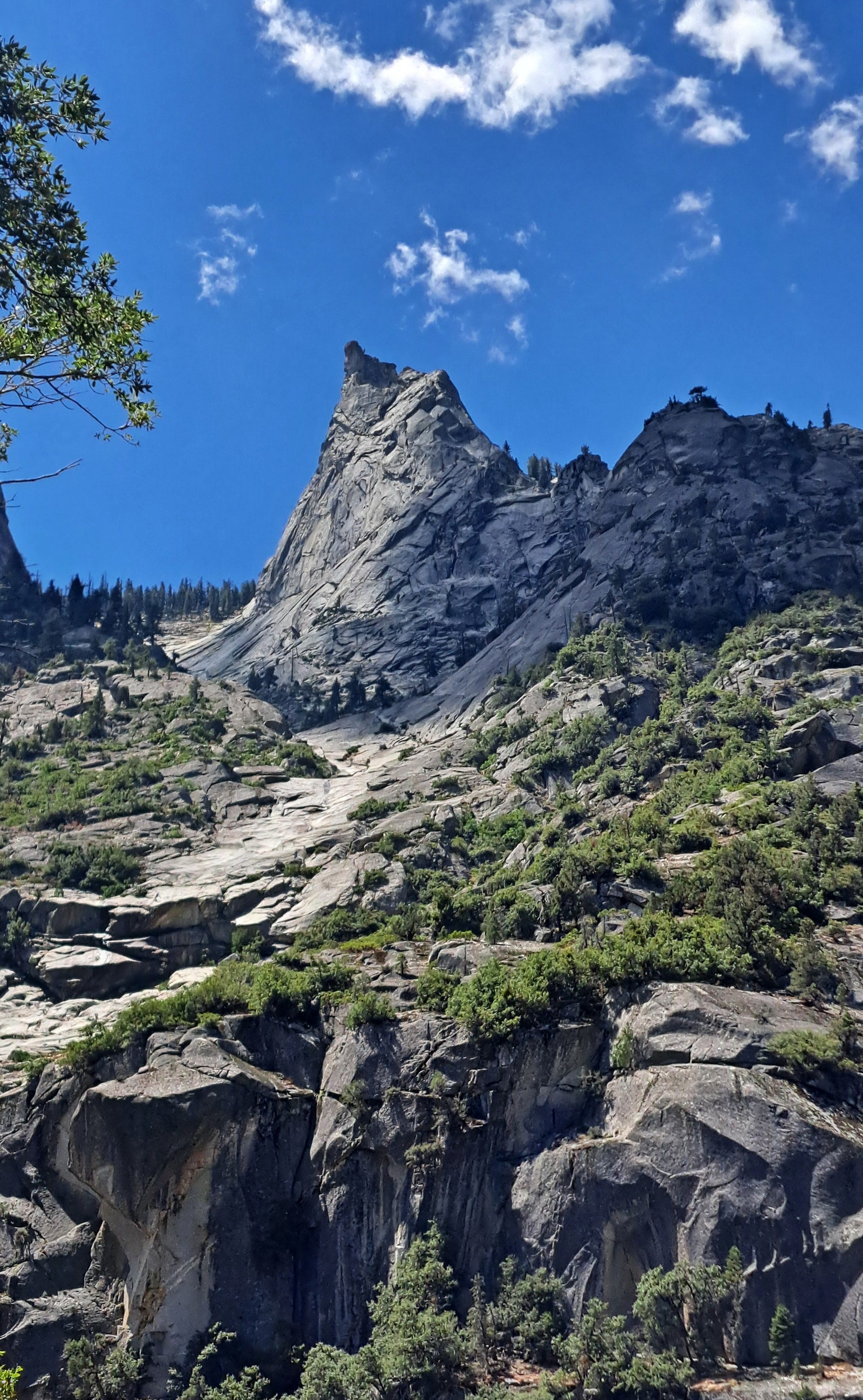
Day 3 was to be my easy day, the middle of the trip, and I would only need to move camp three miles to Middle Rae Lake. Dollar Lake was gorgeous, reflecting a fang of granite called Fin Peak, but I wanted to have an afternoon to explore the more open country around the higher lakes. I arrived there mid-morning, sunny with cute white clouds a-wafting. Ahead, Glen Pass, the 12,000-foot high point of the loop looked clear and inviting. To the left stood a colorfully banded peak, aptly named Painted Lady.
I walked around the lake looking for a tent site, and passed a pretty doe who gave me that look, like “Dude, how many sites do you need?” Minutes later, I dropped my pack at a suitable spot, then immediately heard an animal crying out. As best I could tell, it came from under an overhanging ledge of rock a little above me. It reminded me of a fawn back home that had cried when it got stuck on the opposite side of our neighbor’s fence from mama. A doe nearby, therefore a fawn? Rather than investigate and bother the poor thing, I moved on.
I passed the two French guys packing up, and moseyed over to the next lake. The sky and pass above still looked good, although the clouds were already building. I began to wonder if I should head up there now and spend my down time on the other side instead? Just in case. I’m also not very good at sitting still for hours, whiling away the day, even in a place this beautiful. I usually prefer to be moving. Maybe I should work on that. I’ll just look around the next bend, I thought, and the next and the next.
By now, I’m above the upper lake, the clouds have darkened, the sun is coming and going. I reach a circle of trees with what might be the last semi-protected tent site. Maybe I should camp here and see what’s up with these clouds? When the rain starts, my decision is made. The tent goes up, with me and my stuff quickly in it. I get cozy enough to drift off for half an hour, before I’m awakened by the sun blaring through the fly and rapidly heating things up. When I crawl back out, the storm seems to be over and we’re back to little clouds a-wafting.
I realize I can continue after all, and Camp Maybe suddenly becomes Camp Maybe Not. I collapse the tent and repack everything, exit the trees and—what’s this? More dark clouds and a new dribble of rain! Boom-boom. The lightning has returned. Well, that was fast. And still, there are hikers heading upward.
I watched the intrepid shrinking figures ascending stony switchbacks a half mile up the trail, before disappearing in the mist. Heavier clouds rolled over the ridge, thunder echoing from afar, then not so far, then near. Was this just another quickie storm? I covered the pack and sat in my raincoat pretending to learn something about the weather of the High Sierra.
Again, the rain let up and I detected a slight brightening among the clouds. It’s breaking up! Let’s do this! I headed up, promising myself to turn back if it suddenly got nasty again. As I’ve noted in other recent reports, I’ve had a few too many close calls with thunderstorms, and did not feel like pressing the odds again.
I called it right. The clouds swirled, allowing in more light, then patches of blue, and finally, as I climbed the last steep switchbacks near the crest, sunshine! The view was fantastic, beauteous lakes below, proud mountains everywhere. And it was just me and nobody else on this narrow spine of rock that is Glen Pass.
I descended steep switchbacks into the cirque below, with my sights now set on Charlotte Lake for my third night out. To this point, I had yet to encounter any bears, despite the many warnings to park visitors about bear encounters and securing your food. The only bear sign I’d noticed was just one small bear dropping on the first day. The next bear sign was more disturbing.
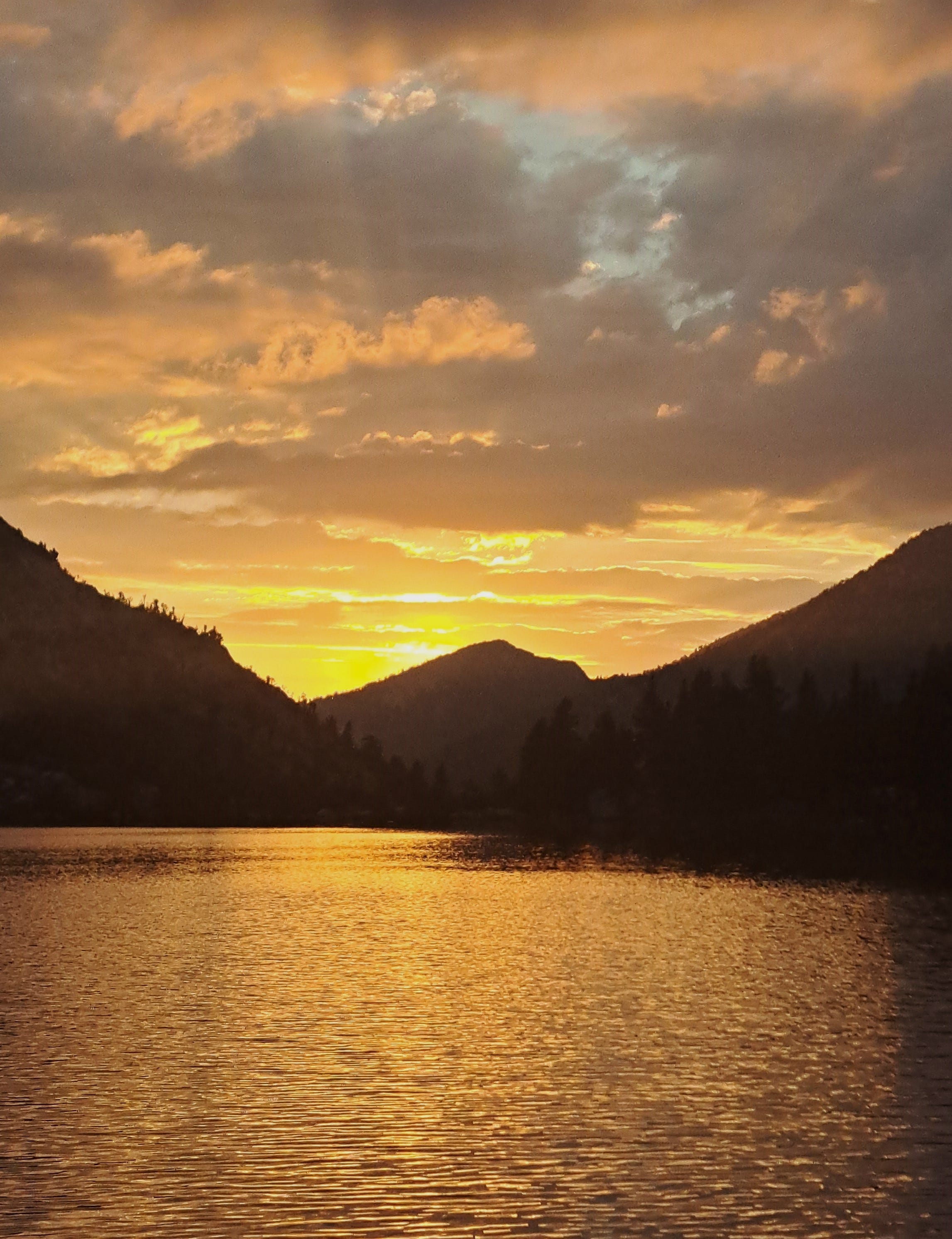
The wilderness ranger based at Charlotte Lake had posted a handwritten sign warning hikers of aggressive bears in the area determined to steal your food. “DO NOT LET THEM,” it read in all caps. As if that wasn’t enough to get your attention, it continued with “If you see a bear, chase it like you are trying to catch it and eat it. Get mad. Be mean. They will run away in terror.” The advice gave me a nervous laugh. I hadn’t seen anyone else on the trail for hours and now it was getting on dinner time and I still had a mile of woods ahead of me with hungry bears eager to pounce. Alas, I’m in no condition to chase one of these brutes as if I’m going to eat it, while lugging a 30-something-pound backpack. After an eight-mile day, I was happy to reach the lake without incident. I was also happy to catch a splendid sunset over the lake right after supper.
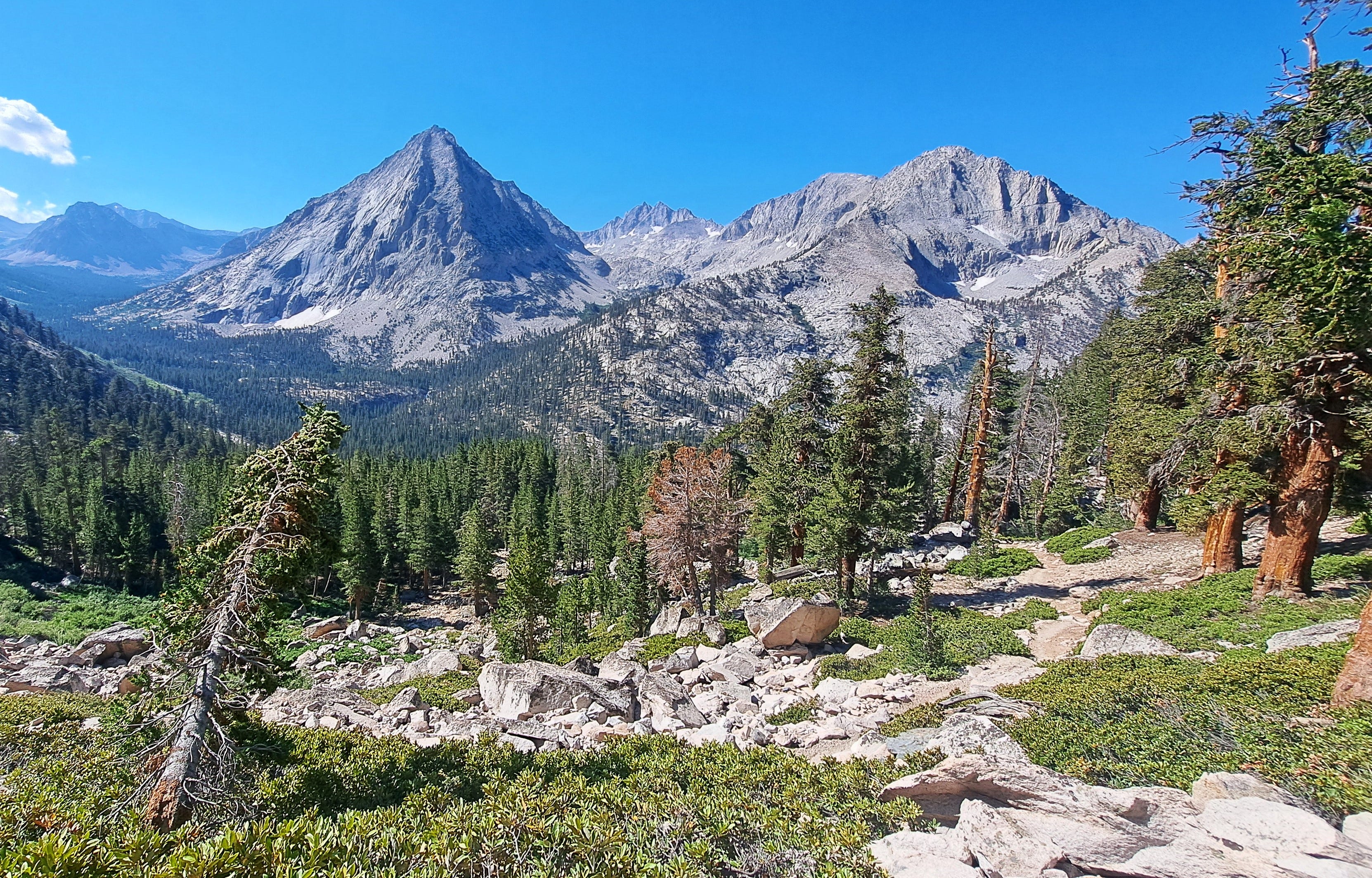
Day 4 was 11 miles and pretty much all downhill, topographically speaking. Stunning views every which way, bend after bend. It was nice to have gravity working in my favor, though the steeper parts were a bit crunchy on the knees. I was soon in the canyon bottom, sauntering along with the continuous roar of Bubbs Creek at my side.
About a mile from my final night’s camp at Sphinx Creek, I passed a large fresh pile of bear sign. This bear sign was serious stuff, not handwritten by any ranger. I clacked my trekking poles on rocks and sidled into the deserted camp. I had just enough light left to enjoy dinner while sitting comfortably alone on the bear box.
Having sucked up the last of the daylight and all the silence I could muster, I crawled in the tent. Tucked in, I opened the podcast app on my phone, and caught an episode of Houston, We Have a Podcast. I learned much about Intuitive Machines and the public/private strategies that have been developed in recent years to send payloads of tools and technologies to the Moon. Much of it is in preparation for Artemis.
The next story in the queue was from Radiolab and the experience of a couple whose apartment looked across at a big window in a nearby building. Another couple there kept their curtains open and put on a show, from everyday life to explicit hanky-panky. What seemed to begin as a smutty kind of story soon evolved into something both captivating and sad. I won't spoil it here.
Just as I began to doze off, lights suddenly appeared from outside the tent. Hikers! Maybe I would have some company after all. But in half a minute the lights were gone and whoever it was continued up or down the trail, having vanished as mysteriously as a bump in the night.
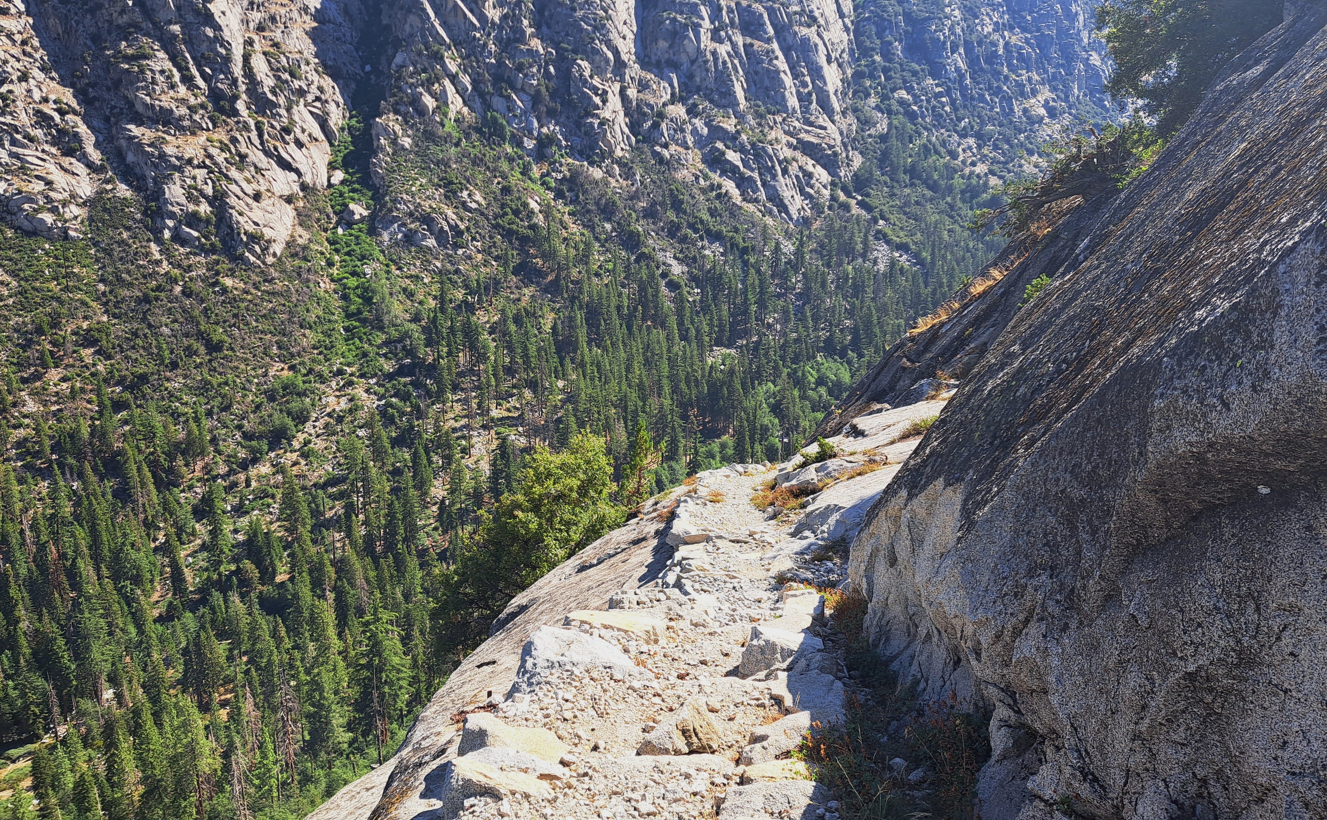
By hiking the extra distance on Day 3, I was now just four miles from the trailhead, which allowed some extra time in the morning to hike an hour up the Avalanche Pass Trail, which I’d read about in a guidebook. The trail began at Sphinx Creek and sounded awesome, if somewhat exposed in cliffy terrain. The hike was better than expected, classic national park trail construction with major stone staircases and airy ledges that offered a nice thrill, yet never too spooky. Since the trail had hardly been used over the previous two years, there were plenty of sticks and rocks cluttering things up, so I did my good deed and cleared most of it off the trail. Should you ever find yourself chugging up the Bubbs Creek Trail, do check out the wondrous first mile toward Avalanche Pass.
Continuing down Bubbs toward Roads End, the canyon drops steeply, with constant whitewater cascades, slides and falls. At one place, a narrow gorge is so steep you can’t quite see the bottom without hanging your own bottom over the precipitous edge, which I would not advise. More great views lay ahead, including a look down on Paradise Valley, the first leg of my loopdeedoo.
At the fork, I retrieved my cherry cola and guzzled it down. Forty minutes later, I was back at the trailhead, certifiably pleased with my little trekabout. After a short wait, Mitch appeared as promised, and we were on our way once again to the next fun thing.
Great hike!! Great story!!