

Despite a cold, spitting rain this morning, Kris, her dad and I headed south to finish up some homework I’ve neglected regarding the nearly completed Whitehorse Trail—a 27-mile rail-trail along the North Fork Stillaguamish River between Arlington and Darrington, WA. It’s only homework in the sense that the trail is highlighted in the upcoming third edition of my guidebook, Hiking Snohomish County, and I still had some info gaps to fill. (The book goes to print in May. Allegedly. We hope.)
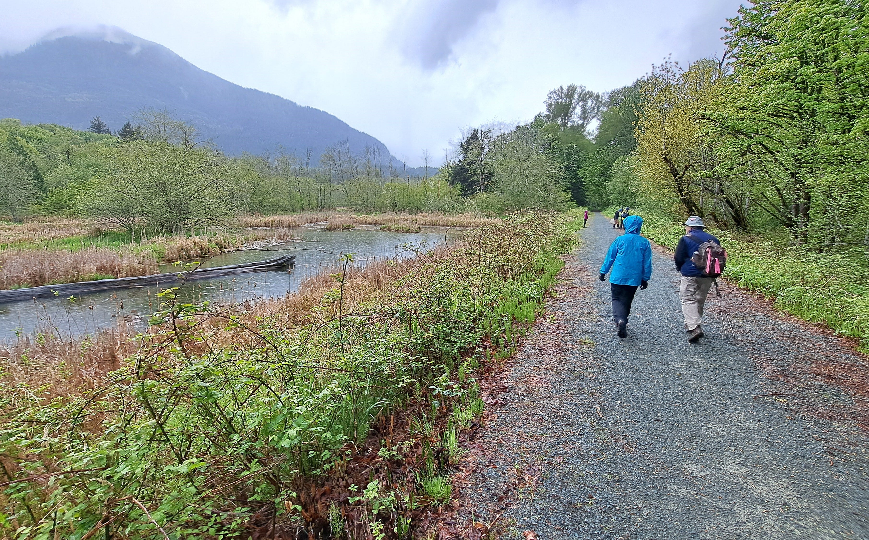
Lucky for us, the rain stopped near the county line, and we savored a few dry miles of walking in all the pertinent places. Most noteworthy, we spent a good hour at the new Oso Slide Memorial about midway along the trail and easily accessed from SR 530 (at Milepost 15.3). The site was dedicated just a few weeks ago and is deeply affecting to walk through. I might even rate the design of the memorial on par with (or even above) what we might commonly associate with a national park. Note that this new memorial is not the same as the temporary memorial you might have already seen. Quite exceptional.
If you happen to be a fly-fisherperson, you probably know the story of the North Fork Stilly and how the Western novelist Zane Grey and others brought instant fame to the fabulous steelhead runs here over a century ago. To learn a little about that, you can google it, of course, or pull off SR 530 at the Hazel Hole kayak put-in near Milepost 38.8. There’s a memorial here to fly-fishing that shares a key part of the story.
The Whitehorse Trail throughout is either packed gravel or paved, so no muddy boots to worry about. And you can pick a place to start and walk as little or as much as you like. The family-friendly trail is also a kick by bike. Just be cautious if your itinerary includes one of the highway crossings (there are only two). When the river is running a bit lower, there are many places to access the water’s edge.
Rather than scribble a bunch of directions here, I’ll just paste below the write-up to be included in the book. Just pick a dry day and enjoy!
Whitehorse Trail
Snohomish County has had much success acquiring old railroad grades for trails, and the Whitehorse Trail, formerly the Darrington Branch line from Arlington, adds 27 miles to the tally. Built in phases, most of the trail is now complete and easy to access, with more work planned for 2024-25. The plan calls for finishing the westernmost section between Arlington and Trafton, and repairing a shorter section nibbled on by the river near Darrington (just west of 435th Ave NE). These areas may be closed until work is completed. If all goes well, the entire corridor should be open in 2025.
A major milestone—the Oso Slide Memorial that lies adjacent to the trail near the midway point—was completed and dedicated on March 22nd, 2024, ten years to the day after the worst landslide in U.S. history. The memorial honors the 43 lives that were lost when the mountainside to the north suddenly gave way in March 2014.
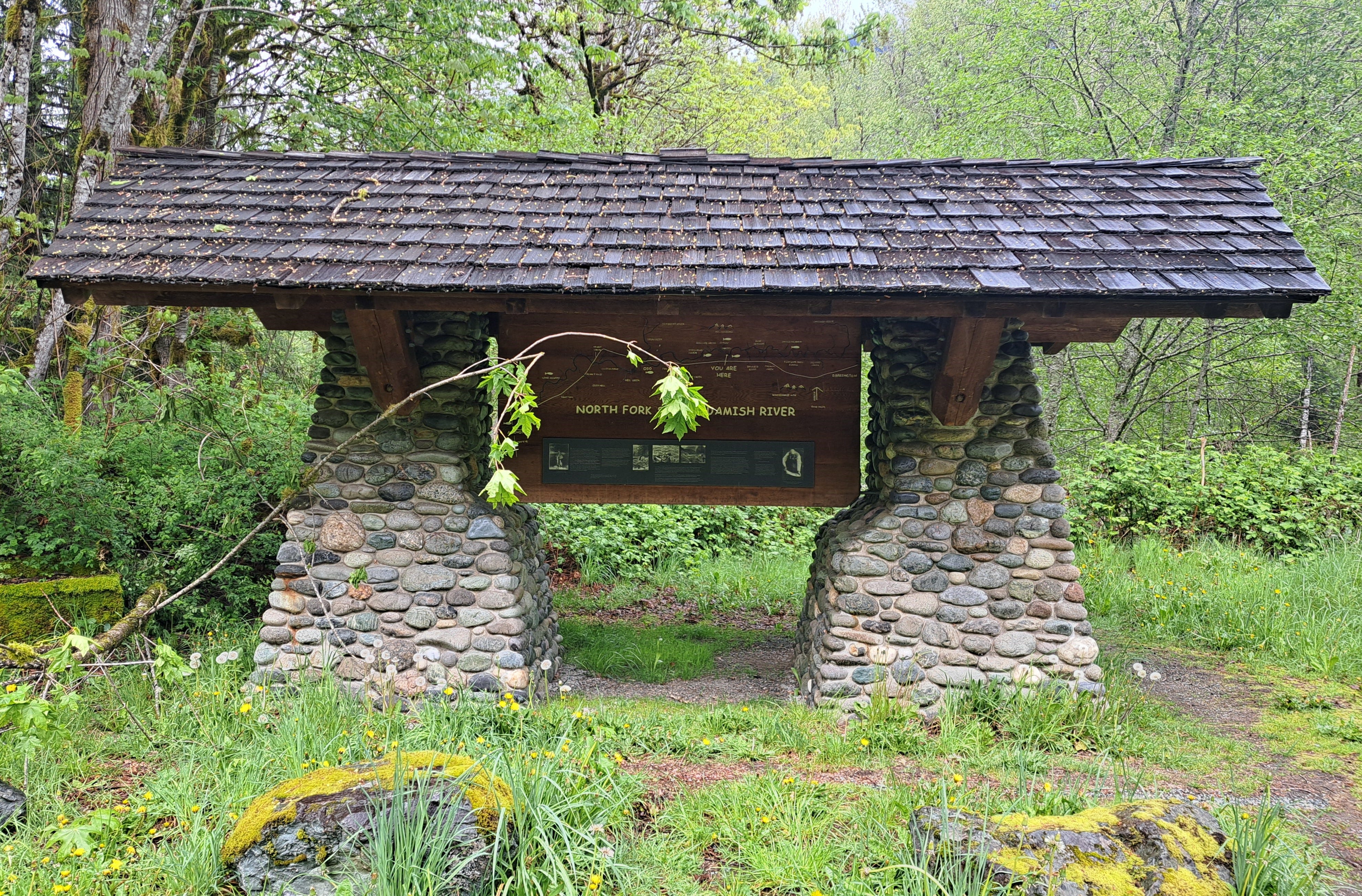
In addition to parking at the Oso Memorial, you can access the trail from SR 530 at Trafton, at a new lot near the town of Oso, at C-Post Rd, at the Hazel Hole kayak launch and fly-fishing memorial, at Fortson Mill Ponds, or in downtown Darrington. The entire corridor has much appeal for hiking and biking, so you can start anywhere and walk (or ride) as far as you like. Perhaps the more interesting areas for footsters begin at Trafton, the Oso memorial, the old Fortson Mill and Darrington. The Arlington to Trafton reach will also be an appealing trek once it opens. Trailhead locations are noted below.
Originally developed in the late 1800s, the railroad mostly carried logs and lumber, but also mined ore, people, supplies and probably a few mooers and oinkers during the early heydays of the upper Stillaguamish Valley. The old grade was abandoned in the early 1990s. The land was acquired from Burlington Northern in 1993 through rail-banking by Snohomish County Parks. The eastern six miles from Darrington to Fortson were opened long ago, and the rest in phases since then.
The west end links to the Centennial Trail immediately north of the old railroad bridge across the Stillaguamish River in Arlington. The bridge crosses at the confluence of the North and South Forks and offers an excellent view. There is no trailhead parking at the junction (0.0 mi), so access there is by way of the Centennial Trail a few blocks to the south. The bridge is worth a look when you’re passing through town.
Heading upriver, the Whitehorse Trail will be obvious throughout, as it roughly parallels the river and SR 530, designated the Oso Memorial Slide Highway in 2019. Until construction is complete farther west, the Trafton Trailhead (3.4 mi) is the preferred western starting point. The trailhead is at an old farm on 115th Ave NE (Kroeze Rd) a half-mile north of SR 530 (at MP 24.9). Park near the blue silo. The trail is to the right, behind the farm buildings. Descend briefly to the Whitehorse Trail and walk left for an easy 1.5-mile out-and-back walk to a bridge over the North Fork (and the 2024 trail closure).
Or walk right (northeast-ish) for just over three miles to where the trail crosses SR 530 (6.6 mi)—caution! Next cross a big steel bridge at Cicero (7.0 mi), then mosey along Cicero Pond and attractive wetlands for another half-mile or so for an eight-mile round-trip hike from Trafton.
From Cicero, the trail recrosses SR 530 (8.8 mi), passes a large new parking area just west of Oso (10.0 mi), then a bridge over Deer Creek (10.7 mi), made famous in the early 1900s as an exceptional steelhead fly-fishing hot spot by the prolific Western novelist Zane Grey. In another mile, cross the North Fork again (11.8 mi) to a stretch that’s often close to the river, with potential access when the flow’s not too high.
Next reach the Oso Slide Memorial (15.3 mi), a site not to be missed. The scars from this heartbreaking disaster are still visible, and interpretive signs describe the event and those who were affected. Do take the time to explore this deeply moving, well designed memorial. After exploring the memorial, stroll east on the Whitehorse Trail, while contemplating the obvious escarpment where the slide gave way. In 0.4 mile you’ll find a story pole by tribal carver Jewell James next to the stump of a large “Grandmother” spruce tree. The tree had remained standing after the slide.
East of the memorial, pass the C-Post Rd (15.8 mi) with a parking area to the left, then the Hazel Hole canoe/kayak launch (16.8 mi). This small site includes a memorial to fly-fishing on the North Fork Stilly, noting the role of Zane Grey and others in protecting the famed summer steelhead run.
Cross the Boulder River (18.1 mi) and soon reach the historic Fortson Mill site (20.6 mi) with a crumbling building and a few old relics and ponds to explore. A sawmill was established here in 1905 and a little town of Fortson sprung up around it. It is now a tribal and county park and can be accessed from SR 530 at MP 39.5.
In several miles more, pass the last good views of the river, improving views of “layer-cake” Mt. Higgins downriver, and the trail’s awesome namesake, Whitehorse Mt., upriver. Next pass the rodeo grounds and outdoor venue for the annual Darrington Blue Grass Festival (24.1 mi). Then finally reach the trail’s end in Darrington off the end of Railroad Ave (27.0 mi). By car, look for it on the north side of SR 530 immediately past the main supermarket and 0.2 mile north.
Well done