

As I made progress last year with my 70 summits quest, it was fun to reflect back on a similar challenge I launched into in 2013, knocking off 60 summits while 60. Kris and I were living in Washington, D.C. then. I was two years into a planning job with a federal energy agency, but getting out every chance I could, often with Kris, sometimes solo. We did a lot of hiking, biking, and road trips, making the most of our eight-year adventure on the East Coast. We truly enjoyed ourselves, though there was no doubt we’d eventually come back to Bellingham.
Those 60 summits, not surprisingly, were spread all over the country, with quite a number of them along some of the most scenic trails in the eastern states. But there were also a bunch in the Mountain West as well, not to mention the good old Pacific Northwest. The highest peaks of severa eastern states, as well as Utah (Kings Peak) and Arizona (Humpreys Peak) we in the mix.
For those interested in skimming a smattering of hikes (with photos) to some great American summits, or to read it all, for that matter, I’ve posted all 60 summits. (If there’s interest, maybe someday I’ll post the 50 summits I climbed at 50!) Below are the first eight summit write-ups that I uploaded to an old blog I kept a decade ago. There’s a link at the end to the next batch. I hope someone other than me finds them at least mildly entertaining.
Let the peak-bagging begin: Shenandoah
When I turned 50, I decided to bag 50 new summits, including way too many easy ones, and a few harder ones, like the 5.9 South Buttress of Cathedral Peak in Washington’s Pasayten Wilderness (bragging rights are still in force for that one).
This year [2013], I’ve stewed up a similar hankering to attain 60 new summits, which is only about one every six days. The point isn’t to impress anyone (other than myself), but more to ensure that I get my backside out there exploring new ground. As if I need the prodding. I committed to this year’s quest months ago, yet here it is almost the end of May and I have scurried up a grand total of zero summits in 2013.
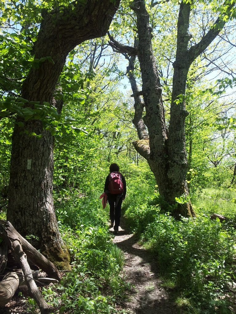
So with a nice forecast for the Memorial Day weekend, Kris and I zipped over to Shenandoah on Saturday for a two-fer: Hightop Mountain and craggy Bearfence. Both were short hikes with tantalizing views and some rock to sit on at or near the summit. Now this is civilized peak-bagging.
1. Hightop Mountain - May 25, 2013
We began the day visiting a colleague from work who was spending the weekend with family and friends at a semi-remote cabin in the eastern foothills above Stanardsville, Virginia. A scenic drive on a narrow road led us to Entry Run and a ten-minute walk up to the cabin. We found everyone dutifully chilling at what is just one of dozens of cabins maintained by the Potomac Appalachian Trail Club. Kris and I vowed to join the club soon and partake in the wilderness cabin thing too. Next stop was Shenandoah.
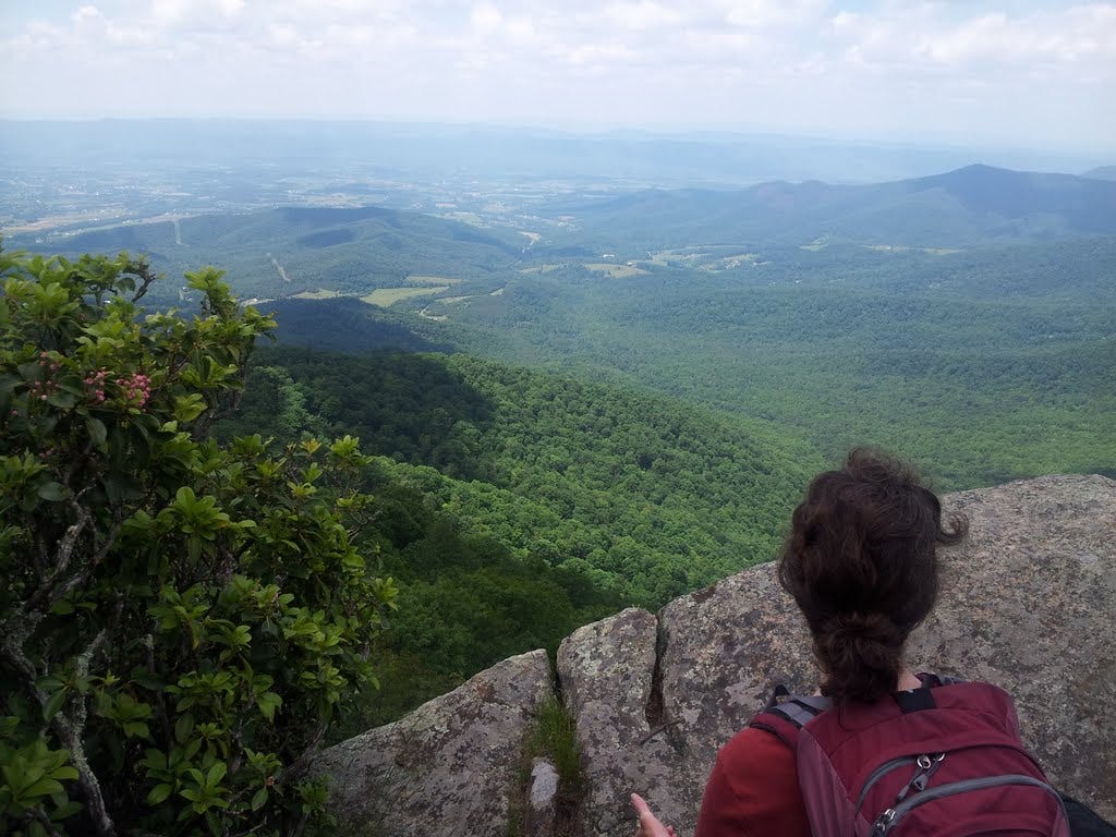
The trailhead for Hightop is right on Skyline Drive, a little south of Swift Run Gap (Highway 33). A pleasant woodsy walk on a steady grade led about 1.7 miles to a fine overlook and a Krissy-approved snoozing rock with a wide view west across the Shenandoah Valley to the Alleghenies. The actual summit was in the trees nearby and a signpost pointed the way. At 3,587 feet, this is also the highest point in the park south of the Gap.
While lunching on the rock, a family sauntered by and mentioned to our surprise that they had been chased up the trail by a deer. Just in case, we kept a sharp eye out for flailing hooves on the descent. Summit #1 in the bag. Only 59 to go.
2. Bearfence Mountain - May 25, 2013
Since I only need to impress myself with my Sixty new summits thing, I’ve decreed that even the little ones must count. Admittedly, had I claimed Bearfence as a “peak” out in the Pacific Northwest, my fellow mountaineer buddies would still be chortling and flicking their nuts and raisins at me. But Bearfence sounded kinda fun as a short rock scramble and it wasn’t too far down the road from Hightop.
A quick hike up some steps led to the start of the craggy spine that aptly gives the ridge its name. It was over all too soon, however, and we sat a spell to enjoy the 360 panorama. The 3,620-foot summit is in the woods again, but was quickly reached, and a return via the Appalachian Trail added a few more minutes of new scenery.

3. High Knob - June 1, 2013
In keeping with the “High-something” theme, the third of my Sixty Summits quest would be High Knob, a moderate hike I’d stumbled on whilst searching the internet for possibilities. I departed solo for this one late in the day on May 31st. It was a longish drive over to Brandywine Recreation Area just across the West Virginia line, but a very nice campground awaited with plenty of sites to spare—and ample warnings about hungry bears. The tent pad was perfect and I slept the night without a stir.
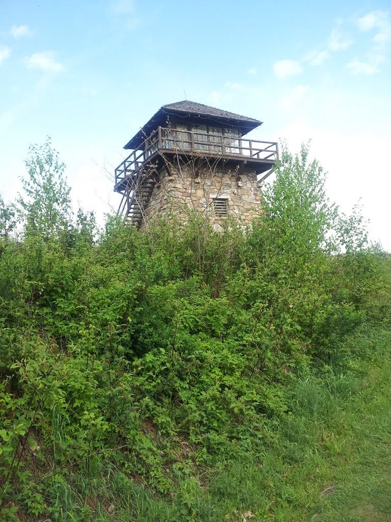
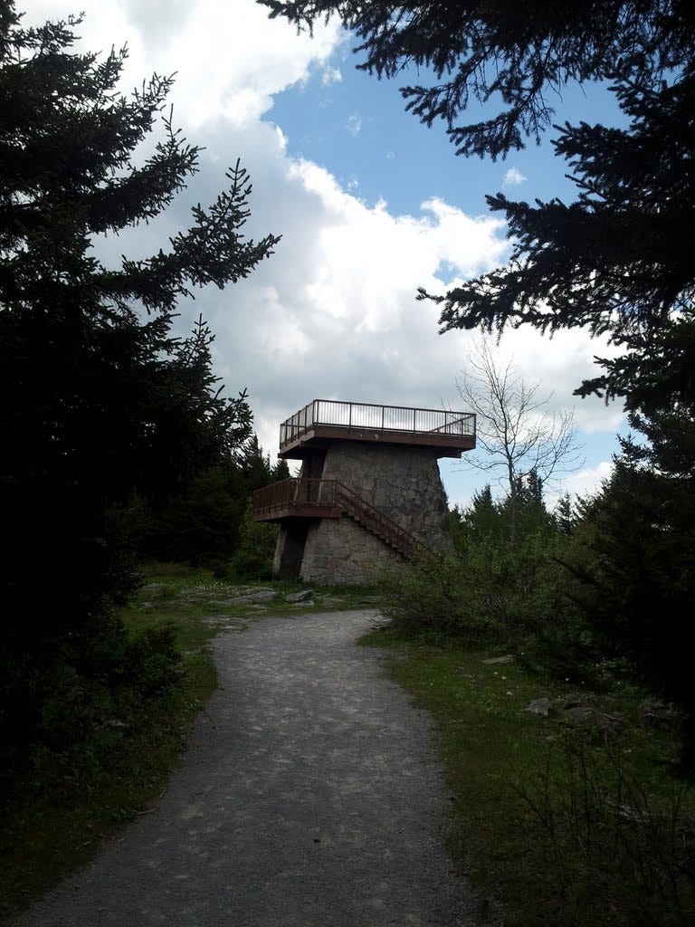
The trail leaves the back of the campground and I was on it around 7:30 am. I borrowed a walking stick from the forest, which was used primarily for clacking against trees now and again, just in case (as an alternative to bear bells). A very pleasant hike up a sometimes steep-ish ridge led two miles-plus to a fire road near the crest, followed by a short path then a few more yards of gravel road to the tippy top, where a fire lookout and outside catwalk afforded views in all directions.
For such a pretty hike and worthy destination, I was a little surprised that I encountered no one coming up as I descended the 2,100 feet back to camp. I was packed in no time and on my way to the day’s second summit.
4. Spruce Knob - June 1, 2013
In keeping with the “something-Knob” theme, and also with a secondary interest in eventually attaining a whole bunch of state highpoints, I planned my day (June 1st) to include Spruce Knob, the highest point in West Virginia. Nothing heroic about this one, however, since a paved road ascends to within three hundred yards of the top.
To make a tiny bit more of a hike out of it, I first ventured down the Huckleberry Trail a short distance, snapped a picture of an odd blade of rock sticking out of the ground, then hiked back up, which gave me license to pretend that I had actually done something with my feet. Nevertheless, the hike across the broad summit of Spruce Knob is sub-alpine (more sub than alpine) and quite scenic. The weather was perfect. Yes, it was an easy hike/stroll/amble/ramble/cavort, but after careful review I determined that I must count it as one of the Sixty, being how purty it was. I soon departed for my third summit of the day.
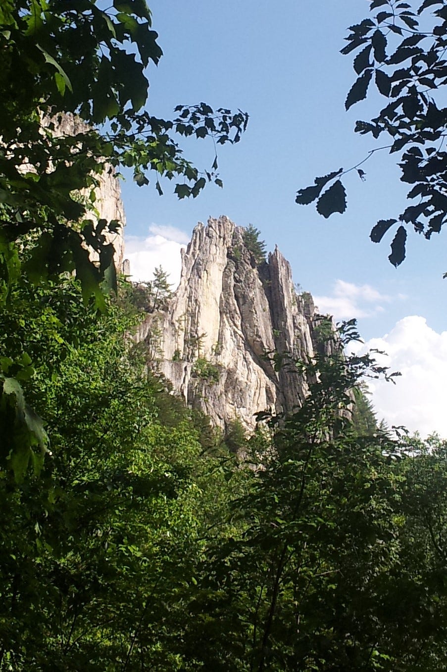
5. Seneca Rocks - June 1, 2013
My three-summit day culminated not terribly far from Spruce Knob in a fun trek up to the Seneca Rocks overlook, a 900-foot gain in 1.3-miles. After some loitering in the visitor center waiting for a brief rain to pass, t-shirt weather quickly returned. I empathized with the rock climbers caught in the mini-storm, having been there and done that a few times myself (though not at Seneca).
I had no idea whether the summit of the higher north crag was attainable without a rope, especially if wet, but regardless, I needed another good hike to finish up the day.
From the overlook, an easy scramble on dry rock led to the exposed summit and a great sense of being astride a giant dorsal fin. The final few feet are very exposed so I did not go for the hero shot and stand on my head or anything. The rock is highly textured quartzite (formerly a sandy marine shoal folded edgewise) and satisfyingly gripable. It just might lure me back for a bit of climbing next time, if I can wrestle up a partner. It was a fabulous finish for a triple summit day. Only 55 to go.
Summits number 6 and 7 were scaled on another fine Saturday in the Shenandoah (June 15). We drove up early Friday evening to find a few campsites still available at Mathews Arm. On the way in, Kris spotted a bear on the hillside above the road—our first big critter sighting out East.
I lit up the charcoal and roasted some brats for dinner. Eggs for breakfast cooked up nicely over the hot coals and we were soon packed and on our way to the Pinnacles and Marys Rock.
6. Pinnacles - June 15, 2013
The moderate approach we chose begins along Skyline Drive at Jewel Hollow and follows the A.T. as it climbs the scenic ridge to a rock outcrop called the Pinnacles. The name is a little puzzling, since the rocks seem more like nubbins than pinnacles. I leaned over the edge and could see that from below and to the west the formation might look like a row of pinnacles all scrunched together—or not. But because the rock has a name and happens to be the highest point in the north section of the park, I deemed it sufficiently mountain-like to count as one of my coveted Sixty Summits. After a short rest and a nibble, we marched on.
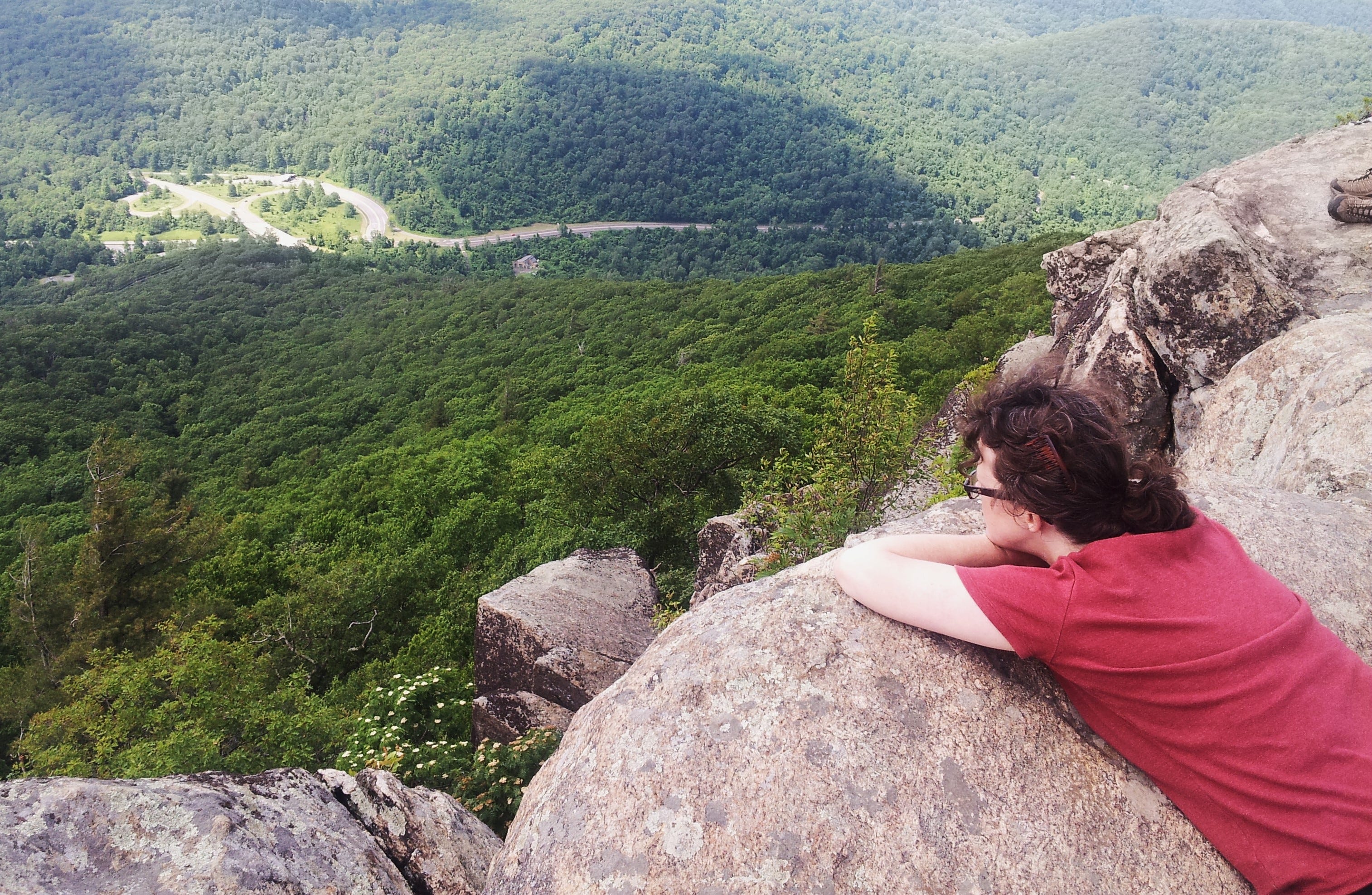
7. Marys Rock - June 15, 2013
The trail descended a couple hundred feet to a saddle and an empty camp with a rock shelter and an outhouse. We arrived at a split where the A.T. descends to Thornton Gap and a spur leads a few dozen strides to Marys Rock, about 3.5 miles from the car. A large overlook offers excellent views across a wide horizon. The rocky summit knob is a thirty-second walkup from there. We lingered long on our lofty lanai lunching leisurely.
The return over the Pinnacles was just as scenic going as it was coming. We also re-passed a rotten log in the middle of the trail that had seemed freshly turned over by a bear in the morning. Distinct claw marks were visible where I could imagine a front paw casually reaching out to flip the thing over for grubs. An ice cream stop on the way home capped off another lovely day out East.
With a week off from work, I flew to Tucson on June 27 and drove to Safford to take care of some things at my dad’s house [he’d passed the prior October]. That night I camped near Theodore Roosevelt Lake, a couple hours’ drive to the north. The campground was spiffy, but the ground was hard as pavement, which prevented me from driving in the tent pegs to hold up my borrowed tent. I gave it up and spread my bedroll on the picnic table instead.
I immediately zonked out, only to be awakened at 2:00 am by a family of coyotes singing and yapping nearby. A little too nearby. I swear they were not even fifty yards away and the racket went on loudly for half an hour or more. A more distant band of coyotes joined in the chorus. This made it difficult to settle back to sleep, as each little noise in the brush was imagined to be a hungry coyote loping around my campsite. It’s funny how a wall of nylon fabric might have negated the imaginary threat. Sheepishly, I crawled into the back seat of the car so I could get back to sleep.
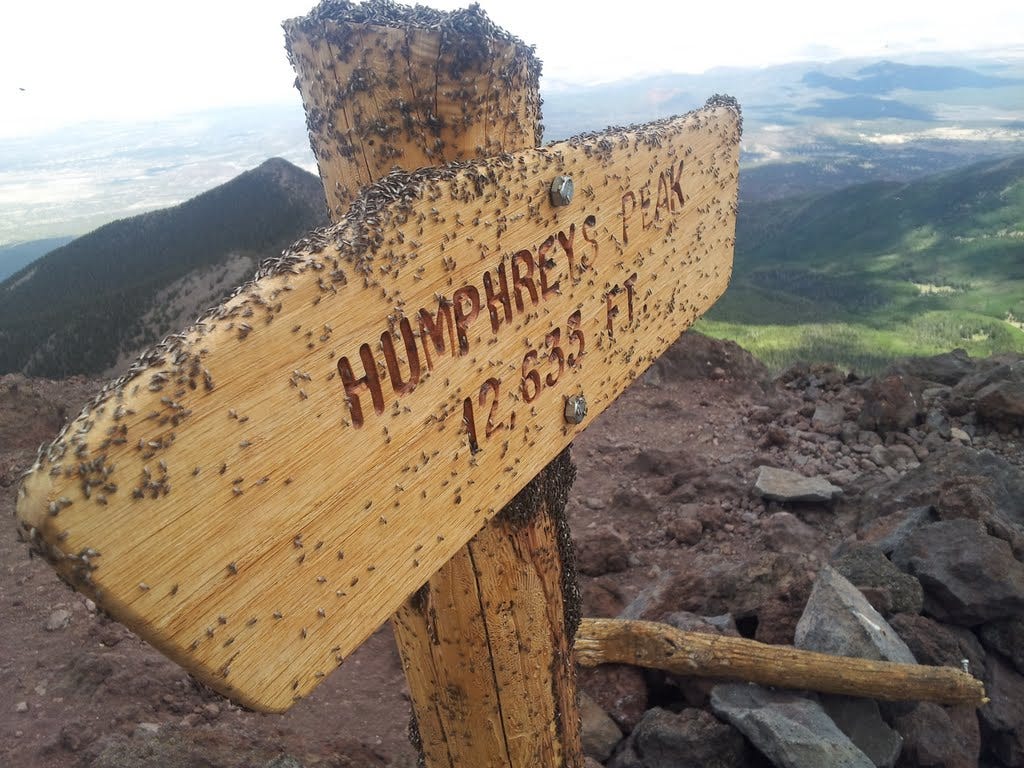
8. Humphreys Peak - June 28, 2013
Up early, I made a beeline for the Humphreys Peak trailhead a few miles north of Flagstaff. My mid-morning start up the trail was not ideal, since afternoon thundershowers were in the forecast. And because Humphreys Peak, at 12,637 feet, is the highest point in Arizona, it is also an obvious magnet for lightning strikes. From the 9,300-foot trailhead, I trudged as quickly as the thinning air would let me. A day and a night at 2,500 feet above sea level was not much acclimatization.
But the weather held and I marched up the easy grade to treeline. Here, the trail steepened and the clouds darkened. Thunder began to roll across the valley from ominous clouds to the west. I kept on.
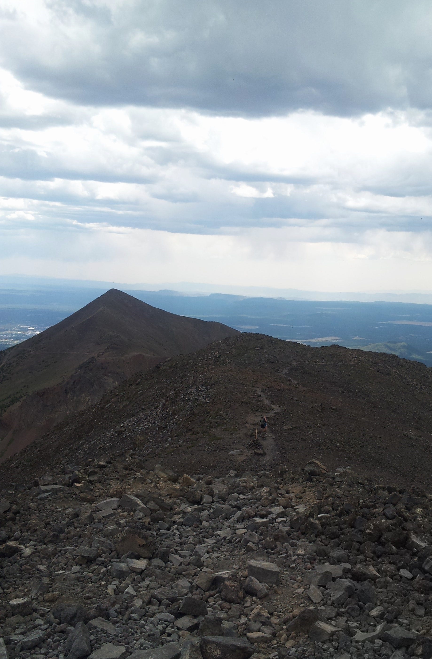
At the summit ridge, the thunderstorm had moved only nominally closer and I kept a sharp eye on things while I continued upward. After several false summits and a couple of internal discussions with myself about aborting the hike, the true summit finally came into view. The storm was closer now and a cold wind started to blow, but I hurried to the top and was greeted by a fabulous view and a dense swarm of tiny flies—the worst I’ve ever encountered. Between the bugs and the advancing storm, I spent maybe 90 seconds on the summit before trotting back down the rocky trail to safety.
The clouds churned almost overhead but remained slightly west of the peak. Several parties after me kept on climbing, while several others turned back. Strangely, the storm seemed to dissipate a couple hours later and I did not hear any thunder coming from Humphreys Peak. I’d happily summited my eighth peak (of Sixty). As the first higher mountain of the year, the test reaffirmed that the legs and lungs still functioned at altitude.
You can find the next batch of summits from 2013 here.