

As I plod along with a 70 Summits notion in 2023, it’s been fun to look back at the 60 Summits quest in 2013. This batch summarizes some of the best that year. The first batch I posted in August and can be found here. I hope you enjoy vicariously traveling along.
9. Mount Olympus (UT) - June 30, 2013
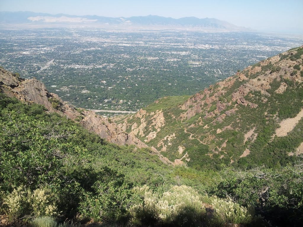
My next scheduled summit after Humphreys Peak (Arizona’s highest point) was Mount Olympus, which rises magnificently above Salt Lake City to 9,026 feet. As a kid, I lived south of the city for several years and would look up at the mountain with awe. When my big brother said there was a trail to the top, I desperately wanted to go, but they said I was too little. So, instead, I would stare at the steep slopes and imagine where the invisible trail might be and how tiny our house would look from the tippy-tippy top.
I was in my 20s and living in Washington State by the time I became serious about hiking. But that childhood mountain in Utah always beckoned. Inexplicably, it’s taken me decades to finally make the trip.
The forecast was for sunny and hot, 100 degrees-plus in Salt Lake City. From my cheesy motel in Nephi, I sped to the Mount Olympus trailhead for a somewhat late start at around 8:15 am.
The first quarter-mile is quite steep and I was a little past that when I suddenly realized I had forgotten to toss my one-gallon water jug into my daypack! I searched my pack and found a 20-ounce bottle of flavored vitamin water that I just happened to drop in the pack the day before. The brand was Lifewater. The flavor was “yumberry pomegranate.”
Okay, I did not want to descend to the car and re-climb that first pitch, not so much for the added effort, but because the trail was still in shade and the time lost by retrieving the water jug would steal all that shade away. But could I get all the way up (a gain of 4,200 feet) and back on two and a half cups of water?
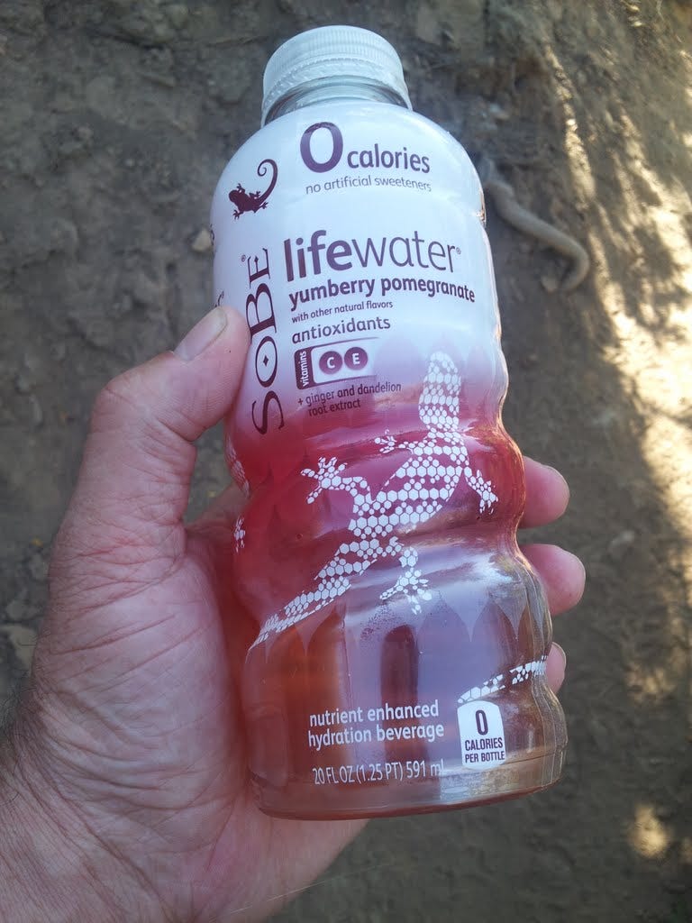
I experienced severe dehydration in the Grand Canyon once and certainly didn’t want to get into that fix again. On the bright side, I’d eaten a quarter of a good-sized watermelon for breakfast and had already drank a liter of water, so, for the moment anyway, I was well hydrated. I looked down at the rental car that held all that luscious H2O, looked up the mountain, and looked at my Lifewater. I chose Life. Lifewater. I headed on up, promising to turn back if things got too ridiculous.
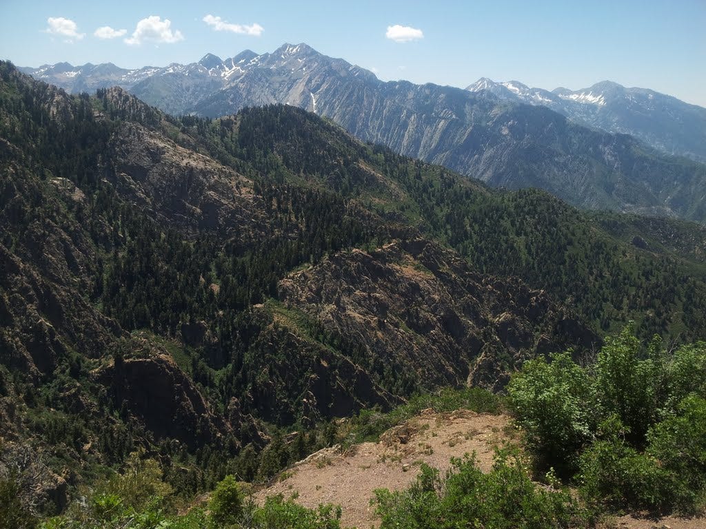
The trail eased off, but elevation was quickly gained and the views were outstanding much of the way. The trail made the most of what shade there was, seeming to have been designed and located with summer heat in mind. Patches of warm sunlight warned of my little predicament. A fellow I met on the trail advised that a nice long shady section awaited higher up.
I reached a trickle of a stream in cool forest and knew that there was at least an emergency supply of water there if worse came to worst. As it turned out, the rest of the climb was never too hot and thoroughly enjoyable, shuffling up some exposed shale to a high flower bed among tall firs and the first good view of the summit not far above. I still had half my bottle of Lifewater left.
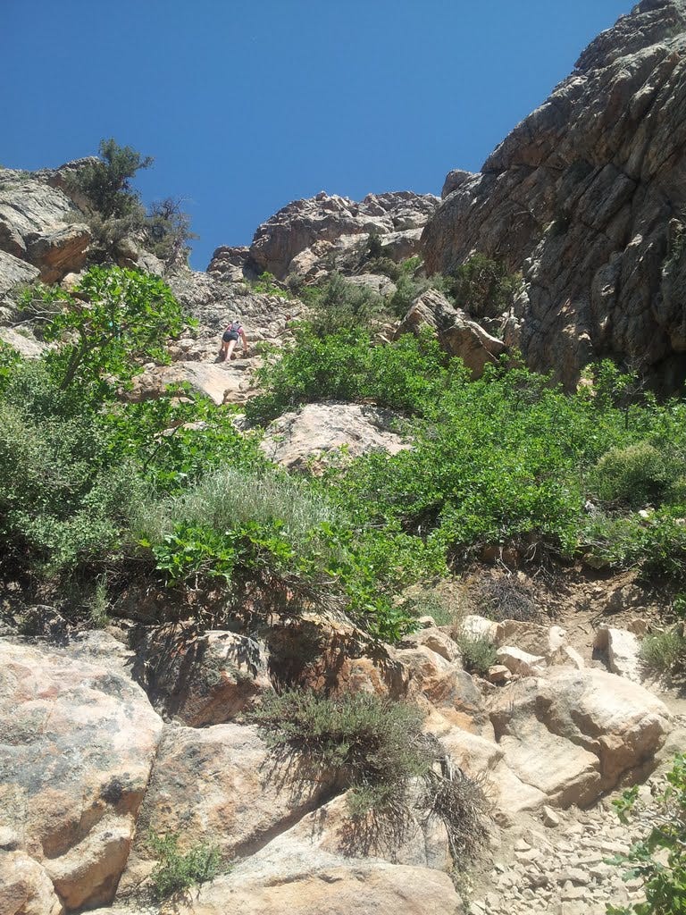
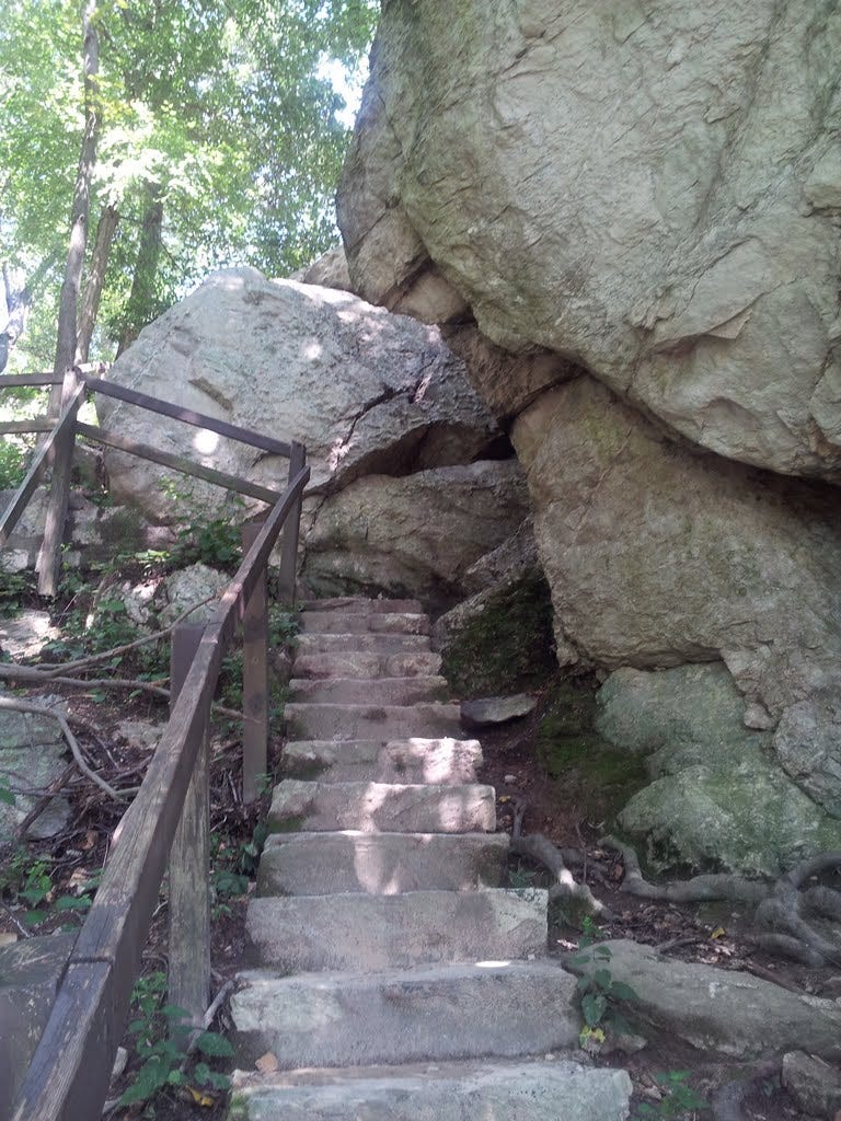
The 3.5-mile hike becomes a scramble for the last 200 vertical feet, including a short section of exposed, easy moves up a shallow rock gully. Here, a family of five was descending. One mentioned they had spotted a rattlesnake in a crevice at the top. Great. My favorite reptile. Not. I danced over the last of the summit boulders almost expecting a hidey snake to take a chunk out of my bare calf.
I did not see, hear, nor poke around for a snake, nor did I feel much like sitting down on the boulder pile for a rest. After a few snapshots and a gaze out toward my childhood home, lost somewhere in the confetti of development that spills ever wider across the broad valley, I reversed course and headed down.
I descended the steep section as another couple came up, warned them about the alleged snake, then enjoyed a bit of a rest and most of what was left of my yumberry pomegranate at the saddle. I would have lingered there if not for the hot sun baking my bones and being down to the last dribble. I finished that off about twenty minutes later.
At the trickle of a stream, I opted to pass on the intestinal risk therein, and basked in the cool woods a spell before continuing down, down, down into the heat, knowing all the water I could ever drink was less than hour away… a half-hour… ten minutes. There’s the car!
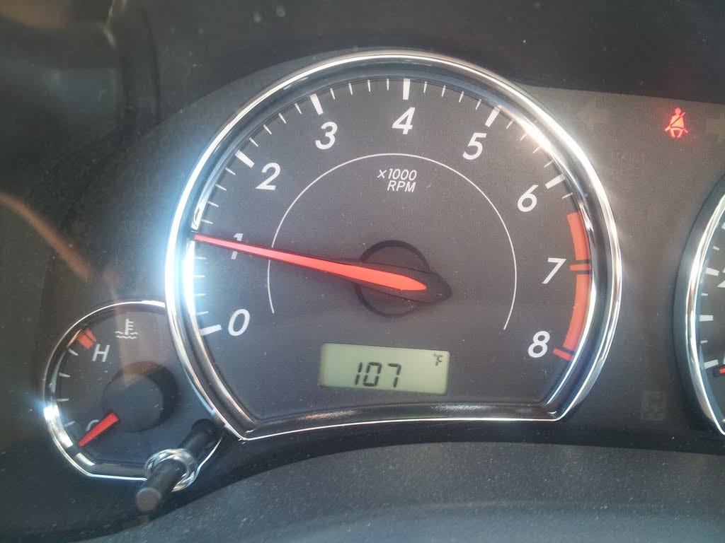
I was parched, but not ferociously dehydrated. The gamble paid off. I’d made the summit and was soon guzzling water like it was nectar from the gods. When I turned on the ignition, the car thermometer read 107 degrees. It read high from sitting there. It was really just a chilly 102.
For the heck of it, I drove over to the house we lived in off 23rd East, parked in the street—nothing like it was so many years ago—and stared up at the mountain awhile, trying to imagine where the trail went.
10. Kings Peak (UT) - July 4, 2013
My brother, Dean, and I have been talking about a trek to Kings Peak, the highest point in Utah, for a decade it seems. Last year it was for sure, then something came up. This year was really truly for sure, the two of us plus his wife and mine. But Kris couldn’t come due to other obligations, and at the last moment Dean’s wife had to beg out, which left the two of us—and eight llamas—to make the trek on our own.
I’d never done a llama trek, nor even spent more than two minutes anywhere near a llama. And my job was to catch them, load them in the trailer and drive them to Roosevelt to pick up my brother. While we could have sufficed with three or four llamas, Dean had some new ones that needed training and a workout, so the whole herd was coming along.
What a hoot. I’d have done as well herding feral cats. I did manage to catch the first three without too much trouble in the open catch pen. These were the docile ones who were easily lured by a bucket of grain. The others wanted no part of me or my bucket.
Fortunately, my brother’s daughter’s daughter, Mallory, a young cowgirl with exceptional skill around animals, was there to assist. Even though she is half as tall as me, she had the next two llamas snared in no time and helped me round up two more that I could lasso at close range. And note that me swinging a lasso in the air is about as much fun to watch as a chicken cackle.
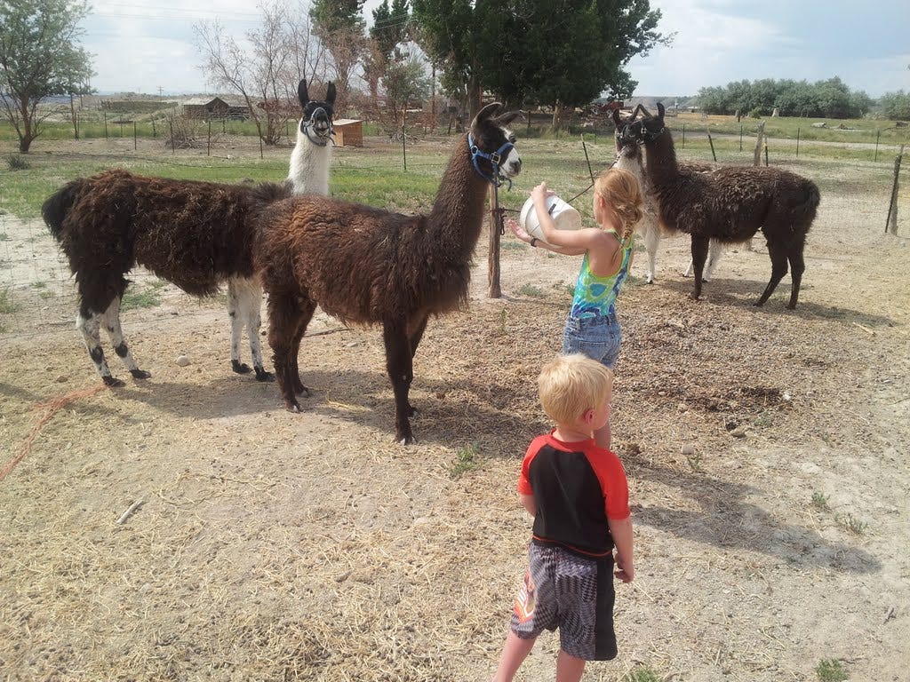
Soon we had all but one, Dilly, and she insisted on staying at the other end of the field or running wide circles around us. Her buds, Dally and Dolly, were much more cooperative, so Dilly, apparently, had missed the memo. After much chasing, Mallory’s dad, Mike, showed up and we went at it some more.
After an hour of running ourselves numb in the Utah summer heat, Dilly made her mistake. She ran right into the catch pen with all the other llamas. As Mike raced to get the lasso over her head, I lunged for the wire gate and stretched it across the opening just as Dilly surged and plowed right into it, knocking me hard to the ground. But the obstacle of me sacrificing my body was just enough of an impediment for Mike to snag her. The roundup phase was over and I was now a bona fide llama wrangler. We loaded the team without further incident, bandaged my wounds, and we were on our way to Roosevelt.

However, this is supposed to be a story about climbing Kings Peak.
After picking up my brother at his chiropractic clinic, we drove nearly four hours by way of Flaming Gorge to the trailhead up Henry’s Fork of the Green River, arriving after dark. We staked out the llamas to feed on grass overnight, pitched our tents and hit the hay ourselves.
Despite a mixed forecast of sun and thunderstorms, the morning looked promising and we saddled up the critters and slung the bags over their woolly backs. I found the llamas to be a joy to work with overall, although half way to camp my lead llama decided to stop and lie down on the trail. We rousted her and she plodded another 100 yards before balking and lying down again.
In fits and starts we eventually reached the camp zone about seven miles in, just as a thunderstorm broke loose. It was the 4th of July and quite a show as big sparks and loud bangs surrounded us, but we were able to quickly establish camp, stake the critters and pitch the tents without getting too wet. The storm passed and we broke out the Coleman stove to boil up some dogs for dinner.
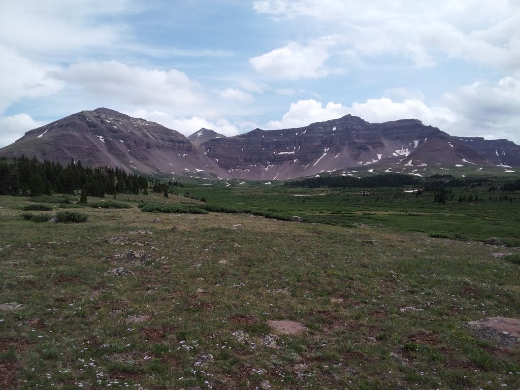
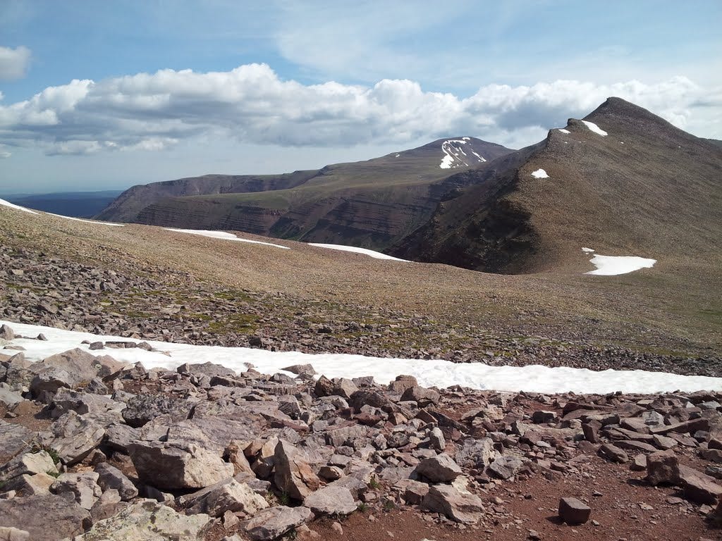
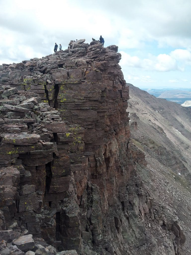
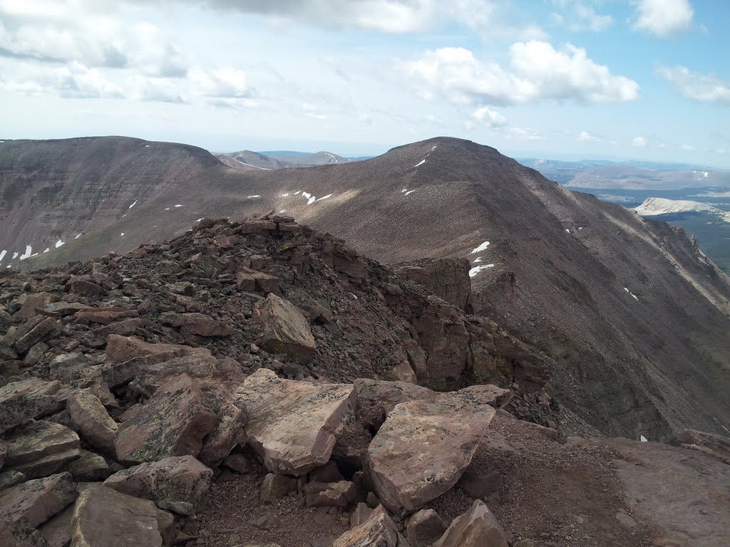
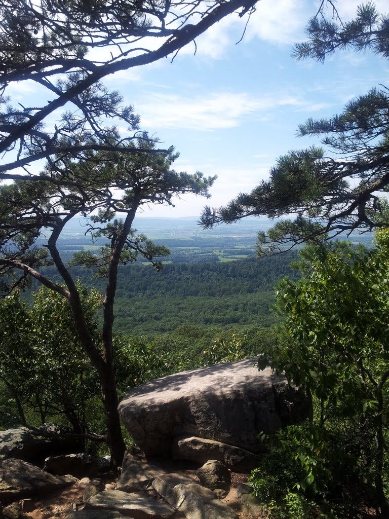
The morning sky was still jammed with dark and threatening clouds, but miraculously, they thinned as the hours passed. The sun shone and we were soon atop Gunsight Pass. We took the short cut trail up through the rubble and low cliffs to a shoulder where the full glory of 13,536-foot Kings Peak rose ahead. Dozens of climbers were on the peak that day—as a state high point, it’s a popular climb.
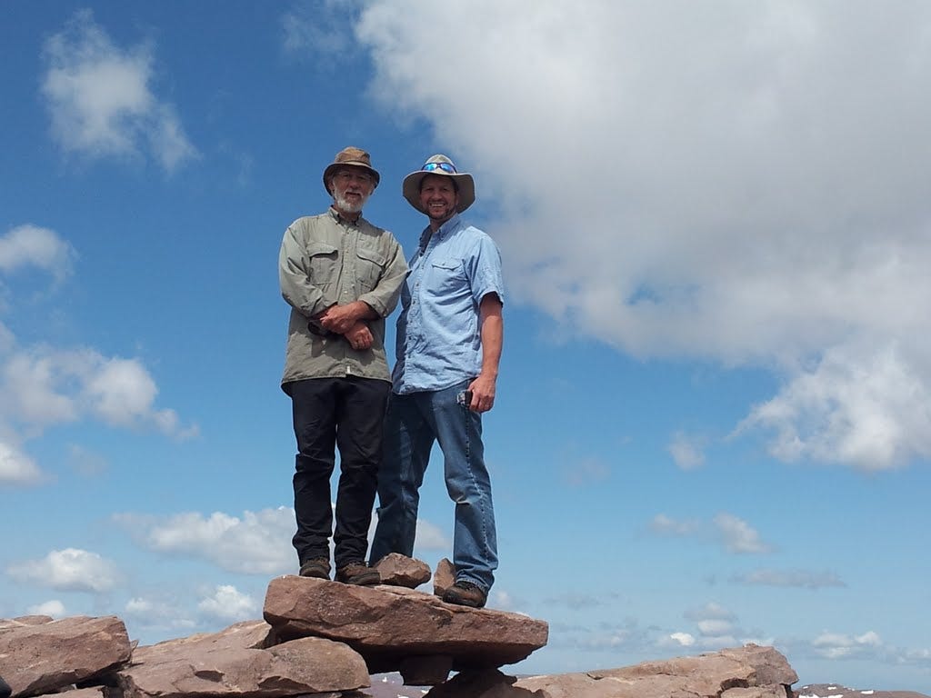
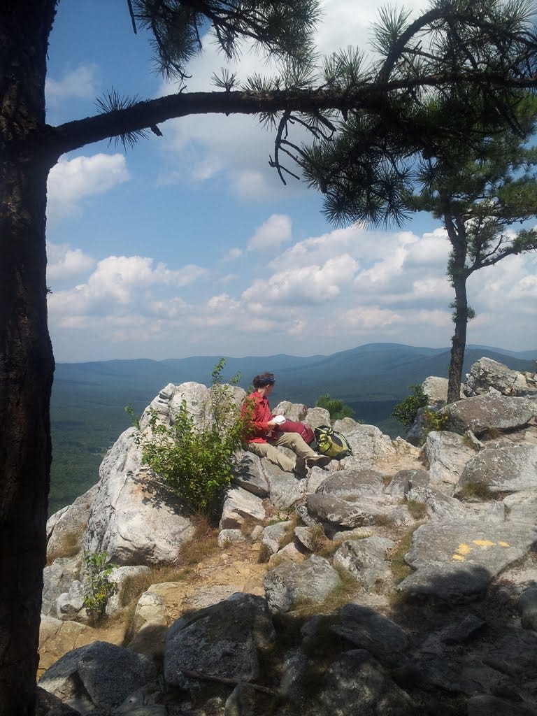
We trudged on to Anderson Pass and wide views into sprawling valleys of meadow, forest and lakes of the Uinta Range. An easy rock scramble led up the final ridge. After many stops in search of some air to breathe, we finally stepped onto the summit for the big view and the ceremonial photos.
It occurred to me that Dean and I had not stood on a summit together since the late 1980s when I took him up Mount Shuksan near Bellingham, Washington. Now with the south peak so close (less than a mile away), Dean was determined to go there too. So after a sandwich, off we went.
11. South Kings Peak - July 4, 2013
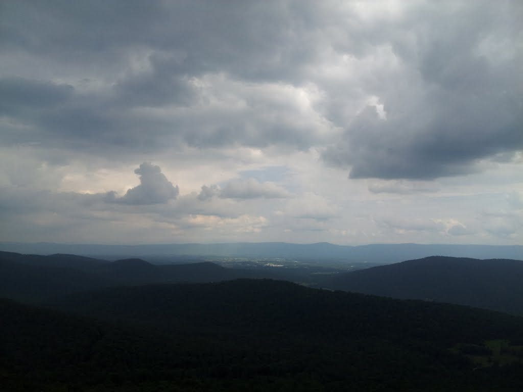
About 40 minutes after leaving the main summit we were congratulating ourselves for reaching the state’s second highest summit as well, at 13,524 feet. For many years, it was assumed to be the highest point, but a more accurate survey corrected the error. Looking back across Gunsight Pass, the third highest summit, Gilbert Peak, beckoned. But we thought the best of it, headed back to camp and our lonely llamas and called it a day.
With a weekend DC forecast in the high-90s and thunderstorms likely, Shenandoah National Park was once again on the radar. I headed out around noon and aimed for Mount Marshall, named for the fourth Chief Justice, John Marshall. Marshall is one of the northerly summits of the park and not horribly remote from the big metropolis. A bonus was Marshall's south summit, which is just a few feet lower than the north--and good enough for a two-fer in my quest for 60 new peaks this year.
It was only about a five-mile out-and-back skedaddle, but 1,000 feet of gain meant it wasn't just a walk in the park either. No wait, it was a walk in the park. The temp was in the low-80s, providing significant relief from the sweltering washrag heat of DC in July.
12. Mount Marshall South - July 20, 2013
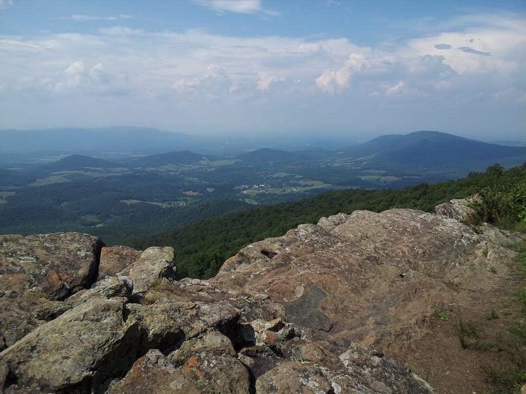
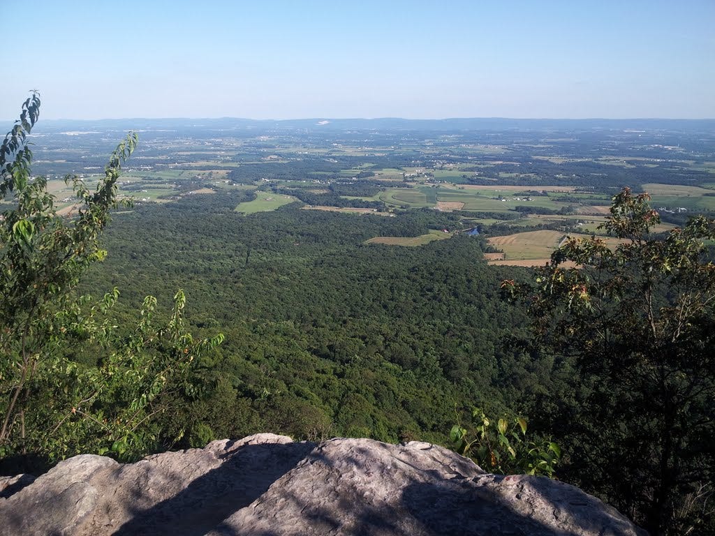
There is not much to say about a simple hike in the woods like this one, other than I started at Gravel Springs Gap on Skyline Drive and marched north on the A.T. Below the top, I paused at a picture-perfect outcrop with a view of the mountains and valleys surrounding the park.
After a deep breath of clear and warm Virginia air, I continued up in search of the actual summit about a mile from the start. I couldn't find it. The gently rounded ridge has a few lumps and bumps here and there, but nothing sufficiently prominent to call the true summit. I wandered on and began descending the other side. My trek would bring me back the same way, so I decided I'd survey for the summit later.
13. Mount Marshall North - July 20, 2013
Descending from the south summit led me back to Skyline Drive, which is crossed to pick up the A.T. continuing on to the north summit. A short, moderately steep hike wound past a rock pillar with a scrabble trail around the back and up to the apex for another photo and a gulp from the water bottle.
A short distance beyond was, yet again, another classic outcrop with a wide view, and not far above that, a craggy hump of rock about 20 yards off the trail that appeared to be the actual top. I hopped over and, sure enough, a brass benchmark reading "Marshall 1933" was fixed to the rock. After a short rest, I reversed course and headed down, or rather down and up to the south summit, which seemed to be a minor hump of rock rubble under a bush. I put my foot on it and called it good.
14. Flat Rock (PA) - July 26, 2013
On track for summit #14 of the big Sixty, I headed north to south-central Pennsylvania mid-day Friday for some leisurely peak bagging. I stumbled on the hike whilst searching around for destinations in the general vicinity of Pennsylvania’s state high point, Mount Davis.
The trail to the top gains about 1,200 feet in 2.2 miles and departs from a state park campground—perfect. I arrived at Colonel Denning State Park near Newville in time to pitch the tent and still hit the trail by 5 pm. A sign at the trailhead about our native cute and cuddly rattlesnakes and how harmless they can be, until you step on one, had me staring at my footsteps most of the way up. After a steep start, the trail eased off at the ridge and ended as an easy stroll up to the stony overlook.
15. Mount Davis (PA) - July 27, 2013
Okay, this is not a peak easily bagged. If it wasn’t for the view tower and a sign, you would never know you were higher than anything else in your sightlines. It seems if you can’t see the forest for the trees, then you also can’t see the high point for the forest. Nevertheless, it is the surveyor’s official high point amid a wide, forested plateau. I suppose it might be more accurate to call this one plateau-bagging.
I began my journey on July 27 with an aimless drive from my tent site at Colonel Denning State Park. I had not yet picked up a road map of Pennsylvania, but I knew I needed to go a good distance west and a bit less south. So I drove west on a couple winding, east-west country highways and south on a couple north-south highways, and lo and behold, I found the historic towns of Meyersdale and Salisbury.
Supposedly, one could start at either town and “just follow the signs” to Mount Davis. So I started at Salisbury. Cross the river, turn right at a T and follow the signs, someone had posted on a website. But at the T, a bright blue highway sign said go left for the Mount Davis highpoint. I trusted the bright blue sign and went left. Never again.
Do not trust bright blue signs in Pennsylvania, especially ones with arrows that say ‘Mount Davis’ on them. After a good hour of driving around in circles, which gave me some quality time to follow Amish horses and black buggies along the backroads, which truly was a nice bonus, I passed a sign that said “Welcome to Maryland.” This was a cue that I might want to turn around, which I did.
I then ended up back in Meyersdale. The directions there said to find the Sheetz gas station downtown, then head north and turn left at the Army tank. After several miles and no Army tank, I thought I’d better go back and regroup. On the return, I found the tank, slightly hidden (assuming it’s possible to hide an Army tank) in somebody’s front yard. Cool! I finally had the right road and twenty minutes later I was at the Mount Davis picnic area, which is a short mile from the summit tower.
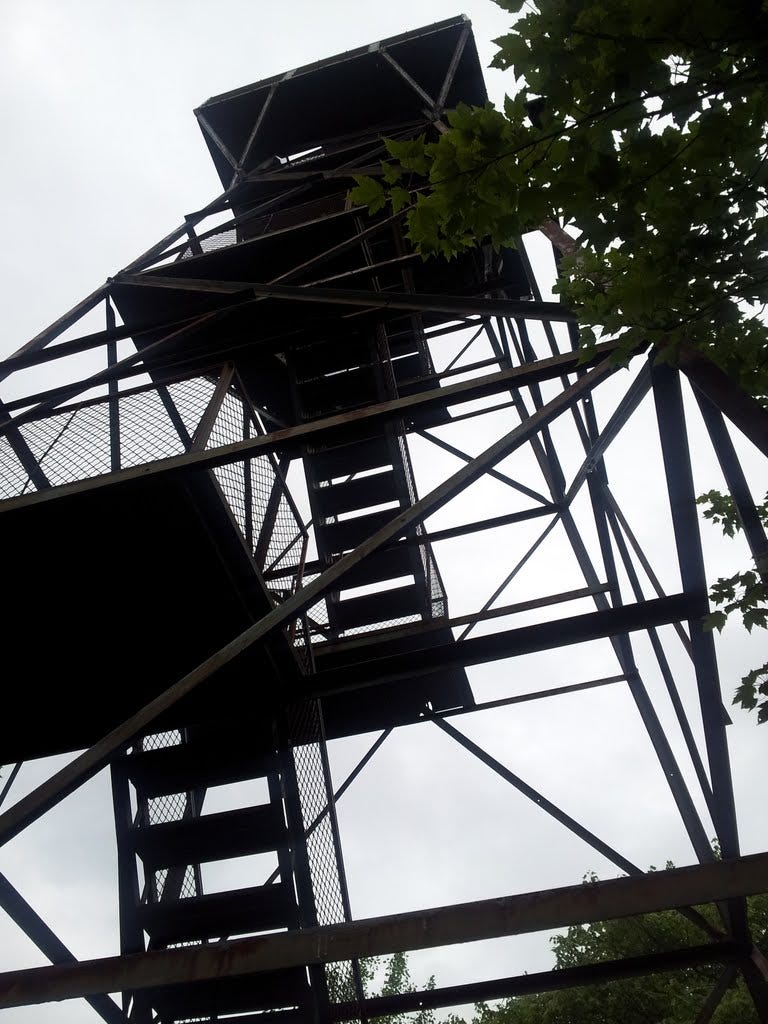
The High Point Trail leads to the steel summit tower with an arduous elevation gain of possibly 50 feet. Add that to the 50-foot tower, give or take, and we’re talking triple digits. So I called it an even 100-foot gain. I was almost back at the car when thunder began to boom to the north—and content to be off the tower.
All in all, for what the “mountain” lacked in arduosity, the circuitous drive up there did tap my routefinding skills; therefore, I proudly enter it in my ledger as Peak #15--a quarter of the way toward my goal.
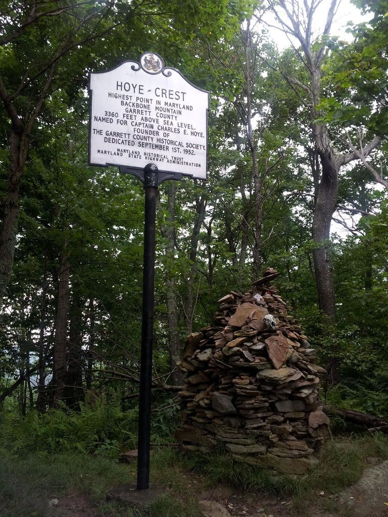
16. Backbone Mountain (MD) - July 27, 2013
The rain picked up as I headed south from the high point of Pennsylvania to the top of Maryland and the highest point along Backbone Mountain. I had good directions for this one at the west end of the long Maryland panhandle. The trailhead was adjacent to the highway. Conveniently, the rain stopped when I parked the car.
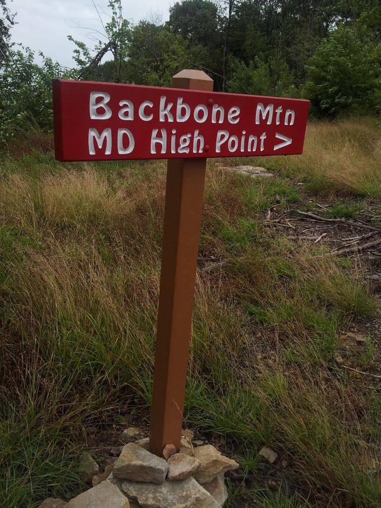
An uneventful, one-mile long, 700-foot climb up an old logging road took me to the rocky crest where a concrete monument delineates the boundary between Maryland and West Virgina. In fact, the whole hike is in the latter state and you don’t reach Maryland until you’re pretty much at the end. A sign with a tall cairn marks the spot. The sprinkles held off and the clouds lifted just enough for a view, which wasn’t half bad.
17. Sugarloaf Mountain - August 10, 2013
On the prowl for my 17th summit, and knowing I had not yet been to the actual apex of Sugarloaf Mountain, I made a beeline for DC’s nearest mountain on August 10—my third time there. I followed the White Trail from the bottom parking area, then cut right to the Green Trail for a scenic finish. The upper trail climbs many steps and passes a lot of rock to reach the rounded top. I put my feet on the highest stone and wandered a few yards to a good lunch spot where the view west was well worth the trouble.
Being that it was Kris and me’s six-year anniversary, I scooted home in time for dinner plans at Public House No. 7 in Falls Church, where our favorite bluegrass band, City Farm, was playing.
18. Tibbet Knob - August 11, 2013
Kris and I heard Tibbet Knob was a worthwhile trek back in September when we hiked up Big Schloss, which is accessed from the same parking lot at the state line between VA and WV. So off we went on August 11, arriving at the trailhead at the crack of noon-thirty.
After losing the trail fifty yards from the start, I refocused and realigned my wandering thoughts with my wandering feet and kept the party pretty much on course for the remaining 1.6 miles to the top. We met a couple descending just as we reached the first of two steep, but easy, scrambles and then the cheery summit just beyond. It was another great view from your standard rock bump on a long wooded ridge.
Too soon, though, darkish looking clouds approached from the west and hinted at the possibility of a thundershower, also predicted by the day’s forecast. I interrupted Kris’ basking and suggested we start descending from the line of fire. The thunder never came, but worse sorry than safe, right?
You can find the next batch of 2013 summits here.