Below is the fifth batch of peaks from my 60 Summits quest in 2013. You can find the previous batch here.
37. Pusch Peak (AZ) - October 31, 2013
On Halloween (2013), I flew to Tucson where my brother and I were hosting a weekend memorial in Safford for our dad and stepmom who’d both passed away in the last year and a half. My plane arrived early enough in the day that I had time for an energetic hike up Pusch Peak, a few miles north of downtown.
Pusch, at just over a mile high, is the westernmost summit of the Santa Catalina Mountains. Given the two-mile distance each way and 2,700-foot elevation gain, plus a 5:30 pm sunset to account for, I calculated there was just enough time to nab the summit before dark. The weather was perfect, sunny, not quite 80 degrees.
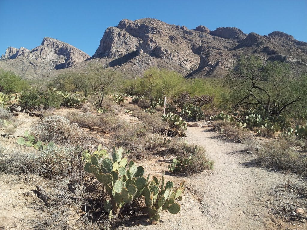
I hit the trail at 2:00 pm and meandered among the prickly pear and creosote into the saguaro zone, with the rocky summit looming dead ahead. As warned, the climb was steep, but the trail was in better shape than I had imagined from the descriptions online. It was just a matter of upward trekking as the valley beneath me slowly fell away from one turn to the next. I saw no one else on the mountain, though Pusch is surely a popular weekend hike.
I was on the splendid summit by 3:50 pm, which allowed for a short rest and still the hour and a half I’d budgeted to descend before dark. From the top, the views into the Santa Catalinas and out across Tucson and Oro Valley were fabulous. Although I was a long way from Mount Lemmon, the high point of the range, I enjoyed once again, one of those top-of-the world moments that make peakbagging a more sensible and honorable endeavor than some might presume.
On the way down, the brilliant light of the low-angle sun turned the mountain to gold and lit up the stately saguaros like little monuments. This one was going into the journal as one of the most enjoyable of the Sixty.
38. Mount Wrightson (AZ) - November 1, 2013
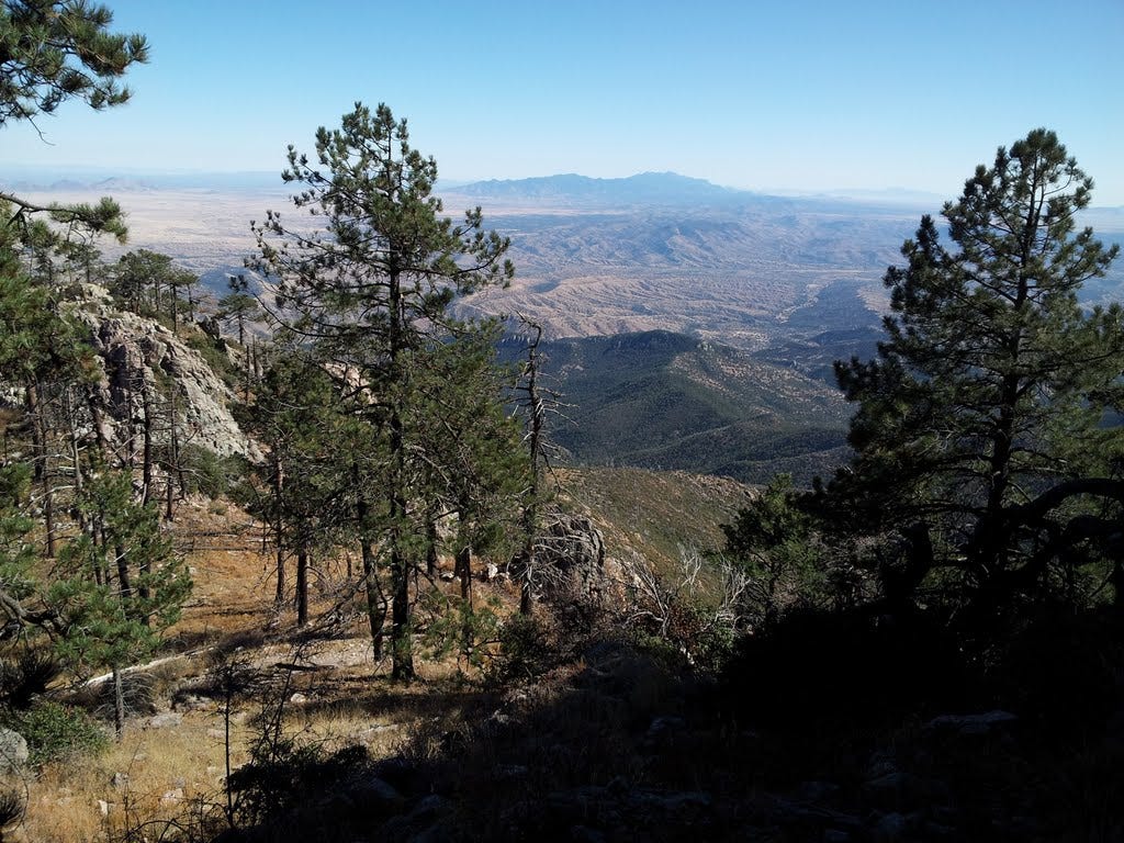
I was meeting my brother and others in Safford Friday afternoon (November 1st), so the morning gave me a suitable time window in which to trudge up another mountain, to sneak a peak, so to speak. My research led me to Mount Wrightson, a highly regarded objective south of Tucson. At 9,453 feet, it’s the highest summit of the Santa Rita Mountains. Its more famous neighbor, Mount Kitt, lies just to the west. With an elevation gain of just over 4,000 feet in five miles, it is also one of the more ambitious day hikes in the region.
The weather could not have been more perfect. I left the trailhead in Madera Canyon around 10:30 am, opting for the more direct Old Baldy Trail, rather than the gentler but longer Super Trail. Both converge at Josephine Saddle, where a marker denotes the tragic demise of three young boy scouts who became lost in a snowstorm near the saddle a half century ago.
The trail continued up the ridge and into an upper basin with occasional views of the valley below and the peak above. Yellow crags jutted up from the forest where a series of short switchbacks brought me to the high crest north of the mountain. The final scenic spur to the top gained the last 800 feet in less than a mile, and I was on top by 2:00 pm.
There I met two couples, including a mother and son repeating a hike they’d done when he was a kid. She rightly (Wrightly?) bragged that her parents had also made the trek when they were in their 70s. I wanted to stay, but alas, I had obligations in Safford that I was already running late for. There are other good hikes in the area and I will have to return at some point. For now, I raced down the mountain, happy that my knee was still holding up well despite the abuse.
Dad’s Farewell (AZ) - November 2, 2013
Dad and Clarice (our stepmom) had a lot of friends around Safford and we’d meant to hold a memorial gathering for them in town last spring. But life got in the way. Summer’s way too hot in the desert, so we planned an event for the fall while the weather was mild.
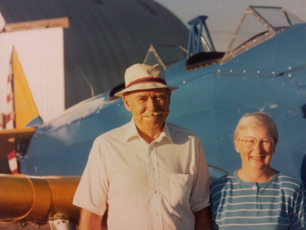
My sister picked up sandwiches and cookies on her way down from Phoenix. My brother flew out from Philly and grabbed the ice and beverages, while I arranged with Ponderosa Aviation at the Safford airport to hold the event in one of their spanking new hangars. We set up the tables and chairs and I picked up some flowers at a local shop for the occasion. I had also enlarged some pictures of Don (my dad) and Clarice and brought along my dad’s photo albums and log books from his sailboat and airplane days to share.
Dolan, a friend who did a little work on Dad’s airplanes as well, brought the model of the Great Lakes biplane that I had given him last year as a memento. We set it next to the flowers. Dad built the model after also having built the actual airplane and flying it around the West for about three decades. It was a familiar sight over Safford and everyone wanted to go for a spin in the open cockpit, hand-cranked, bright yellow airplane. I flew in it once, wearing a leather jacket and matching leather helmet. I sat in the front and enjoyed my dad’s piloting like a carnival ride. After some acrobatic maneuvers a few thousand feet up, he said, okay, you take it! So I did, for about ten thrilling minutes.
Dozens came to the memorial, including a family friend and hospice nurse, Mary, who gave the greatest of care to Don and Clarice in their final year or so (Clarice passed only a few months before Dad). Many others came whom I’d never met, but whose names were in the address books I used for sending out invitations. All thought highly of Don and Clarice and a few good stories were told.
My long lost aunt Marilyn came with her husband Herman and we enjoyed a lot of catching up over dinners on two consecutive nights, whereupon I learned a great deal about her and my longer-and-loster Wilcox cousins (I grew up with my mom and as a kid had never met my dad). Marilyn was married to Uncle Jack who passed away in 2000. My dad’s only sister, Marion, passed away a few years ago. Her husband, Grant, is still going to the gym in his 90s and now living in Kentucky. Marilyn gave me the run down on all of my cousins to boot (both her kids and Marion’s). I’ll look forward to meeting some of them, perhaps on my next trip out west.
The American Legion surprised us with a moving tribute to Don, a Navy veteran. After a prayer and recognition for his nearly twelve years of service, riflemen fired shots into the air and a trumpeter flawlessly performed Taps. Behind them rose the Gila Mountains, a perfect backdrop for a final send-off to Don and Clarice. It’s still hard to believe they’re gone.
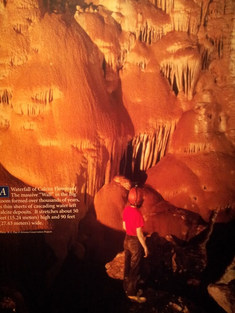
Kirchner Caverns (AZ) - November 3, 2013
The day after my dad’s memorial in Safford, I headed back to Tucson for a flight home the next morning. On the drive west, I stopped at Kirchner Caverns in time for a 90-minute tour of the Big Room. Wow, very cool.
Unfortunately, no cameras are allowed, not even the cell phone kind, since people have a habit of absentmindedly (or intentionally) taking flash photos when asked not to. The light damages the delicate ecosystem of the cave and, of course, disrupts the ambience of this mysterious underworld. Kirchner was discovered just a few decades ago and has emerged as one of the more coveted caves in the U.S., and certainly among the best preserved.
Day of the Dead (AZ) - November 3, 2013
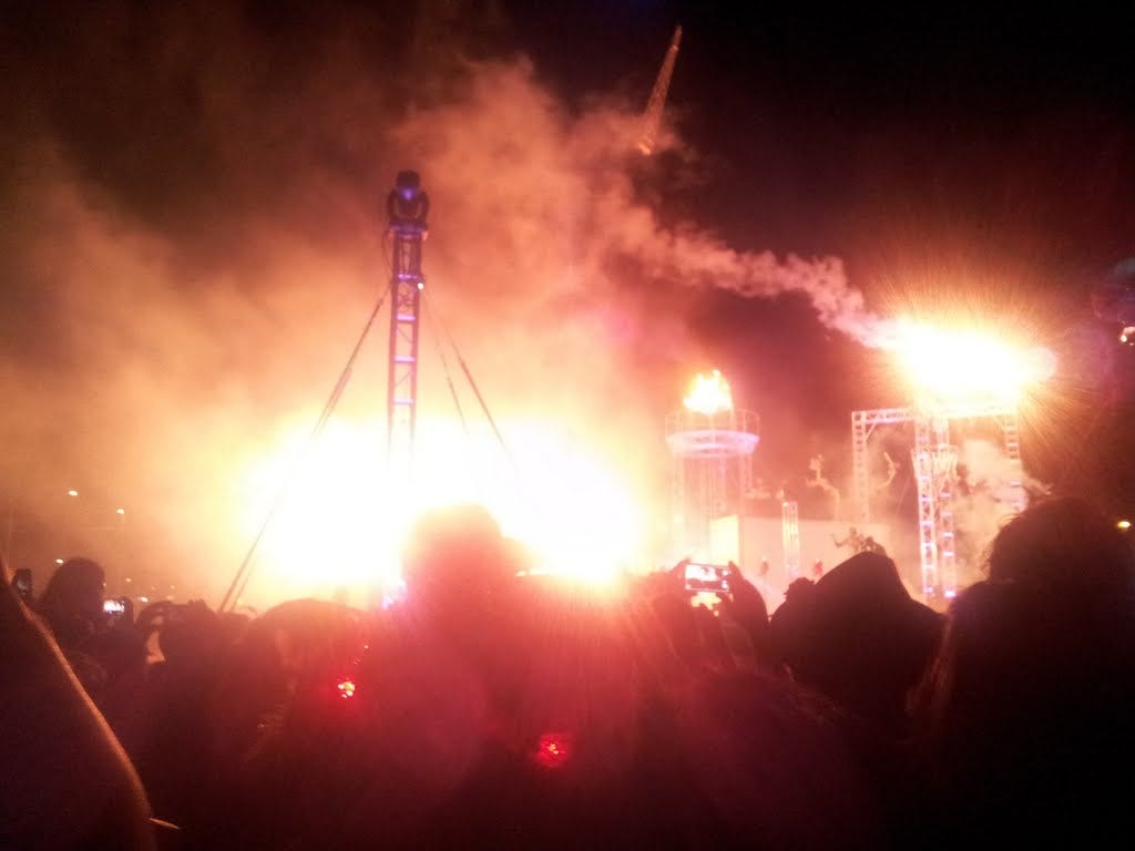
Serendipitously, I arrived in Tucson late afternoon, the day after my dad’s memorial service, just in time for the annual Day of the Dead parade, which I only learned about after noticing people were parking their lawn chairs along the curbs as I headed to my motel.
For some, the parade is a solemn sign of remembrance for those who have recently passed from this world to the next. For others, it’s a hell of an excuse for a zombie party. I walked in the parade as a non-zombie for a few blocks in remembrance of Dad and Clarice. Altogether it’s become quite an event, reportedly 35,000 strong. The night culminates in a fire and brimstone visual and auditory grand finale with an eclectic mix of dancers, drummers, fire artists, acrobats and zombies all doing their best to be solemnly odd, and succeeding at it pretty well.
While the end of it might have been a little overdone, I was moved by the act of so many who took to the streets to remember the loved ones lost. And happy I could participate so unexpectedly.
39. Sentinel Peak (AZ) - November 4, 2013
Above my motel room in Tucson rose tiny Sentinel Peak, also known as A Mountain, due to the giant white “A” plastered across its face (one of those college things). Coming into town after my dad’s memorial, I thought I might have just enough time to run up the peak before dark and thereby add one more baby summit to my list. After driving around in figure-8s lost for a while, I found the correct sideroad leading up the hill. But police had the road blocked and shooed me away.
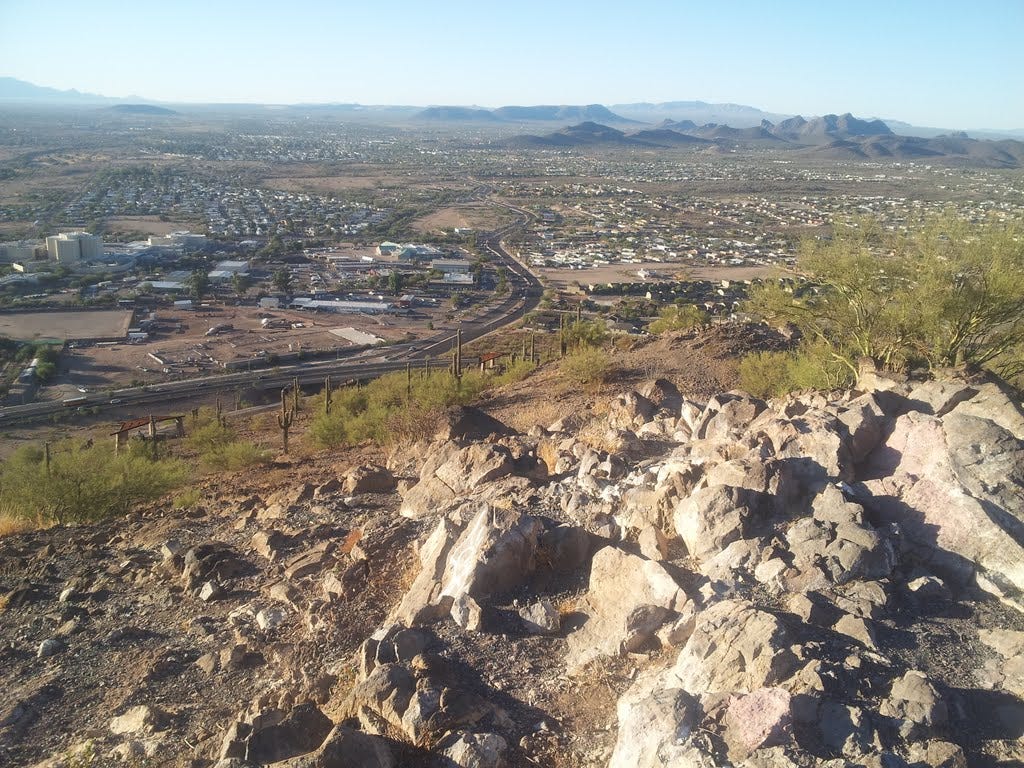
Early the next morning, my brother agreed to a drive up the hill before heading to the airport to catch our flights back east. This time, we made it up and I hopped out of the car at the bottom of the “A” and walked the last 0.3 mile and 100 vertical feet up to the top. Okay, it was a wimpy summit hike, but it was such a gorgeous morning I had to count it. I zipped down the other side to meet my brother and we scurried to the airport.
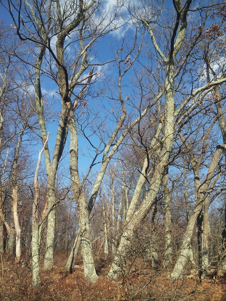
40. Robertson Mountain (VA) - November 9, 2013
This fun little summit is located adjacent to Old Rag Mountain 90 minutes east of DC and has been on the list from the start of my quest for Sixty. I was late getting out of Dodge and arrived at the Old Rag trailhead at 2:00 pm on Saturday. That gave me about three hours to complete a seven-mile loop with a 1,700-foot gain before dark.
As I headed up the access road from the parking lot, it was apparent that masses of people were strutting back to their cars after a glorious day on Old Rag. So I started counting. In the mile from the car to the former trailhead, I passed 151 people. Whoa. My turnoff for Robertson was a mile farther and by the time I reached that junction, I’d passed a total of 334 fellow hikers all headed for the cars. Whoa again. I seemed to be the only one hiking upward. (Speaking of which, www.hikingupward.com is a great website I’ve used many times to come up with destinations and directions for dozens of hikes in the region.)
Once I was on the lonely trail to Robertson, I passed only one solo hiker and a couple coming down from the top, plus a large gaggle of some tired looking Boy Scouts lugging overnight packs. I thanked their leader for flushing the bears off the trail and continued to the craggy, scenic summit.
I hopped around on the highest boulders to be sure of tagging the highest one. I could have hung there for an hour and soaked it all in, but for the lateness of the afternoon. I continued down the other side to a fire road and a junction with another trail leading me along Brokenback Run back to the start. I hit the access road well into dusk.
Of note, on the way in and not far from the parking lot, I had passed a guy under a canopy selling apple cider. On the way out, he was still there, sitting in the dark picking his banjo. I asked if he still had any cider left and he said absolutely. He asked if I wanted it hot or cold. Whoa again. By then the temp had dropped considerably so it was hot cider for me (and the young couple behind me as well), which made for a very pleasant walk in the dark that last half mile or so to the car. I thought about those 334 hikers I’d passed—and 1,000 more I did not pass—and figured the cider-banjo entrepreneur must be doing alright.
41. Kepler Overlook (VA) - November 10, 2013
This was another hike I found at hikingupward.com and it sounded like a good choice for a cool-ish fall day for Kris and I. It took us a couple wrong turns to find the trail, but we eventually got there and suffered a not too interesting ascent to the rockily scenic ridge crest. It wouldn’t take much to improve the trail to the best view point with a nice sitting area and I was tempted to give it a go right then and there. But lacking any tools to flail around with, I conceded it would have to wait for another day.
A quick lunch and a few pics later, we were downward bound, having chalked up another summit for Kenny Boy. Interestingly, the 1,200-foot elevation gain over 3.3 miles to Kepler put me at exactly (more or less) 50,000 feet and very nearly 180 miles. That’s an average of just over 1,200 feet and 4.4 miles per summit. Nothing superhuman about it, but hey, it’s exercise. I’d originally thought I might hit 100,000 feet, but a handful of itty bitty summits with 100 to 300 feet of gain are scrunching my averages. Guess I better lay off those.
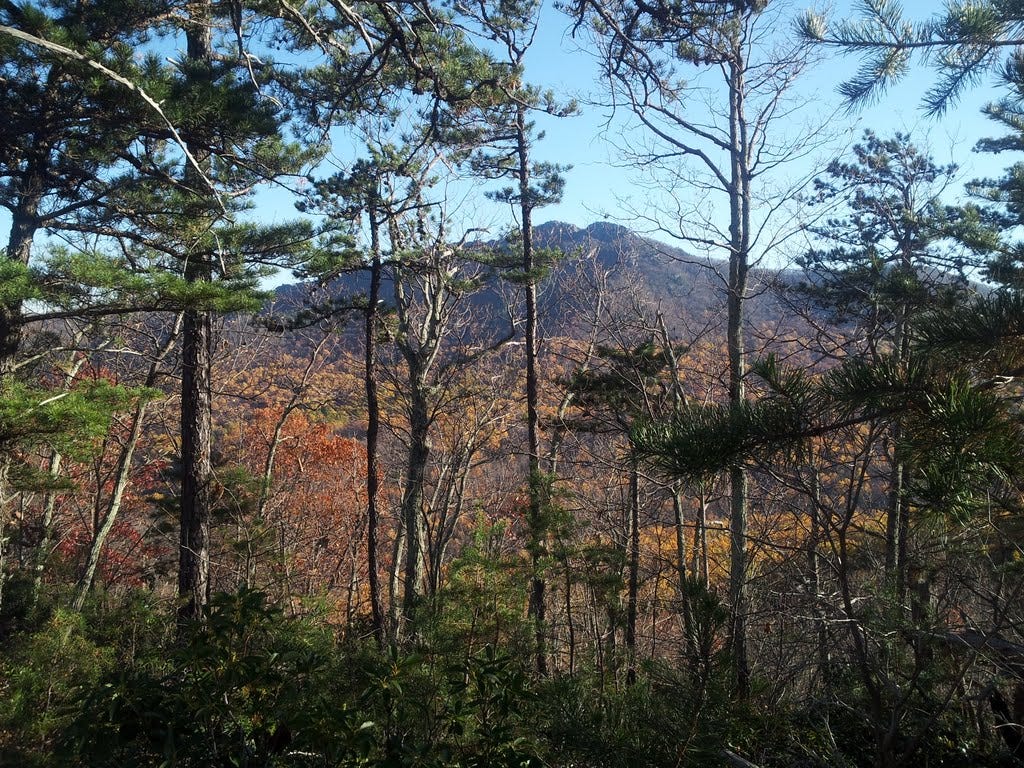
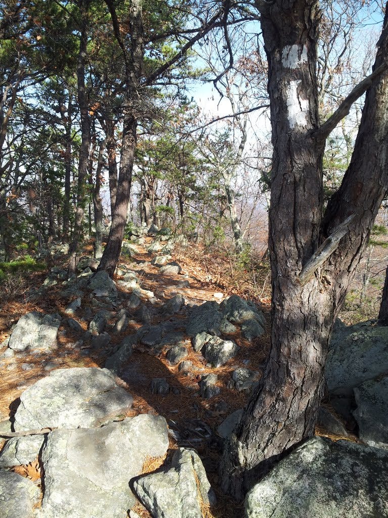
42. Buzzard Rock - November 16, 2013
This easy hike to a very scenic ridge near Shenandoah had eluded me previously because it did not appear to entail a summit. On a second glance, I noticed that the trail, namely the Massanutten Trail, continued along the ridge to and over the highpoint a mile south of Buzzard Rock. So I reckoned that even if the summit was in trees, there would be an excellent view to enjoy both coming and going.
The path lazily climbed to the ridge, steepened briefly, then straddled the jaggy crest with fabulous views from the top of a 100-foot wall of near-vertical rock. I marched on and was soon at the high point, and the views were not half bad after all. I reversed course and stopped on the return to watch a couple of rock climbers ascending the slabby wall. Gotta take Kris up this one, ‘twas quite enjoyable. The tally: six miles total with an elevation gain of 1,400 feet.
43. Kennedy Peak - November 23, 2013
With 18 summits left to scale and less than ten weeks to get ‘er done, I was duly motivated to find myself another twofer—two summits in one day, that is. The weather looked good for a November 23rd outing and my sleuthing led me to Kennedy and Compton Peaks, in and near my old standby for dayhikes, Shenandoah National Park. I might as well get my money’s worth out of that annual pass.
The three-mile hike up Kennedy, west of the park, was easy, pleasant and lonely. I forwent the easier start at a ridge crest parking area and instead launched at the trailhead a mile below in order to enjoy some semblance of a workout. The trail gained 1,300 feet to the crest and rambled along an old jeep road with lots of sun lighting up the hardwoods. My pyramidal objective rose dead ahead.
At about three miles, a final huff upward led to the highest rocks and summit overlook, an elevated platform that presented a mostly unobstructed view. The stairs and handrails were sketchy but the aging deck felt solid enough for a sandwich break. Yup, that’s Virginia alright. I hate to admit it, but these views of the Shenandoah were starting to feel a little too familiar. Halfway back to the car, I passed a handful of hikers and one squirrel. I still had just enough time to zip over to Compton.
44. Compton Peak - November 23, 2013
Entering the park from the north, I needed to continue ten miles south to the trailhead at Compton Gap. Once there, I had an hour and a half of daylight left and a round trip of just 2.4 miles to cover, so no problem. The hike to the summit requires no description, other than to say I gained 800 feet and it was getting rather cold and windy about the time I arrived. That other sandwich would have to wait. Nice view though.
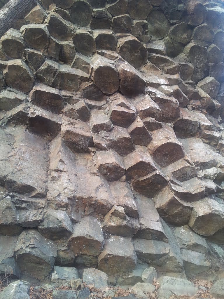
I did manage to make the stair-steppy side-trip down to the oft-touted columnar jointing outcrop of Catoctin lava, an added visual treat and worth the effort. Reportedly, the lava cooled more than a half billion years ago, which is somewhat more than a wee bit on the Gregorian calendar.