

Below is the fourth batch of peaks from my 60 Summits quest in 2013. You can find the previous batch here.
Rough Ridge (NC)
On a road trip down the Blue Ridge Parkway, I woke up on October 5th in a dive motel in Boone, NC (named for Daniel Boone). This quaint, mountain, bluegrass, college town of 15,000 is located about 200 miles southwest of Roanoke and 100 miles northeast of Asheville.
It seemed to be a place worth getting acquainted with, and I spent the previous evening wandering King Street downtown. It was a lively Friday night with quite a number of young musicians, alone or in groups, strumming out bluegrass tunes. The shops and eateries were kinda cute too. I’ll have to drag Kris down here, I thought. The region is also known for some world-class gemstone mining, with several sites offering tourist-friendly options to find your own emerald or ruby in the rough.
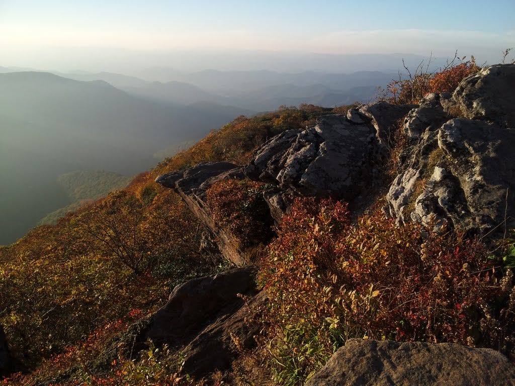
Rising early, I pointed the Toyota to Grandfather Mountain as my main objective for the day. But first, I had in mind a short morning stroll up Rough Ridge next to the Blue Ridge Parkway. I reached the parkway just in time for the sunrise. It was quite the spectacle. I accidentally stopped at the unmarked trailhead for Rough Ridge for a view and noticed the unsigned trail. Some other early birds confirmed this was the place.
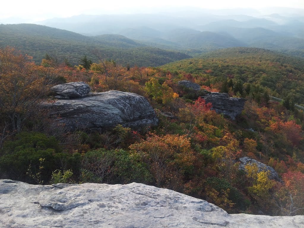
Twenty minutes later, I stood on the slabby “summit” of the Ridge, a minor promontory well below the main ridge system of Grandfather Mountain. The 1.2-mile roundtrip hike gained only a couple hundred feet and did not end at what I would normally think of as a summit, so I decided I’d better not count this as one of the Sixty. That would be lame. I may have to rewrite the rules, however, if I come up short a few months from now. I savored the view from well above 4,000 feet, where fall colors were coming on strong, before making the quick jaunt down.
Grandfather Mountain (NC)
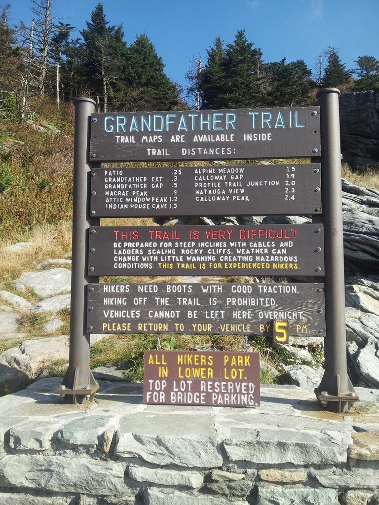
Grandfather Mountain in the Black Mountains northeast of Asheville is unusual in that its primary access is within a privately-owned park and reserve run by the Grandfather Mountain Stewardship Foundation, although a sizable chunk of the mountain is within a new (2008) state park. I was a little dubious about forking over the $18 entrance fee since the higher ground I was interested in appeared to be over-developed.
The drive up was nice enough and a few pullouts offered great views, but I would have preferred a little less pavement at the top. A much lower parking area with a trail heading upward would make a nice improvement. Nevertheless, the trail from the upper lot quickly departs the car zone and provides for a superb hike through Grandfather’s gorgeously rugged high country.
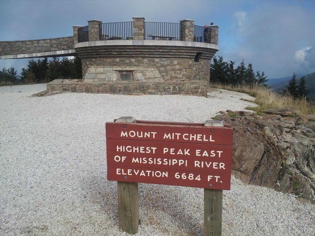
The elderly mountain rises to just shy of 6,000 feet and encompasses a number of named peaks, the highest of which (Calloway) was once thought to be the highest point east of the Mississippi. It turned out that the highest was actually Mount Mitchell (6,684 feet), also in the Black Mountains, but well to the south. That makes the Blacks the highest mountain range in the eastern U.S.—certainly an area not to be missed by this mission-driven peakbagger.
I was parked and on the trail by 9:30 am on October 5th. Six hours later, I was back in the car zone, having summited four peaks along the ridge: Linville, MacRae, Attic Window and Calloway. Linville we can debate—It was way too easy to go on bragging about. Attic Window (who names a peak Attic Window anyway?) was pretty much a stroll too. But it’s October and I’ll take what I can get.
28. Linville Peak - October 5, 2013
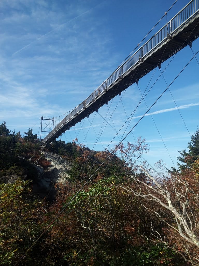
From the Grandfather Mountain parking lot, a 0.4-mile trail leads upward 300 feet to the famed “Swinging Bridge,” which happens to be one of the major draws for people headed to the mountain. The impressive 228-foot long footbridge spans a rocky gulch and connects the upper paved-over zone to the rocky top of Linville Peak. I scooted over and shuffled up to the high point. The old bridge was rebuilt in 1999 and was designed to be more stout, so it doesn’t swing so much any more. It’s something to marvel at just the same. And it wiggles. A marker in the middle notes the elevation—5,280 feet—a vertical mile above sea level.
29. MacRae Peak - October 5, 2013
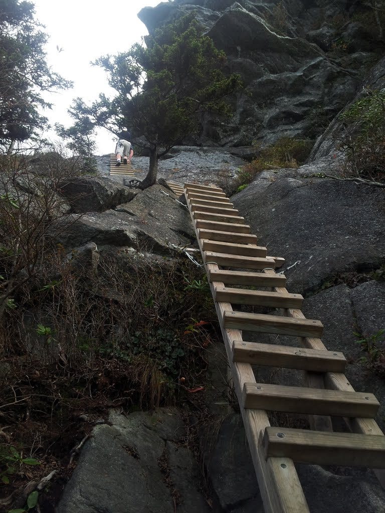
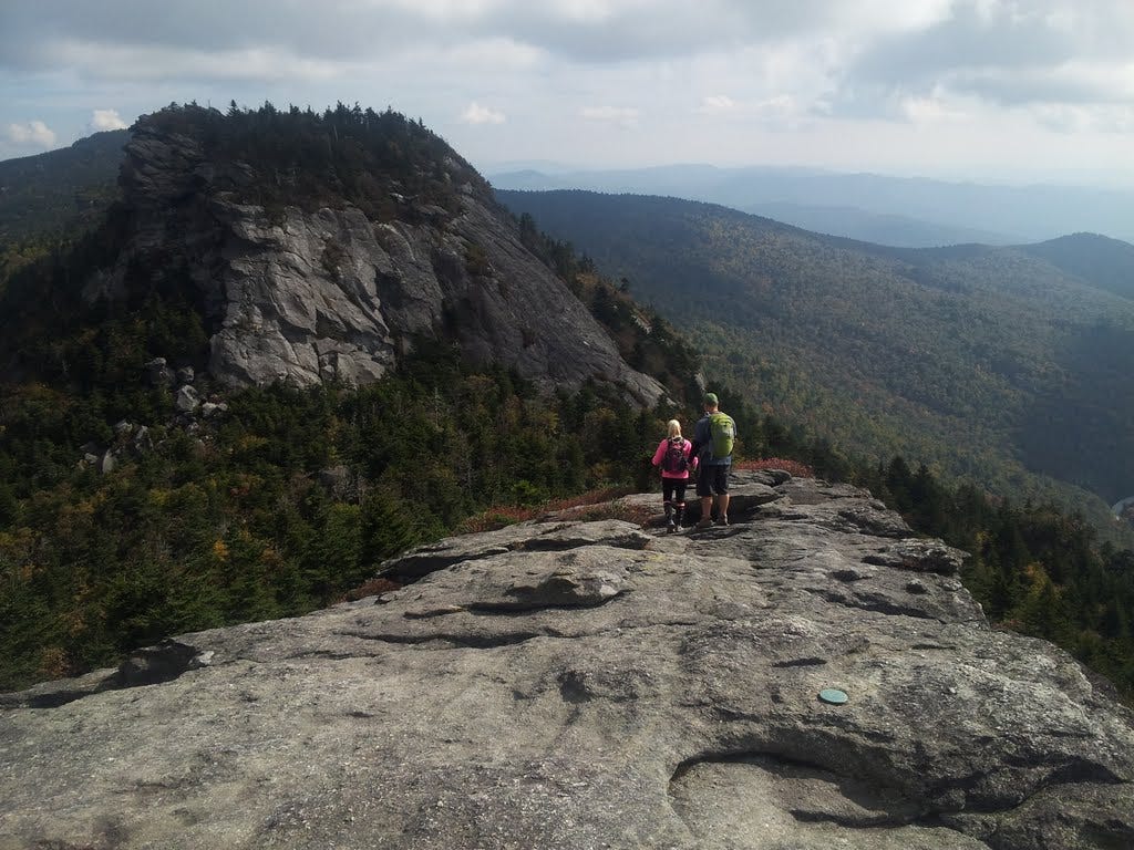
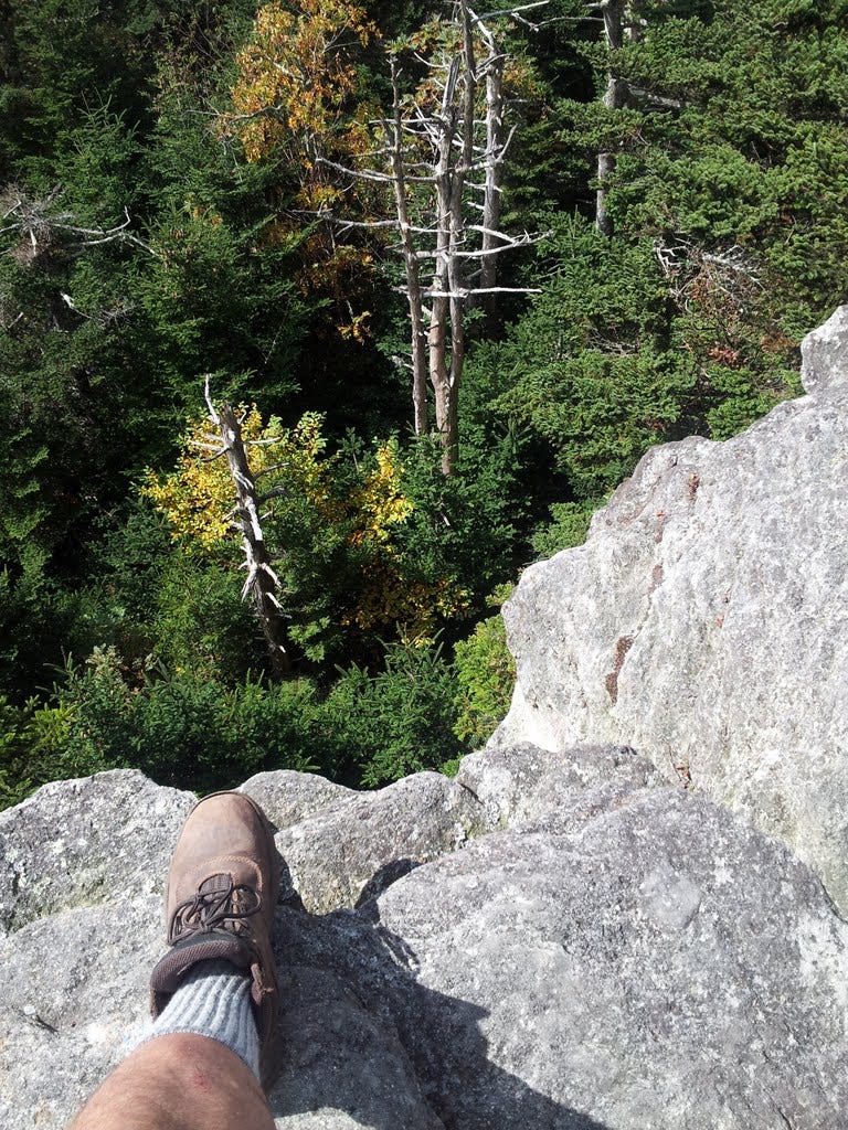
MacRae would prove to be the most enjoyable summit of the day. Leaving the parking lot opposite the Swinging Bridge, one immediately begins to climb steeply on rough, rocky ground to a wooded nubbin, then down slightly to a saddle before the real fun begins—ropes, cables and beefy ladders leading up slabs and cliffs to more fun stuff above. I met Pete, a devout hiker dude from Florida taking photos with a digital SLR, which made me wonder about relying on my smartphone so much to record my adventures. It turned out we had much in common and hiked in tandem the rest of the day.
After a little more up, you finally see two hefty blocks ahead with little people perched on top. A final 20-foot ladder to another cable makes the insurmountable summit, well, surmountable. If you enjoy easy scrambling and your acrophobia is in check, MacRae is a totally entertaining “hike.”
Kudos to those who laid out the route and have kept it maintained for public access all these years. Not for the faint-hearted, of course. But for my climbing friends and for most experienced hikers, it’s a walk in the park. At least when it’s sunny and nice out. I don’t think I’d want to be up there in rainy or icy weather.
30. Attic Window Peak - October 5, 2013
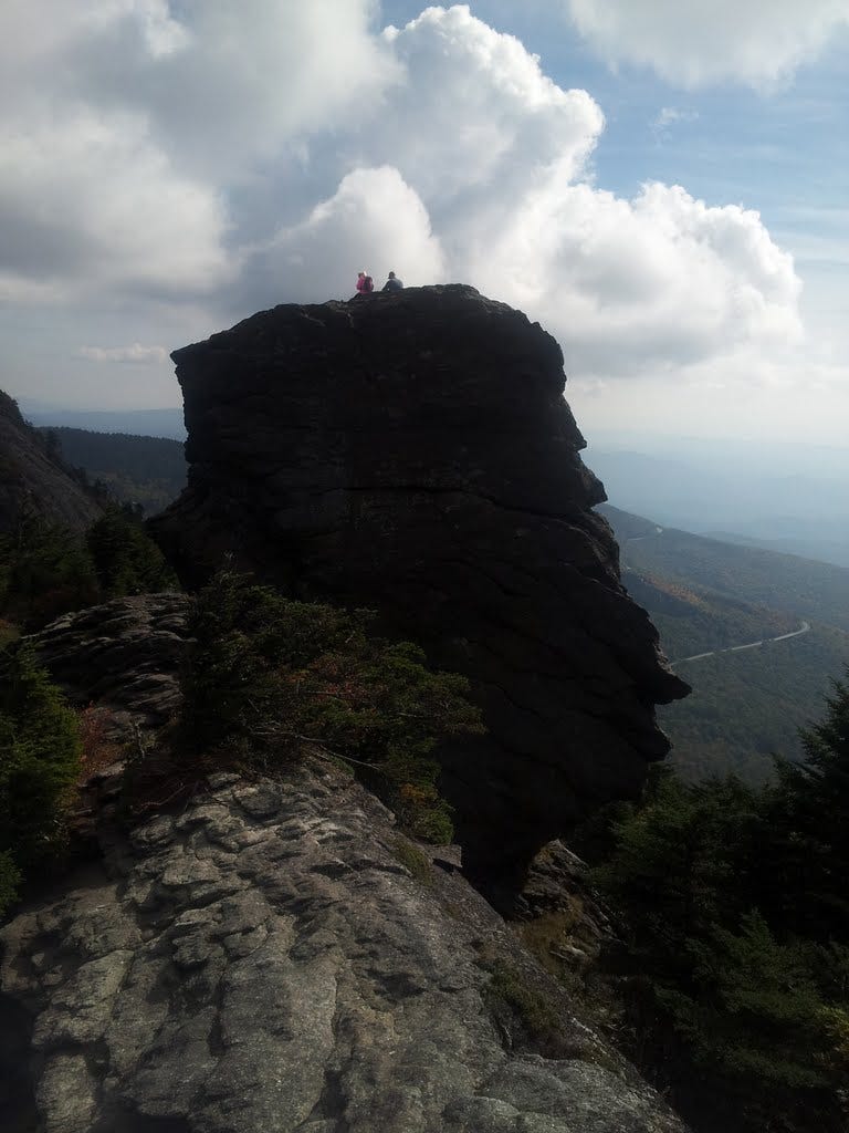
Attic Window is really just the next bump on the ridge on the way out to Calloway, Grandfather’s official high point. The trail getting there continues through more rugged terrain, around and over big outcrops with gorgeous views, through a tunnel between boulders and up a steep rock gully. At the top, we paused for another 360 view, collected some pics and moved on. I wasn’t counting at the time, but Attic Window would mark the half-way point in my Sixty Summits adventure.
31. Calloway Peak - October 5, 2013
Just past Attic Window, at a point where the trail runs along the edge of a precipice, we passed a young, barefoot fellow who said he’d been on the trail many times before and wanted to experience things a little differently this time—so he skipped his boots. He looked like his feet were on fire, but kept his chin up just the same.
From there Calloway looked like it was 40 minutes away, though the signs suggested it was not even a mile. We were on top in half the time. I lingered to enjoy a quick lunch and another stunning view, though not quite as dramatic as MacRae’s. My new pal, Pete, and I agreed we should plot a hike together in the near future, and bring the wives as well, both of whom also enjoy getting out on the trail.
All in all, Grandfather Mountain gave me no regrets about that $18 entry fee. And I got to bag four glorious summits while hardly breaking a sweat. By the way, there is a back way in via the state park, for those who might prefer that option, though it’s not nearly as convenient.
On the way down the mountain, I stopped at the Habitat area, a veritable zoo perched on the mountainside where visitors can view black bears, mountain lions, bald eagles and otters at close range, animals that were injured or otherwise unable to survive on their own in the wild.
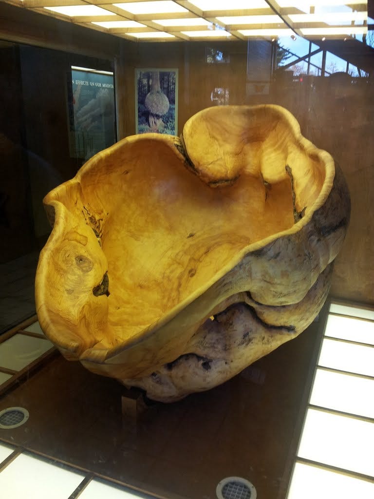
The museum next door is also nicely done and displays the largest amethyst crystal ever mined in North America, and what’s got to be the largest wooden bowl carved from a burl. The dern thing is six feet across. The ice cream and fudge were also excellent. You come away feeling like the people who run Grandfather Mountain are pretty dedicated to the place. It’s a lot to look after and they seem to do a stellar job of it.
32. Craggy Pinnacle (NC) - October 5, 2013
After leaving Grandfather Mountain, I’d hoped to find a campsite on the way south along the Blue Ridge Parkway. But no luck. I passed a trailhead to Craggy Pinnacle just before sunset and stopped to bag one more summit for the day.
This one was even easier than Rough Ridge, but it was an actual named summit, though not very craggy and definitely no pinnacle. To be sure, I consulted Section 2.E(z) of my Sixty Summits rule book and determined that a special exemption applied and thereby took credit for the summit. I wandered up, soaked in the sunset views with about 20 other folks and shuffled back down. Check.
33. Mount Mitchell (NC) - October 6, 2013
I somehow ended up in another dive motel in Asheville on the night of October 5th. It was too late to do the town and I’d eaten so many bagels and whatnot, I decided to turn in early and scoot out the door at dawn. Everyone tells me Asheville is a nice place. I’ll have to return and find out.
The day’s menu, however, called for an easy jaunt up to the highest summit east of the Mississippi—Mount Mitchell in the Black Mountains. The second highest, Mount Craig, is just up the ridge, and a third, Big Tom, was only a tad farther. Mitchell was named for Dr. Elisha Mitchell, a North Carolina botanist, who in the 1840s determined that the peak was the highest in the range. He estimated the height at 6,672 feet, missing the true elevation (6,684) by only twelve feet. While exploring the area in 1857, his life abruptly ended in a tragic fall at a waterfall. His friends buried him on the summit.
Though already aloft in mile-high country, the Blue Ridge Parkway intercepts the scenic road to Mitchell, which climbs a good deal more in a handful of miles into the state park. I seemed to be the first car in the parking lot when I checked in at the ranger station to grab a trail map.
From there, I followed the Old Mount Mitchell Trail that preceded today’s modern two-lane highway to the top. It was a good stroll, two miles with about 500 feet of gain. Along the way, the trail skirts another wooded summit, but the scrub forest there was as dense and impenetrable as a hairbrush. I skipped the prospect of an extra summit. I’m not sure I could have found it anyway with the limited visibility. The trail meandered in woods a bit before breaking out at a park restaurant, where I stopped for a cup of joe, then deftly carried it with me up the trail, careful to sip and not trip.
The woodsy trail met a paved walkway near the upper parking lot that took me the final 200 feet to the big overlook above. The peak was only lightly peopled with morning visitors. Views were far and wide and magnanimous, as one might expect. There was definitely a feeling of being up pretty doggone high, though it wasn’t quite the Rockies. Even the Great Smokies sprawl across a larger area than these here Blacks, but the Blacks are higher. It was fun to contemplate the world, which for a thousand miles in every direction, was lower than me.
34. Mount Craig - October 6, 2013
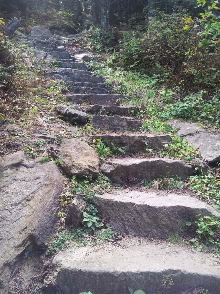
I skipped off Mount Mitchell, skirted the parking lot on a nature trail, and enjoyed a very pleasant hike on a good path to Mount Craig. There must have been over 200 stone steps leading down (mostly), then up to the second-highest peak in the eastern U.S., which at 6,648 feet is just a few feet shorter than Mitch. A survey monument marked the tallest rock. Another great view was had from this mountain named for a visionary governor, Locke Craig, who was instrumental in securing the area as a state park in 1915.
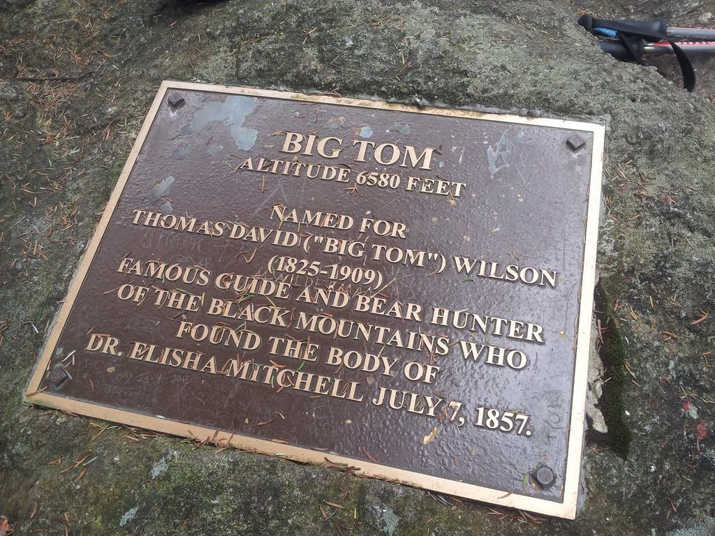
35. Big Tom - October 6, 2013
A final short trek along the ridge led to a wooded bump and another marker for Big Tom (6,581 feet). Tom is apparently the fellow who found Mitchell’s body where he had apparently slipped over a waterfall. No view this time, but I’d bagged three new summits for the day. Thirty-five down, twenty-five to go.
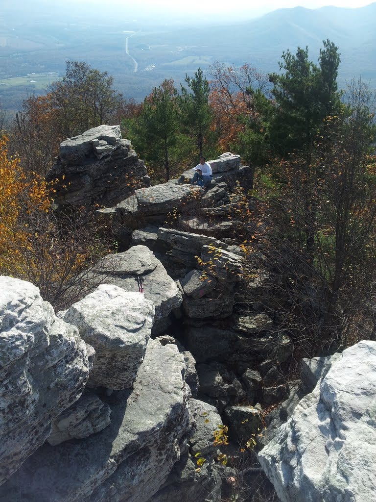
36. Strickler Knob (VA) - October 27, 2013
Following a mid-October tour of western New York state (Corning to Niagara Falls to Syracuse), Kris and I joined the Center Hiking Club on October 27 for a moderate jaunt to a highly rated vista atop Massanutten Mountain. Massanutten, just west of Shenandoah National Park, is one of countless linear ridge systems forming the mid-Atlantic portion of the Appalachians. Many of the high points are rocky crags and sometimes the ridge crest itself is exposed rock offering views across the adjoining valleys. Strickler had both.
Access has become easier in recent years thanks to the efforts of volunteer trail builders. One of the write-ups online warned of rattlesnakes warming themselves on the rocks. I noticed our experienced hike leader bounding up the ridge in shorts, unconcerned, which suggested that those who’ve hiked these hills for many years remain unfazed by the threat.
Fall colors enhanced the walk-in-the-woods portion of the hike and the scenic ridge gave a nice finish. The top was a craggy jumble of giant boulders that we scaled for more views and a quick lunch. While there were bound to be snakes lurking in the rocks, none came out to greet us.
Find the next batch of 2013 summits here.