

Part 1 of this story is here.
After a week of tramping across new ground at Capitol Reef and Paria Narrows in sunny Southern Utah, it was time to move on to Northern Arizona for the main event: a five-day excursion into, and hopefully out of, the gaping void known as the Grand Canyon. I looked forward to both the glory of the canyon and a somewhat arduous hike, even moreso if the weather turned hot as is often the case by the middle of May.
My highly focused training regimen consisted of eyeballing the map and tossing a bunch of backpacker stuff in the car. And there was the single backpack I’d done this season, that one-nighter in and out of Paria, less than 20 miles total and pretty much flat as a turnpike. I also had two rest days to make the most of. The hiking had done me some good, though. A nagging lower backache that had me slightly hunched over for weeks had magically gone away.
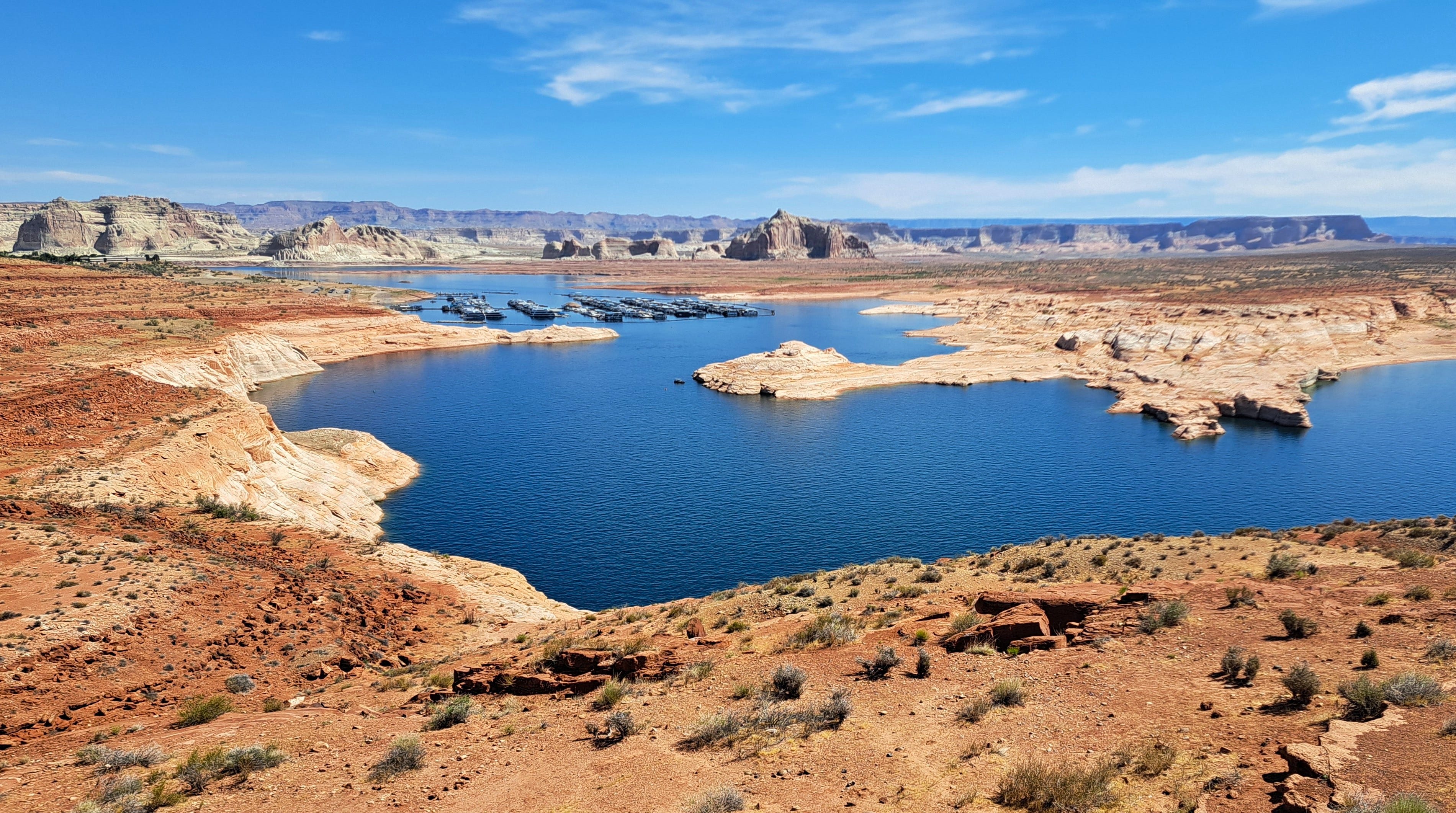
Back on the road, I paused at Lake Powell for a look at the sorry reservoir and Colorado River below the dam. Driving down to the boat launch only heightened the dreariness of the omphalos. (Sorry, found a new word I’ve never used before.) At the dam, a nice guy at the info desk offered useful tips for a future kayaking trip I’d like to do. I continued into Page, a town built for the dam, to stock up, re-ice and visit the post office. Kris had mailed me a book special delivery, but alas, it hadn’t arrived.
The day’s destination was the Desert View Campground at the east end of Grand Canyon National Park. The volunteer campground host, Kent, dropped by to check me in. We chatted, shared a couple of stories. He insisted that I holler if I needed anything. He had to be one of the most hospitable hosts I’ve ever met. In any case, I pitched my tent and headed for Grand Canyon Village to pick up my backcountry permit.
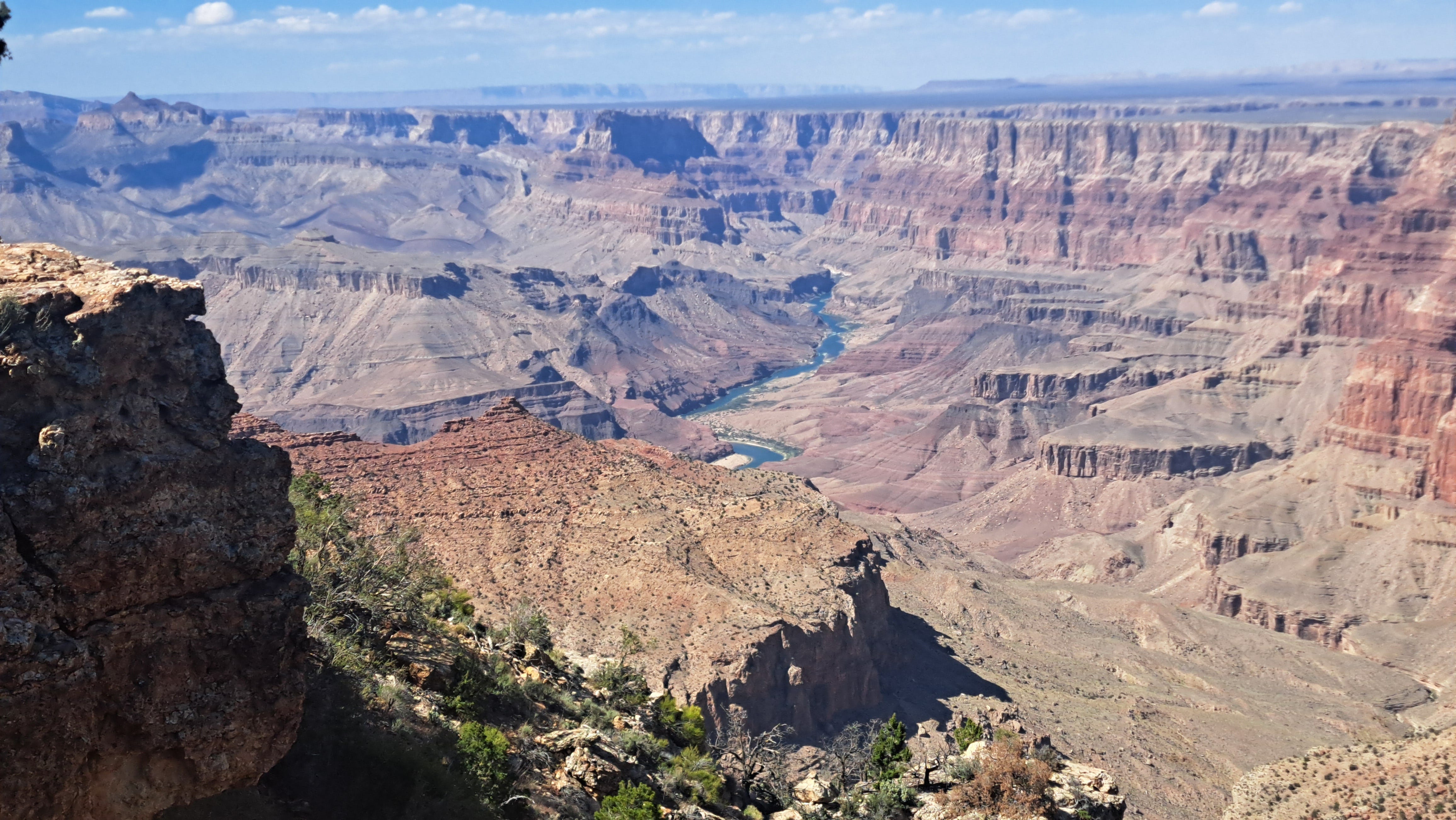
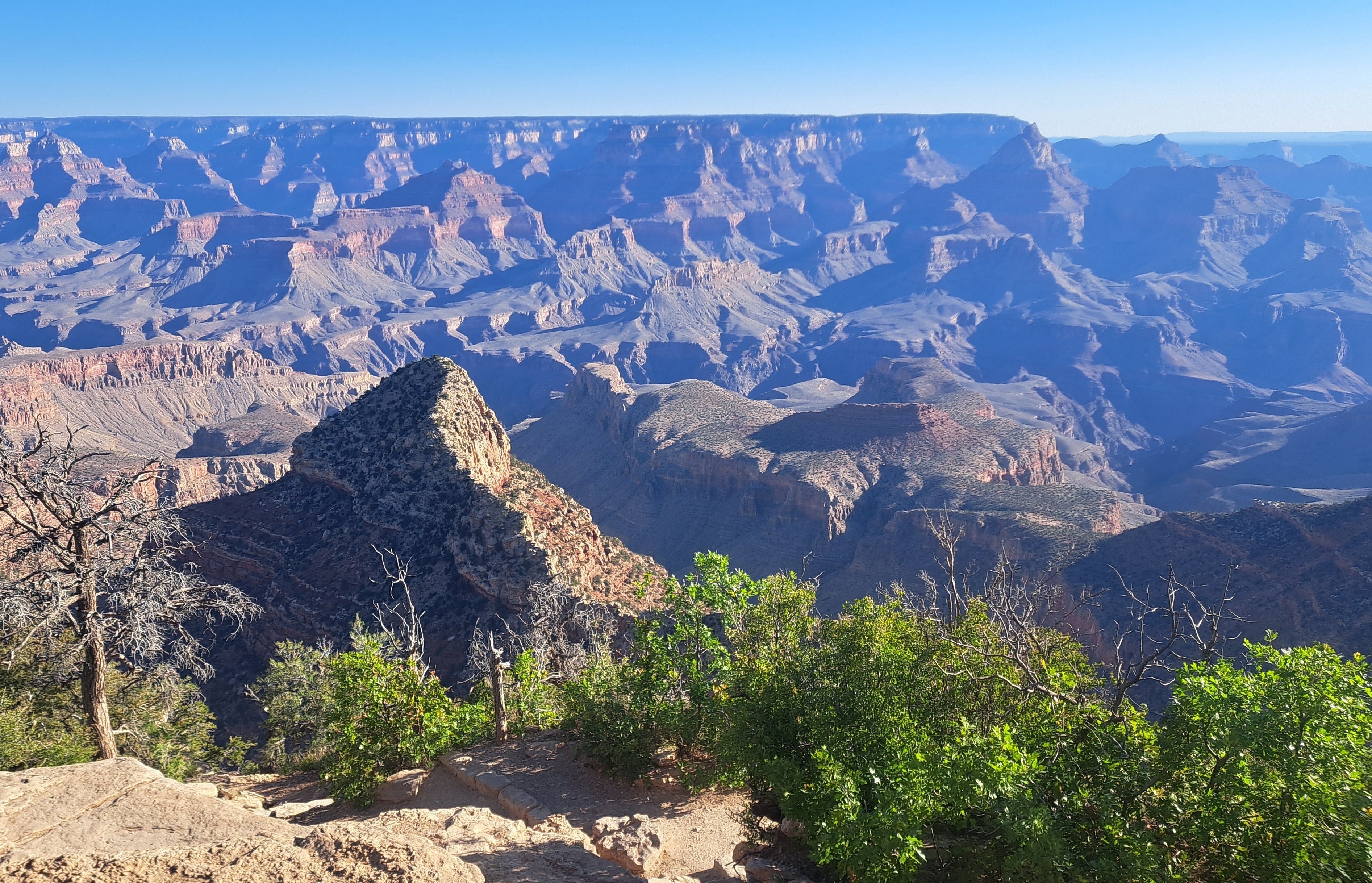
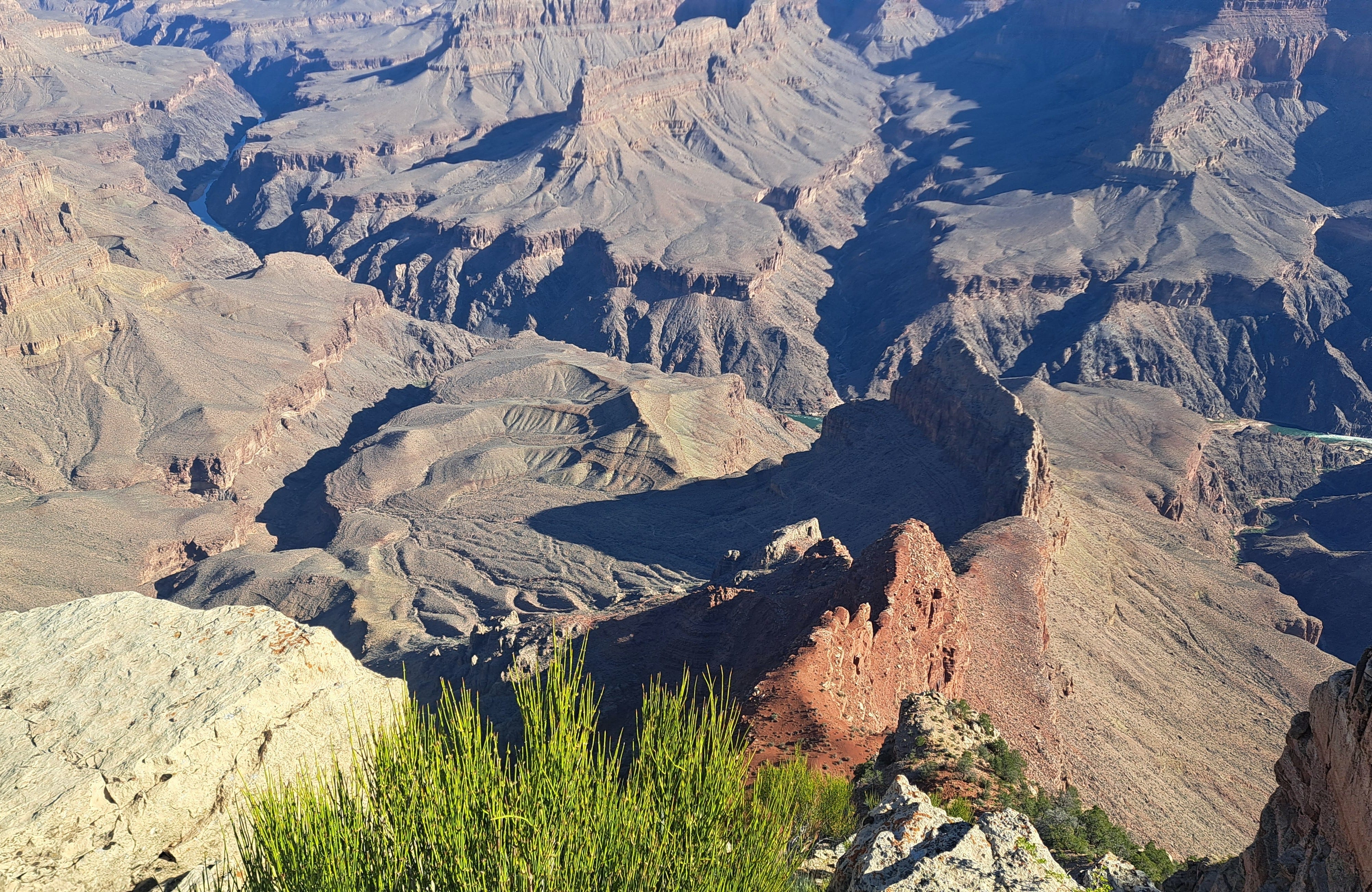
I stopped at a couple of overlooks to take in the grandeur, trying but failing to remember the last time I was there. A dozen years? Twenty years? From Grandview, I looked down at Horseshoe Mesa, clearly recalling two trips there in the 1980s and 1990s. The first an overnight backpack with my little brother, Dean, highlighted by a rattlesnake who slithered by for a visit one evening. The second just a solo day hike down and back. Both hikes were especially memorable for running out of water in 100-plus-degree weather.
As I rolled in for a glance at the Village, I hardly recognized the place. It’d been too many years and a lot had changed. It was a more sprawling place than I remembered. Excited to be here nonetheless. Besides a permit, I desperately needed a shower, but when I found the facility, it was closed for cleaning. Come back in an hour, they said.
The logical next move was to find the visitor center for a weather forecast and a look around. I walked up to the door just after 4:00 pm. But it was already closed! Who closes a visitor center at 4:00 in one of the most heavily visited national parks in the U.S., while crowds of visitors are milling around, walking up to the building and frowning at the closed sign? (When I checked the park’s website later, different pages showed different hours, ranging from 4:00 or 5:00 pm to 8:00 or 9:00 pm, the latter seeming to refer to the summer months.)
I checked out the Grand Canyon Conservancy gift shop across the plaza, open till 7:00 pm! When I strolled past a bookshelf, Kevin Fedarko’s, A Walk in the Park, nearly jumped off the shelf and into my hands. My river-rafting buddy, Mitch, had highly recommended the book some months before, along with Fedarko’s earlier work, The Emerald Mile. The latter is the gripping story of a record-setting run down the Colorado River during a major flood.
A Walk in the Park details an epic traverse of the entire canyon from end to end, a trek spanning hundreds of miles, the vast majority of it off-trail in very difficult terrain. It sounded like a perfect Canyon read. But do I further burden myself, in addition to five days’ provisions and a gallon or more of water, with a 400-page tome on my back? It was only available in hardcover, so I shrugged and walked away. Then I turned right around, tested the weight in one hand, and bought it. I’d planned to carry my spiffy camp chair as well, so what better way to pass the broiling hours of the day deep in the canyon than sitting comfortably in 90-degree shade reading a Fedarko.
I’d presumed the permit office would be somewhere in the vicinity of the visitor center, which was not the case. Instead, it was tucked away out of sight and took a bit of navigating to find. Once I arrived, it had just closed. So it goes. Back at Shower Central, they were open now, but there were more than a dozen guys with towels sitting around outside waiting for one of stalls to open. So much for that.
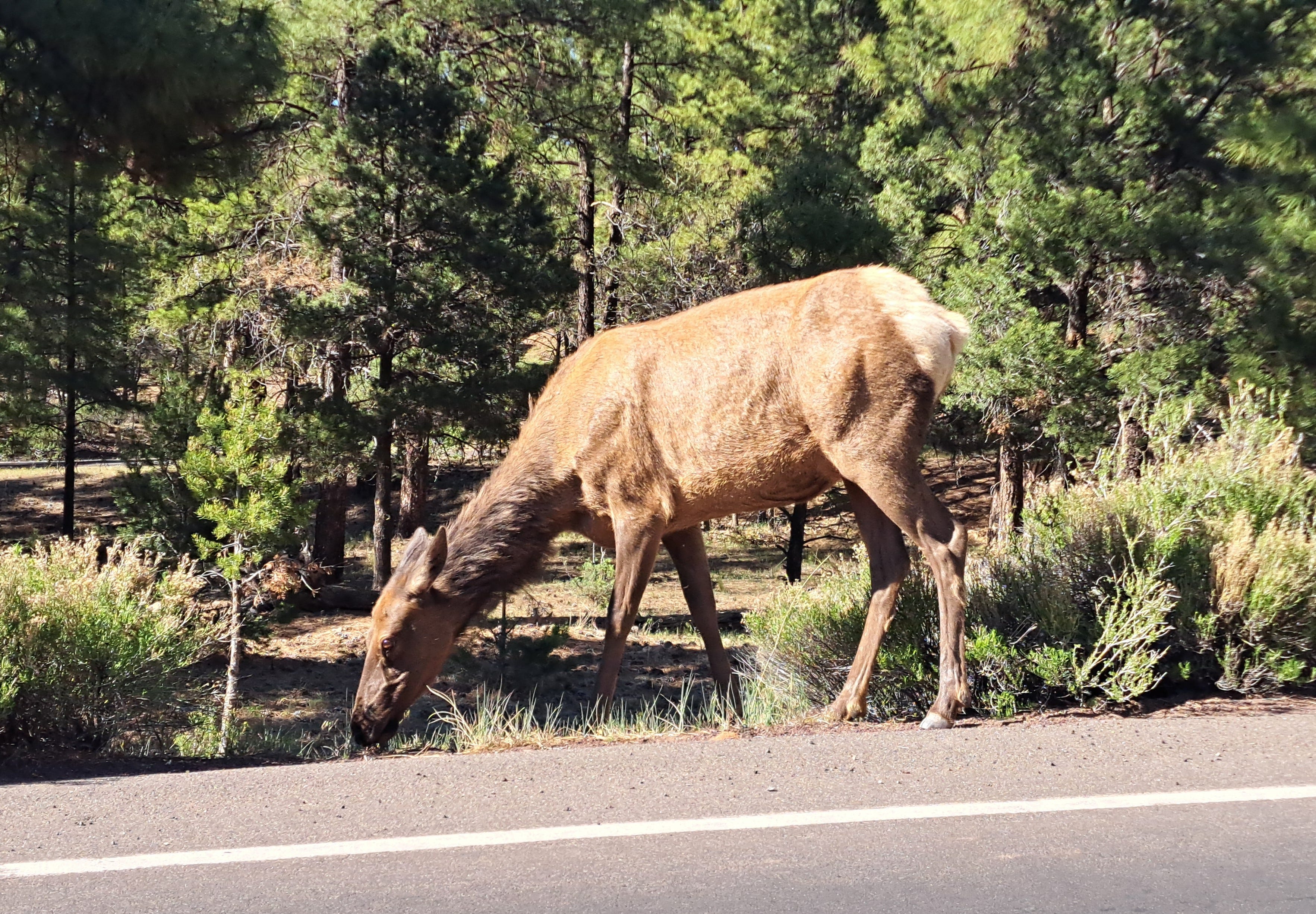
I drove back to my campsite, dodging dozens of fearless elk grazing along the roads, or standing proudly in the middle thereof. Nearing sunset, I sat in my camp chair to read a few introductory pages of Fedarko while the light was good. I still had a full day left to organize the mess in the back of the car and to pick up my permit, and just maybe get a shower. I’d gone nearly a week without.
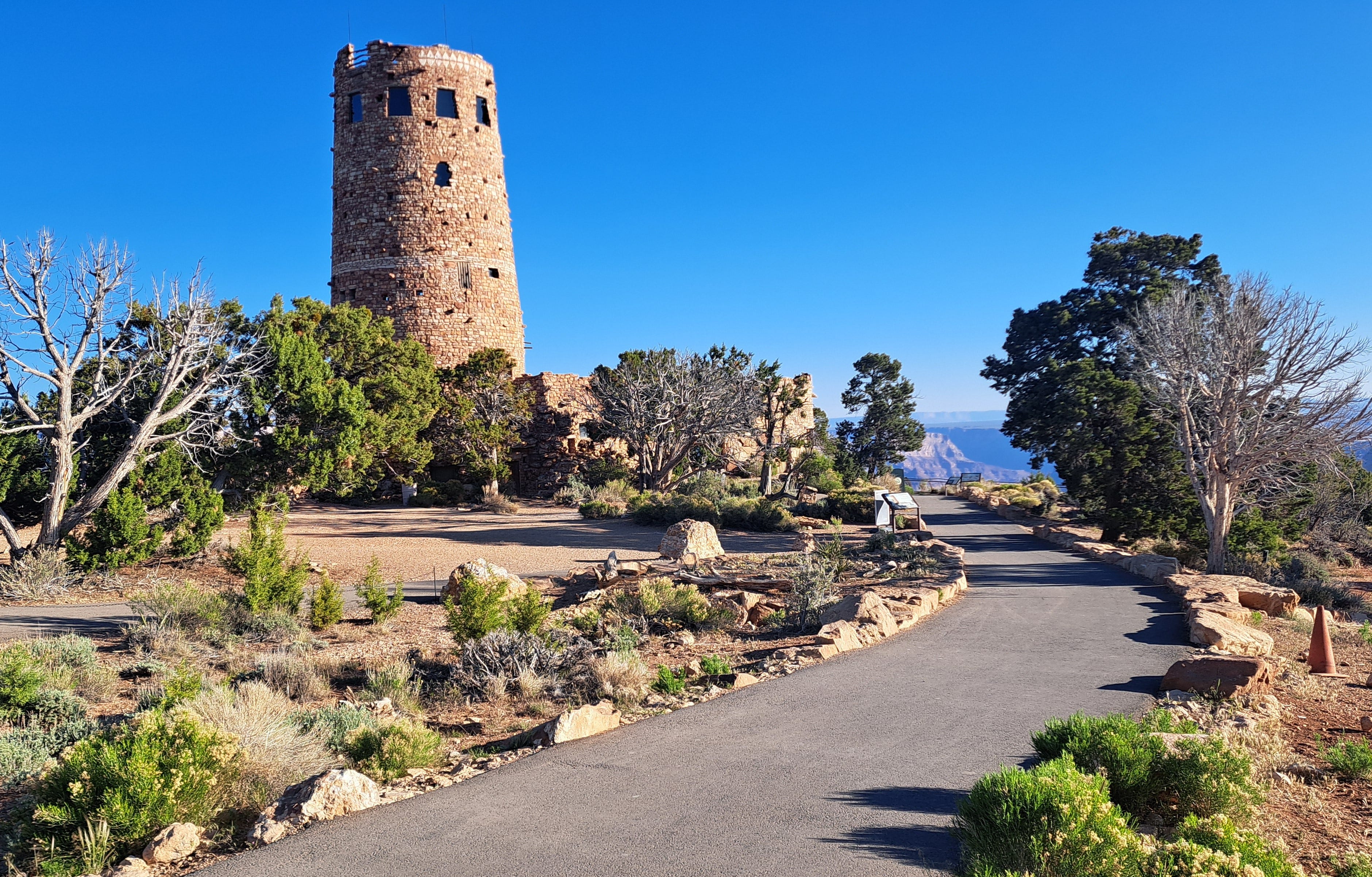
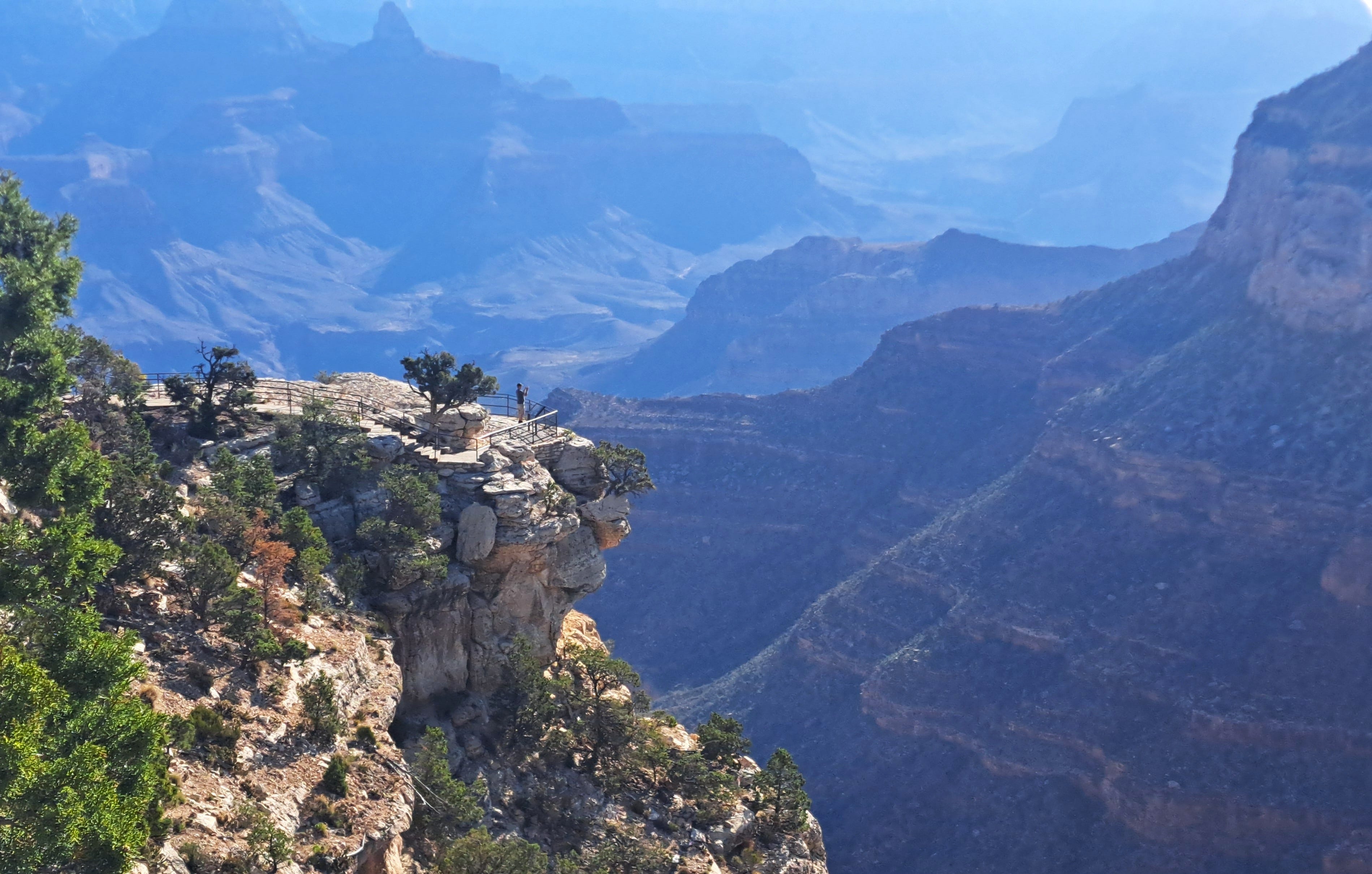
Departing early, I stopped at the Desert View overlook ahead of the crowds. The famed Watchtower was brightly lit, nicely complementing the wider vista of the canyon. Designed in the 1930s by Mary Colter, one of the more prominent American architects of her time, the 70-foot tower was inspired by Native American construction techniques, while also utilizing local materials. Her legendary work and influence extends to both rims of the canyon, in the lodges and at Hermit’s Rest, the trailhead I would soon be off to.
First things first. I got my shower. Hallelujah. Next stop: the permit palace. When I asked about possibly changing my itinerary to spend the first two nights at the same camp on Hermit Creek, the nice woman there made it happen without a fuss. Then she suggested a more logical last night at Havasupai Gardens (formerly Indian Gardens) which wasn’t available when I originally booked the trip months earlier. She made it all work and handed over the permit, along with a metal mesh food bag designed to keep the mice and squirrels from pilfering my precious vittles.
“Eat a lot of salt,” she said. “Potato chips.”
“I have salami and salted peanuts,” I replied.
“Potato chips are better. They metabolize faster.”
“Okay, potato chips.”
As I headed out the door, I heard her voice once more, “Potato chips!”
A week’s weather forecast was posted outside, one each for the South Rim and Phantom Ranch. For the latter, it said sunny and hot, just over 100 F., with a slight chance of a thundershower by Friday, though partly sunny at the rim. I was hiking out on Thursday, so I’d skip the fly for my tent, which would save me the equivalent of about a half chapter of Fedarko.
I drove around half lost, till I found the market to grab a few last minute items, including of course, a $6 bag of BBQ potato chips. I’d eaten half my salami already, so I grabbed another, along with a half-pound brick of extra sharp cheese and a handful of snack bars with the word “salted” in the name.
I took some time to rearrange the disaster inside the car, separating the stuff that goes from the stuff that stays. I bagged and boxed the latter and stuffed the former into my backpack to help reduce the clutter. I’d do a more orderly repack at camp. The trash was trashed and the recyclables recyclabled. And it still looked like a mess.
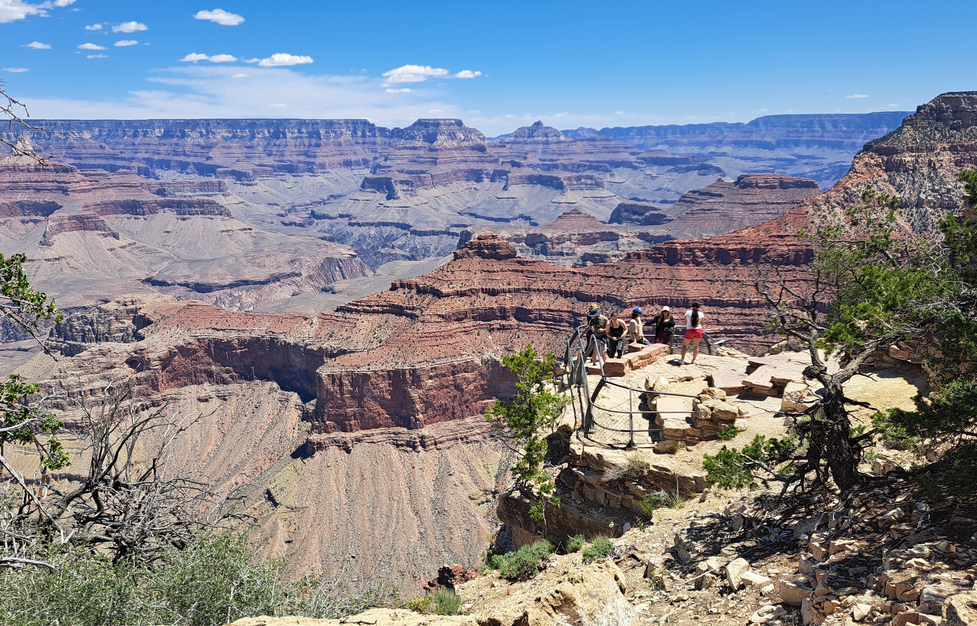
Returning to the rim, the one thing that hadn’t changed was the stunning spectacle of the Canyon. I ambled along the busy rim trail, gazing into the abyss, recalling other hikes I’d done in the past, including my last overnighter, a four-day tramp with Kris in 2006, 20 years ago almost to the day. We’d hiked down the South Kaibab Trail to the river, encountering a rattlesnake along the way. We camped in the heat near Phantom Ranch and hiked out in one push on the fourth day.
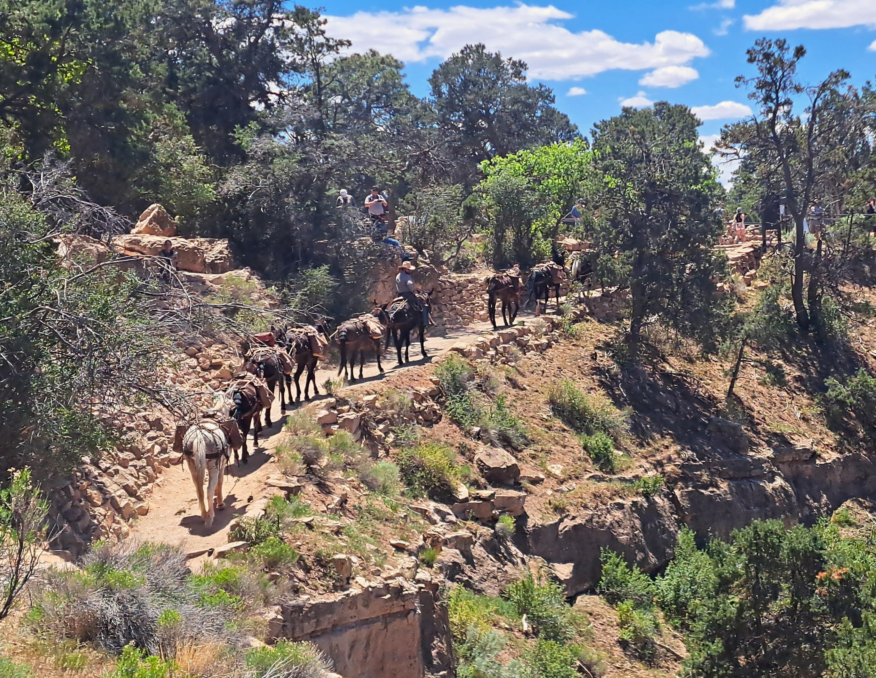
Prior to that was a family reunion camp-out back in the 1990s. Based at a group site at Mather Campground, our gaggle of nieces, nephews, siblings and I marched along this same path at the rim, making up stories about mules. And just now, while I stood near the top of the Bright Angel Trail, a team of mules made their way up the trail’s final switchbacks.
I also thought about my first big hike in the canyon, memories that were rekindled by my plan for the next five days. About 35 years ago, Janet, Ken and I descended from the South Rim via the primitive, sometimes non-existent, Boucher Trail, named for the hermit-guide-trailbuilder-prospector, Louis Boucher. One source suggested he was born in Quebec in 1840 and may have joined the Fraser Gold Rush of 1858. Thus he feasibly could have passed through my hometown of Bellingham, a major departure point for Fraser gold at the time. Perhaps more likely, he trickled down from farther north in Canada. The lure of the Fraser was short-lived, however. By the late 1800s, Boucher had moved on to Arizona, where he is now memorialized in the names of two perennial streams and two major rapids on the Colorado River, as well as Mary Colter’s rustic wayside at Hermit’s Rest.
The three of us stumbled our way down to a camp at the creek crossing, spending the next several days working our way east along the Tonto Trail and descending side canyons to the river and the rapids to watch the boaters go by. We crawled along the Tonto Trail in the heat to Monument Creek and down again to Granite Rapids, before finally retrieving the gumption to ascend the Hermit Trail back to the rim.
Janet had put together a perfect trip for us. She knew the canyon well, both as a history buff and river rat who had boated through the canyon, and as an avid maps geek in charge of the map library at Western Washington University in Bellingham. She planned and led it all, while the two Kens simply tagged along. En route, we were duly edumacated on the layers of history that can be read in the rocks: Kaibab, Toroweap, Coconino, Hermit, Supai, Redwall, Muav, Bright Angel, Tapeats, and the Vishnu Schist, the bedrock beneath it all. To remember the order, we learned the mnemonic phrase: Know The Canyon’s History, Study Rocks Made By Time (Very Slowly).
A few years later, during that hike with my brother, we survived 105 F. temperatures with no water for miles. We’d hiked down via Horseshoe Mesa, and ambled west on the Tonto, finally finding a horrible brown mess of a puddle. We poured the muck through a bandana and treated it with iodine tablets to save our souls. The rattlesnake prowling around in the dark added a special flare, being that we were sleeping on the ground without a tent. Rattle-rattle.
Later, I day-hiked down to the Mesa on my own, again in 100-degree May heat, this time carrying three liters of water. Plenty, right? Wrong. Halfway back up to the rim I was all out and dragging my parched self up the final 1,000 feet of switchbacks. Two older women saw me sitting in the shade and somehow knew I was out of water. They gave me a pint of theirs which might have saved my butt, although I think I was still coherent enough to stay put in the shade till the late afternoon cooled a bit. In any case, toward sunset I reached my one-gallon stash in the car and all was well.
Lesson learned. I was more careful with water when Kris and I backpacked down the South Kaibab Trail to Phantom Ranch. For my current adventure, I calculated how much water truly was “plenty” and carried it and more. No skimping this time.
For the past year or so, I’ve had this lingering urge to revisit the Hermit and/or Boucher Trails, as well as the Tonto and the rapids, while the knees are still mostly functional. Being solo, my preferred descent would be the Hermit to avoid some steeper rockslides and brush on the much lonelier Boucher. I figured I’d loiter for a day or two and hike back up. Say, four or five days’ worth of trudging and moaning in warmish spring weather, ideally late April or early May.
But early in the year, the only permit I could snag was for Boucher in the second week of May, which is cutting it close to when tolerably warm becomes blazingly hot in the belly of the chasm. Regardless, Boucher it is. I’d go in May 11th, come out May 14th. I booked a second night at Hermit Rapids and a third along the Tonto, leaving myself a very long final day to climb back out. It worried my knees some when I told them where we were going.
As the weeks passed and the departure date neared, I checked the website again (for the umpteenth time) and suddenly there was a night available at Hermit Creek on May 10th! With the ranger’s help, I could now descend the somewhat less hazardous Hermit Trail and continue the itinerary from there.
When I walked in to get my permit, the very helpful potato chip lady did some checking. I could now stay two nights at Hermit Creek and avoid the extra carry to the rapids and the trek over to Boucher! That sounded much more civilized and closer to what I originally had in mind. Two luxurious nights in one camp, instead of packing and repacking and lugging a heavy pack all five days.
I rose early the next morning, loaded the car, refilled the water jugs, and drove to another overlook where I commenced a more orderly stuffing of the backpack: light and fluffy down low, heavier in the midsection and close to the back, medium up high. Okay, good. Now where does all this water go?
The permit came with a gate code to get you out to Hermit’s Rest, on a road normally accessible by shuttle bus only. I was an hour ahead of the first shuttle so it was kinda fun to have the whole road to myself. I stopped for pics here and there, especially where I could get a look down to where I’d be trekkin’ over the next few days. I found a spot with a weak cell signal and was able to check in with Kris before heading off to oblivion.
By the first bend I knew why I was so drawn to this place. Not just due to the sublime views from the trail, but from the trail itself. Having planned and designed trails for a living and having built a few and walked a ton, I’m always impressed by the hard work and imagination that’s been invested in the best of them. Hermit Trail is right up there on the list, although it’s not quite the showpiece it was a century ago.
Strangely enough, it was built by the Atchison, Topeka and Santa Fe Railway around 1910, along with a tramway and a tourist camp with a phone and showers far below. I vaguely recall seeing some of the artifacts on that hike with Janet. Perhaps most impressive were the immovable slabs of rock sandwiched together like upturned cobblestones. It would have been quite laborious, but lasting work and pretty comfortable to walk on. Little of that old tread survives, but enough to appreciate the quality of the work that went into it.
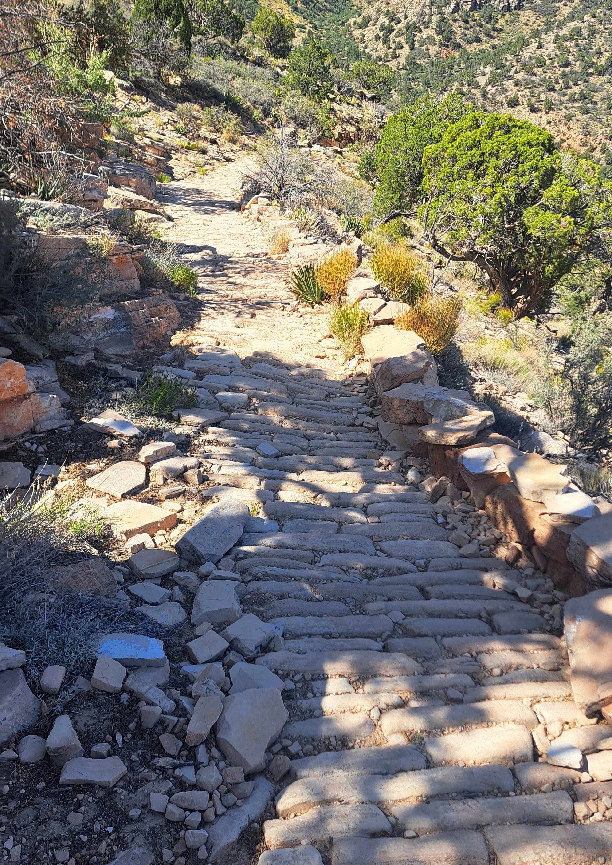
Unfortunately, the trail has for decades remained in a kind of purgatory between lightly maintained and abandoned, though it still attracts plenty of visitors looking for a more adventurous, less crowded hike. That would be me. The Park Service advises that less experienced hikers consider choosing a better trail.
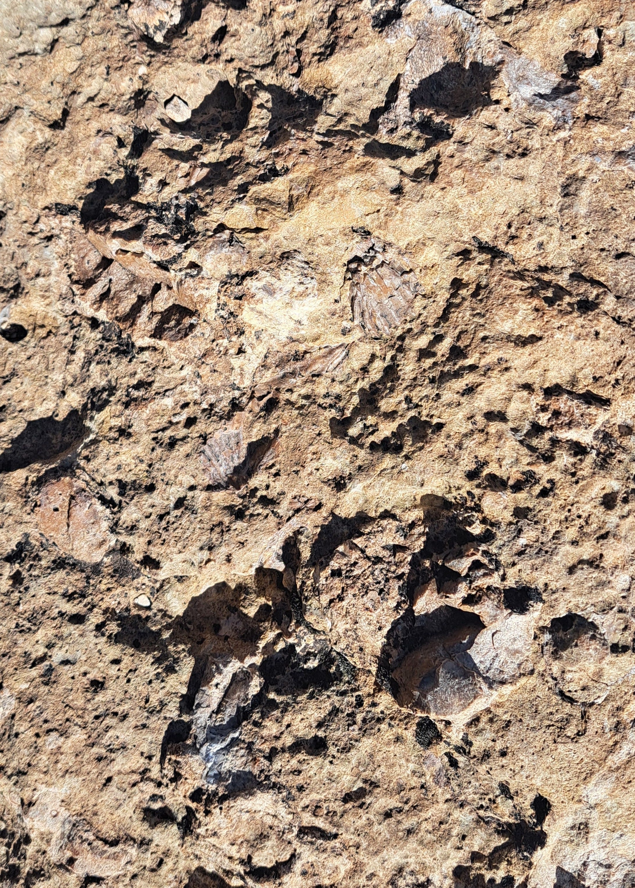
The Hermit begins with a good drop through the Kaibab, Toroweap and Coconino Formations, made of sediments deposited 270-plus million years ago, some in a marine environment, as evidenced by fossilized bivalves. With the Coconino, imagine blowing sands, with dunes hundreds of feet high preceding the seas that would apparently come and go in the eons to follow. Remarkably, lizard and scorpion tracks have been found in the Coconino, and even the ancient impressions of raindrops.
I passed junctions with the Waldron and Boucher Trails where we’d split off the last time I came through. After a couple of miles, I met two backpackers coming up. They’d departed a distant camp that morning under the stars.
A much easier path now sidled up to the Santa Maria Spring sandwiched between the somewhat older Hermit Shale and Supai Group, or mostly the sandstone, mudstone and siltstone detritus of flowing fresh water over a coastal plain, intermixed with more dunes. Various sublayers and variations have also been identified, meaning the complexity of it all won’t fit in a single sentence, or inside my brain, so don’t quote me on it.
A water trough next to the trail was filled to the brim and available for pumping water if you don’t mind the cute squigglies swimming around in it. I replenished my supply for the long dry descent to the Tonto. I figured three liters would suffice, so I carried four. A small stone shelter invited a bit of lazin’ and a snack, before slinging on my pack and marching on.
After a while, I noticed a hiker some distance ahead who seemed to be having trouble staying upright. It turned out she was trying to get through the worst of the rockslides that have wiped out parts of the trail. I had almost as much fun plodding through it myself. When I caught up, it was clear she knew her stuff. She’d completed a rim-to-rim hike the year before. I kinda knew my stuff too but I’ve never done the rim-to-rim. I haven’t scratched it off my to-do list, although it presently sounds more like work than fun.
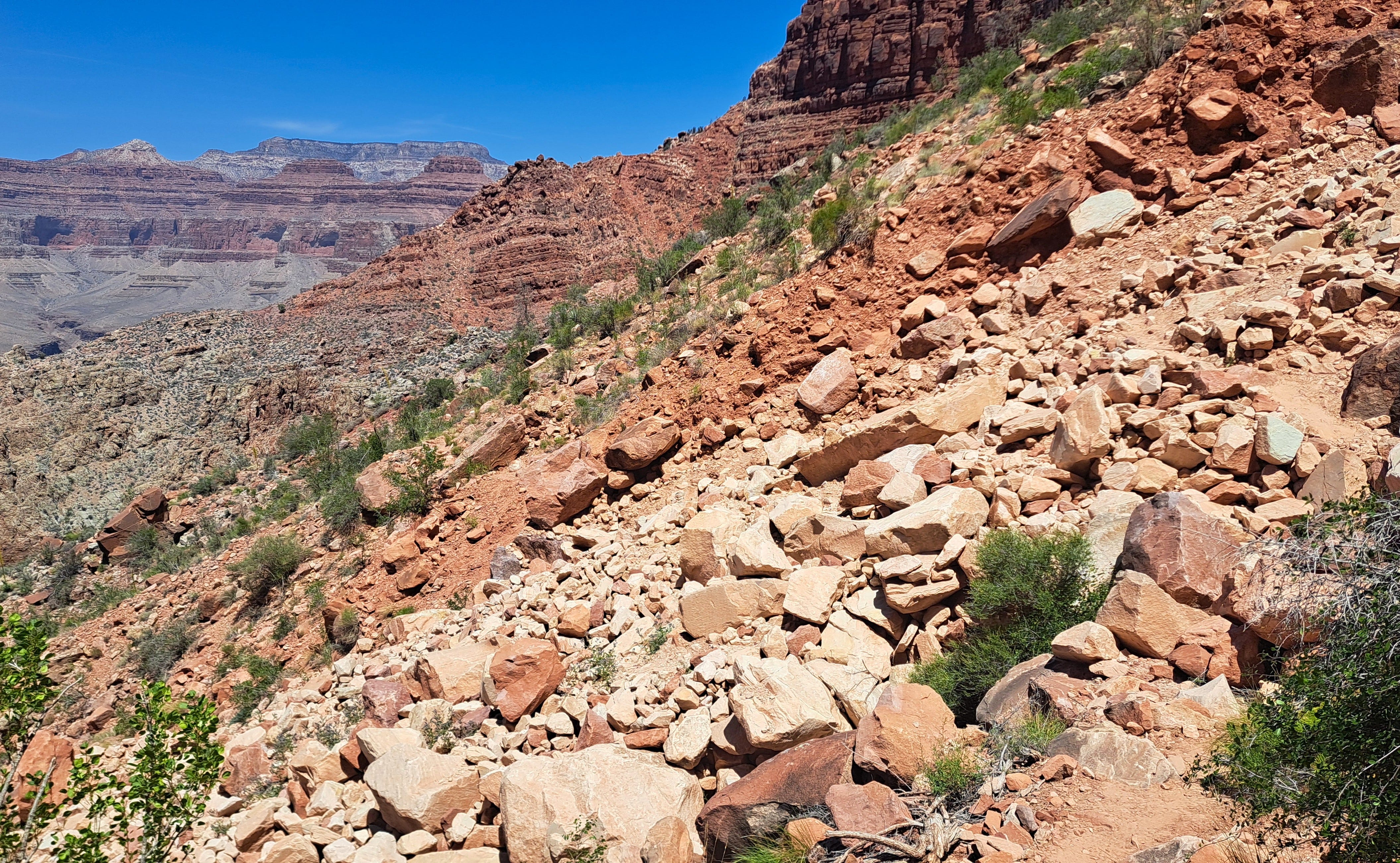
I left her at shady spot near Breezy Point and proceeded down the notorious, though not that difficult, Cathedral Stairs. It’s a steep, hot descent via endless switchbacks through a break in the imposing Redwall Limestone Formation. The abrupt band of Redwall cliffs, typically 340 million years old and more than 500 feet high, are prominent throughout the canyon, always capturing the eye. Deposited during the time of another shallow sea, the redwall is only red because of leaching from the layers above. Fossil finds have included corals and brachiopods—marine critters similar looking to bivalves, but the kind that opens up and down instead of side to side.
By now it’s 2:00 in the afternoon, probably 100 degrees and still heating up. I reached the last shady spot and wondered about whether to continue or just sit for a spell. It was still a mile down to the Tonto junction, and another mile to a shady campsite and the waiting relief of Hermit Creek. I had two liters of water left and at least a half bag of well crushed BBQ potato chips. Do we sit or do we hike?
Part 3 to follow soon! I thought I could finish in two installments, but I got a little wordy.