

October 29th happens to be a pretty special day on the Wilcoxian Calendar, as it’s the anniversary of the first hike Kris and I did together, effectively our first date 18 years ago. We’ve often marked the occasion with another hike, except in snooty weather. Given a solid mountain forecast and only a little snow so far in the high country, I made it my task to come up with something new and not too onerous that had the side benefit of another summit for moi.
Sights settled on Rattlesnake Ledge near North Bend. It’s a well known hike to a popular viewpoint on Rattlesnake Mountain, overlooking Rattlesnake Lake, formerly known as Rattlesnake Prairie, and named for my least favorite reptile. I’ll explain the name later. I’d known about this hike for decades and always meant to get up there for the big view. Not sure how it escaped me for so long.
I noticed that the east peak of Rattlesnake Mountain, though just shy of 3,500 feet, was the highest point along the unassuming ridge. If we hiked two miles to the Ledge, I could continue another 2.4 miles to bag myself a peak. No problem.
We began our hikaversary morning with a drive to historic Snohomish for a breakfast burrito at the city bakery, preceded by a spectacular double-baked almond croissant and a caffeine injection. Then it was onto Duvall to scope out the Grateful Bread for future excursions, while snagging a coffee refill. Snoqualmie Falls demanded a quick stop as well, before finally completing our last leg to Rattlesnake Lake around 1:30 pm.
The wildly popular hike begins easy, then steepens considerably half way up. But the trudge is worth the scenic payoff, despite a predictable crowd on a sunny Sunday. We joined a couple dozen other hikers sprawled across the slabby rocks at the lower ledge, the best viewpoint of the hike.
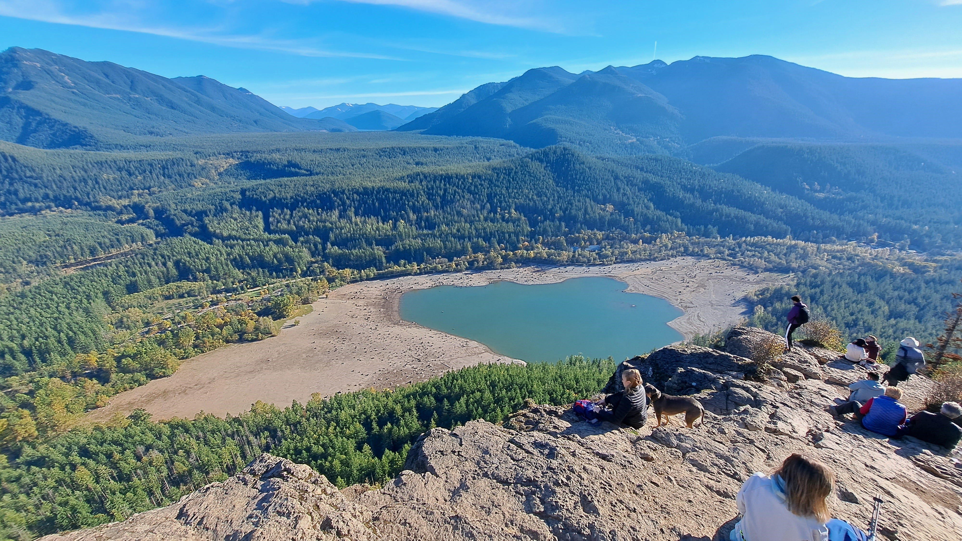
Despite the crowd, there was still room to sit and enjoy the view, and I could look across at a couple of peaks I’d been up over the summer. If you go, don’t take the exposure lightly. It seems every couple of years someone manages to fall off the cliff and die. Gravity sucks, as they say. A deep fracture had me wondering how much geological time might pass before a massive chunk of the ledge lets loose.
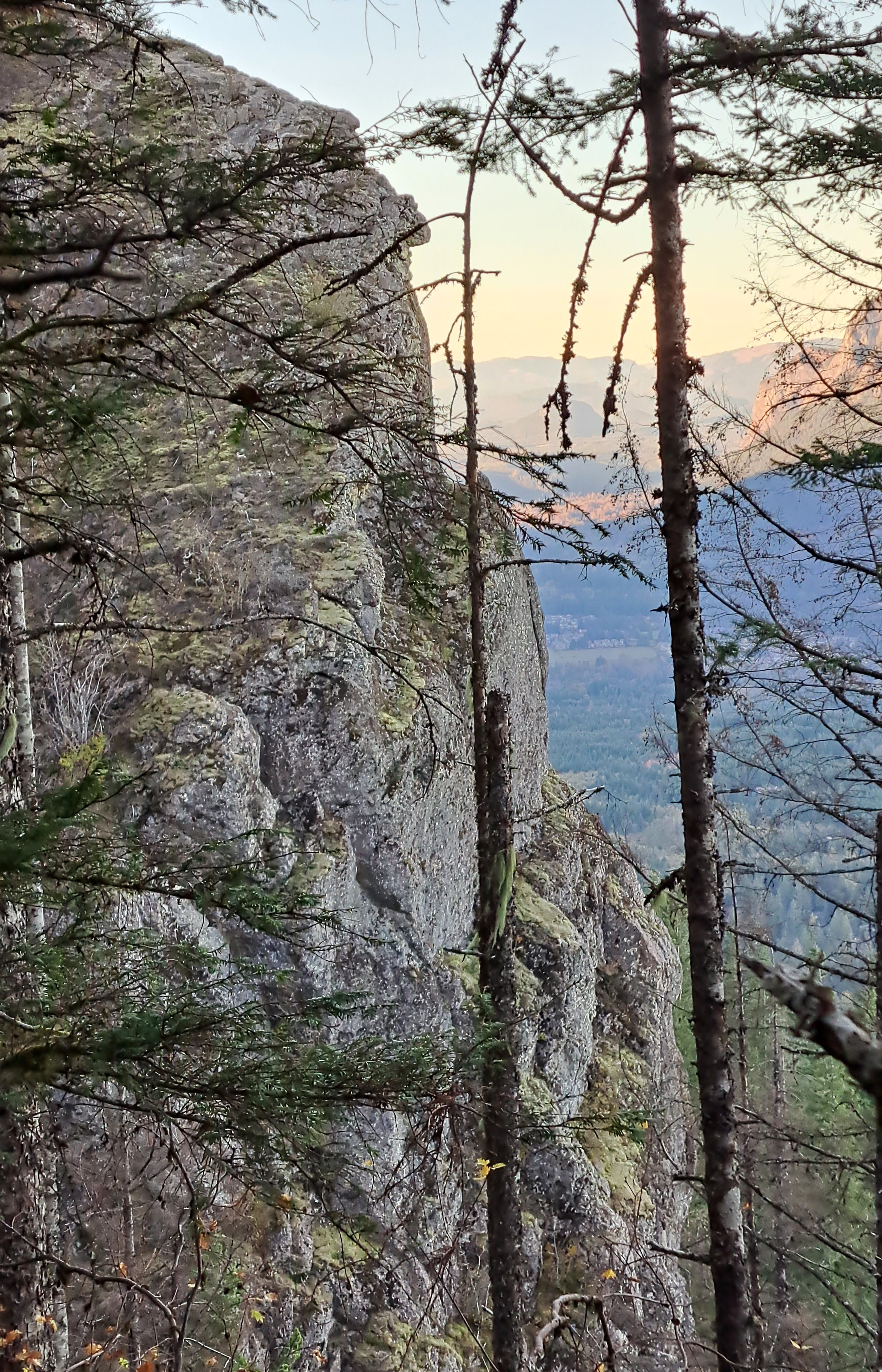
After a rest, I headed upward, with a plan to meet Kris back at the lake or trailhead by 6:00 pm. As it turned out, the extra 4.8 miles I walked (round trip) beyond the ledge was mostly a dud. The view at the East Peak was marginal at best, mostly trees and a couple of seemingly abandoned radio towers. But I get to count it, so it’s 45 down, 25 to go!
As for the placename, it apparently comes from Rattlesnake Prairie, which once existed where Rattlesnake Lake lies today. One of Seattle’s founders, Arthur Denny, while exploring the area in the mid-1800s, heard a rattle in the weeds there, mistaking a seed pod rattle for the venomous snake. The name stuck.
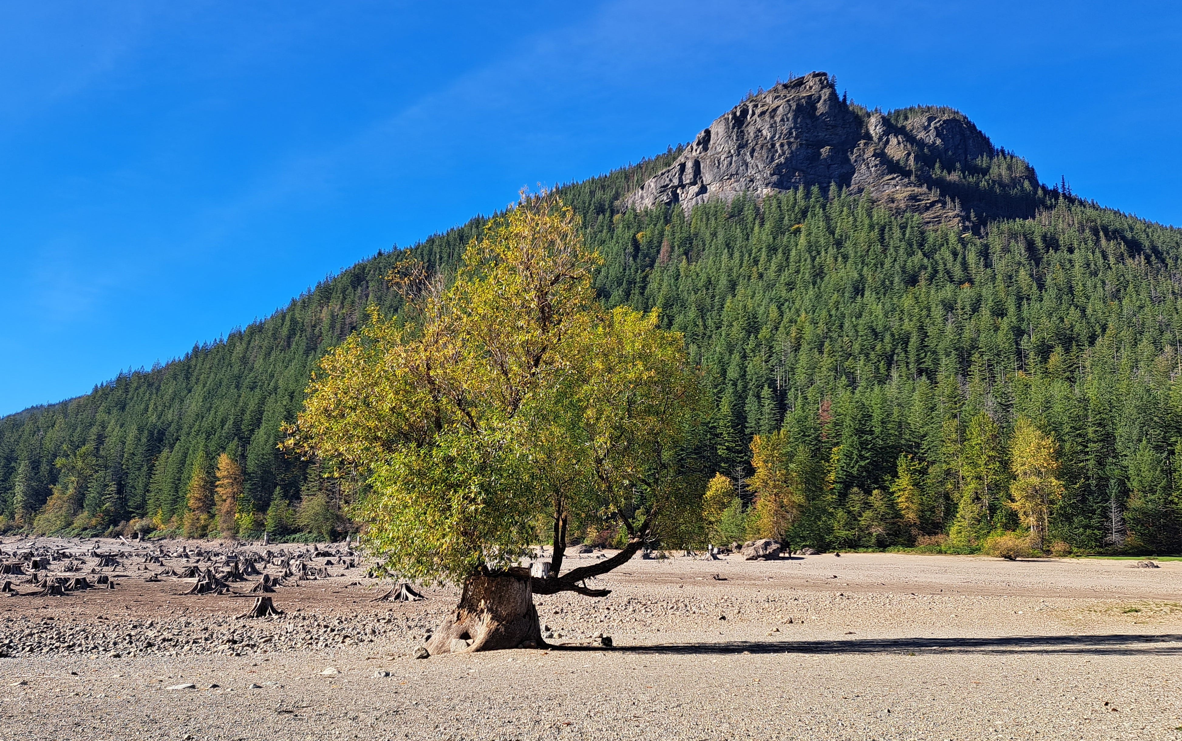
A small railroad town sprang up at the prairie in the early 1900s. Dams were built on the nearby Cedar River to provide water and power to Seattle. Oddly enough, as the reservoir filled to higher levels, water began to seep through a glacial moraine left behind during the Ice Age. This created springs in the hillside above the town and within Rattlesnake Prairie itself. The town soon flooded and had to be abandoned. To this day, when the reservoir fills in the spring, the lake rises, then recedes in the fall as the reservoir recedes.
And in case you were wondering, there are still no actual rattlesnakes in the wilds of western Washington. Which is a-okay with me.
Don’t like rattlesnakes? Don’t visit Arizona. The ranges of North America’s venomous insects and animals overlap only on it.
Happy Hikeversary, Ken and Chris! Looks like a good one.