

Below is the sixth batch of peaks from my 60 Summits quest in 2013-14. You can find the previous batch here.
45. The Mummy Nubbin (NV) - December 9, 2013
Before Thanksgiving (2013), I noticed that I could fly home to DC from Bellingham by way of Las Vegas for the same price as going direct from Seattle to DC. Surely, it will be mild and sunny in Vegas in early December, right? The normal high then should be around 60. There was also an early flight out of Bellingham and a late flight out of Vegas, which gave me a 12-hour layover in the desert city, just enough to dash off for a good hike in the hills. I’d catch a red-eye flight to DC and show up at the office right on time, bedraggled, but functional. I booked the flights two weeks in advance.
My research led me to the Mount Charleston area and two attractive summit hikes—easy Cathedral Rock and modest Fletcher Peak. Maybe I could knock ‘em both out in a day, although they were pretty high up and possibly snowy and icy by now. Fletcher’s summit was over 10,500 feet.
I landed in Vegas on December 9 with a forecast high of, sigh, 40 degrees, the same as Seattle. Well, whatever. I got to the 7,000-foot Spring Mountains Visitor Center around noon, with the temperature in the low-20s. I parked in the snowy/icy parking lot, which, of course, was not a good sign for conditions at 10,000 feet.
The ranger inside informed me that, regrettably, the Cathedral Rock Trail was still closed from a July forest fire. So nix that one. How deep is the snow on Fletcher? Probably a foot or two with some drifts. That meant much of the trail would likely be obscured, and since I don’t know this area at all, heading up midday without a clear trail to follow seemed a little silly. Instead, I settled on a chilly trudge up the North Loop Trail toward Mummy’s Toe. I wouldn’t attempt the summit, since it is actually 400 feet higher than Fletcher. But I noticed an unnamed 10,089-foot nubbin on the map that was just off the trail. It would be a five-mile hike round trip.
I drove to the trailhead at 8,400 feet and found a good boot track in about a foot of snow. At 1.5 miles, the path reached a scenic terrace where most of the snow had melted or been blown away. From there, the tread morphed into wandering snowshoe prints that led upward in deepening snow to the next ridge crest above.
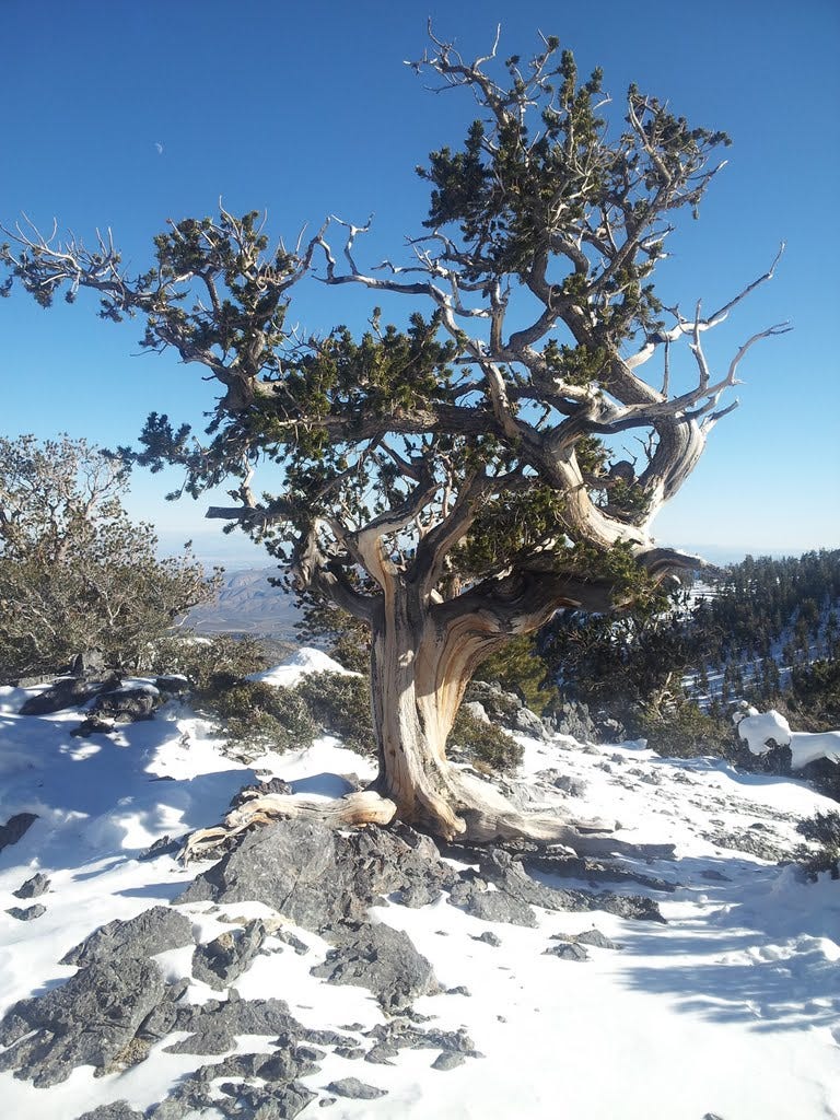
I began punching through to my calves and a couple times up to my knees. But I was close to the top and managed the last 100 feet of vertical to the nubbin, which I proudly named the Mummy’s Toenail Clipping. But because the summit was over 10,000 feet and my nose was cold, I just had to count it as Summit #45. Only 15 to go!
46. The Priest (VA) - December 21, 2013
Back in Virginia, I’d discovered another two-fer possibility in the Blue Ridge and headed out early from DC on Saturday December 21st. Snow and closed roads had put a crimp on peakbagging the previous weekend, but now, on the winter solstice, the forecast was spectacular, with a predicted high close to 70. Not bad for the first day of winter.
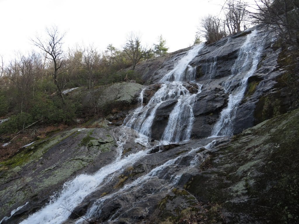
I made the long drive to Crabtree Falls southwest of Charlottesville, with my sights on The Priest and Maintop Mountain, including a short detour to Spy Rock. It was also going to be a great day to try out my nifty new Canon PowerShot-SX280HS-Wifi-HD video-GPS-20x-blah-blah-point-and-shoot-cameroid.
The 9-mile round trip hike can be shortened considerably by starting at an upper parking lot, but then you’d miss the scenic climb past the highest series of falls east of the Mississippi. Crabtree Creek drops over 1,000 feet via multiple falls and cascades. An excellent 1.7-mile trail to the top offers great views throughout. A few lingering patches of ice demanded some extra care in spots, but nothing treacherous.
From the top of the upper falls, an easy path led another mile to a fire road, followed by a short stroll upward to intersect the A.T. Hanging a left there, it was 1.2 miles farther to the summit. The high point is a rock pile in the trees, but a fine overlook awaited along the ridge a short distance below. With the 2,500-foot gain, it seemed I had the entire mountain to myself and I didn’t see another hiker until I returned to the falls. I did, however, see my first fox east of the Mississippi, right close to the summit. I figured he must have been working on his summit list too.
Note of caution: Signs at Crabtree Falls state that 28 people have died here while venturing off the trail onto rocks that are slicker than they look. The most recent fatality occurred in 2013.
47. Maintop Mountain and Spy Rock (VA) - December 21, 2013
After burning up way too much time at Crabtree taking way too many pictures with my fancy new camera, I burned rubber up to the Spy Rock trailhead behind a fish hatchery, a short drive from Crabtree Falls. It was already 3:30pm and I had, at most, two hours of good light left. The hike up and back would be a bit under four miles with 1,500 feet of elevation gain.
About a quarter mile up the private road that leads to the A.T., I met a boy of maybe six or seven running toward me looking as happy as all get-out. He came right up to me like I was his uncle and said “Deh uh voo at duh en—uh woowy guh wun!” Which I translated to mean there was a really good view at Spy Rock. I thanked him for his generous insight, then noticed the rest of the family approaching from around the bend.
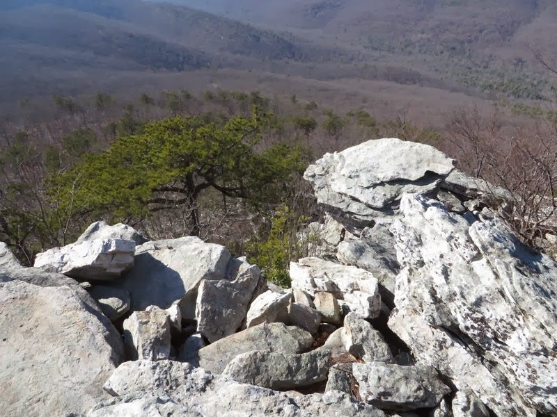
Within an hour, I was atop the rock, which rises like a massive blob out of the surrounding forest. The hiker boy was right. It was gorgeous. Tiny pools at the summit reflected a darkening sky. Confederate soldiers spied on their Union enemy from this perfect vantage point approximately one sesquicentennial ago.
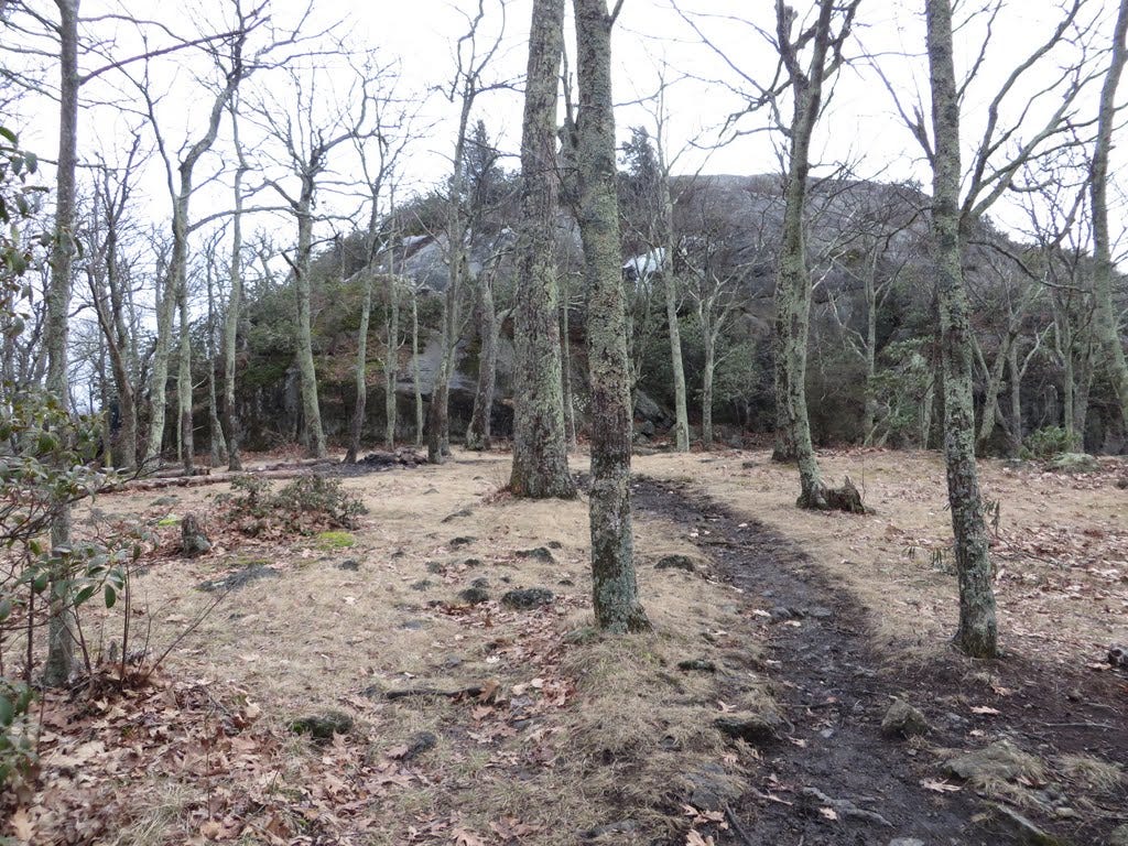
But since Spy Rock is not the high point, I clambered down and continued up the A.T. briefly to where a former, less obvious path climbs leftward to the top of Maintop Mountain. I presume it’s called the main top, since Spy Rock isn’t the actual top of the mountain, even if it’s the main destination for day hikers. By now dusk was approaching and the wind was howling, so I snapped a picture of my feet on the highest rock pile and skittered back down.
48. Buzzard Hill (VA) - December 26, 2013
The day after Christmas, we opted for another attempt on Buzzard Hill, a little summit hike we’d aimed for a couple weeks earlier. The narrow side road leading to the trailhead was steep and icy at the time and I didn’t want to risk it, so we bailed. This time, however, all was perfect with no snow in sight.
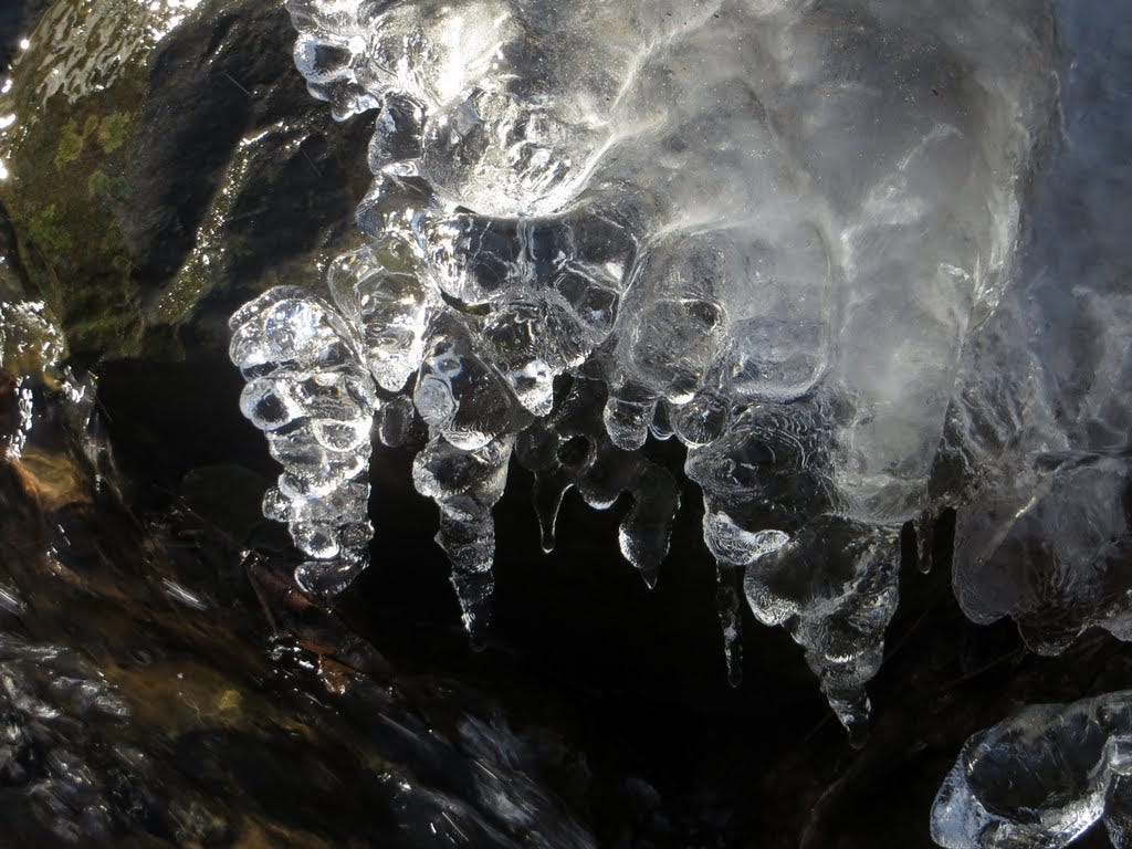
The trail, a section of the A.T., passed a small waterfall early on where much ice had formed during the preceding cold spell. We ogled the icicles and assorted frozen sculptures, then continued upward, landing on the summit an hour and half from the car. A big old gnarly tree gave the place a cool ambiance and we enjoyed lunch at our scenic, sunny perch on the rocks. Summit number four dozen was in the bag, which meant I was 80 percent of the way to Sixty, with just over five weeks to go.
On the way down, we passed a herd of three white-tailed deer browsing only a few yards from the trail. They spooked at first, but then decided to ignore us and went about their chewing and chomping as if we were just a couple of overgrown squirrels. ‘Twas a fine hike, just under four miles round trip with an 850-foot elevation gain.
On the drive home, we stopped for a light dinner at Clyde’s Willow Creek Farm, a unique farmstead eatery that a friend at work had recommended. Not bad and a cool place to go with family or friends.
49. Big Ridge and Cranny Crow (WV) - December 28, 2013
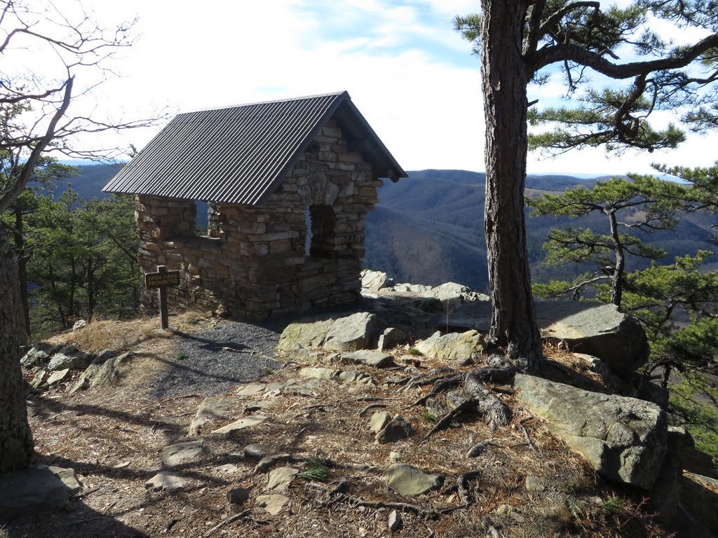
On December 28th, Kris had to work so I took advantage of another gorgeous day off and raced over to Lost River State Park just inside West Virginia, though not all that far from DC. The trail up Big Ridge reached a high point with a fire tower, although it was inaccessible—perhaps too rickety for public use. Lower down, an overlook called Cranny Crow also caught my interest and offered a nice loop of 6.4 miles, with a gain of just 1,500 feet.
Once I found the park, it took some figuring to determine where the trailhead was, since the directions I found online weren’t entirely clear. The park’s visitor center had just opened minutes earlier and the kind woman behind the counter was quick to set me straight and hand me a trail map.
The hike was quite enjoyable, I thought, with several overlooks, historic homestead, the impressive tower and an old cabin at the top. Cranny Crow, was the best stop though, with an aesthetically pleasing rock shelter looking out over Duck Hollow and the surrounding hills. Who knows how the name came about? I imagine someone seeing a crow in a cranny in the rocks and sayin’ hey, lookie dat! It’s a cranny crow! Fun place. And a nice hike to end on for 2013.
50. Duncan Knob (VA) - January 12, 2014
When I came to DC in January 2011, one of the first hikes to catch my attention was Duncan Knob, a hike up a scenic rock pile that I’d noticed multiple times on the online calendars of local hiking clubs. I called to sign up once, but winter weather cancelled the trip. Somehow, it’s taken me three years to finally make my way up the knob, in January no less, which was kinda cool. Doubly cool was the fact that it would be Number Fifty in my quest for Sixty Summits by Groundhog Day.
For the ascent, I just happened to pick a fabulous winter-blue day with temps in the 40s and no snow anywhere. Amazingly, I didn’t see a soul coming or going. It felt as if I had half of Virginia to myself. Bright sun lit up the leafless forest, casting long shadows into the detritus.
A longish slog, maybe three miles, led partly along an old road and creek to a junction where the trail steepened to climb the ridge. At the top, the white-blazed summit trail broke off to the north and a steep scramble up talus brought me to the summit. A perfect, stone lunch counter invited a sandwich break capped by a big hunk of chocolate. Since I’m counting, summit #50 was eight miles round trip with a gain of 1,500 feet.
Down to the final ten!
You can find the next and final batch of 2013-14 summits here.